AS09-25-3684
| NASA Photo ID | AS09-25-3684 |
| Focal Length | 80mm |
| Date taken | 1969.03.08 |
| Time taken | 20:52:00 GMT |

Cloud masks available for this image:
Spacecraft nadir point:
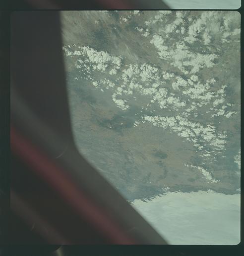
Photo center point: 19.0° N, 98.5° W
Photo center point by machine learning:
Photo center point: 19.0° N, 98.5° W
Photo center point by machine learning:
Nadir to Photo Center:
Spacecraft Altitude: 112 nautical miles (207km)
Country or Geographic Name: | MEXICO |
Features: | WINDOW OBSTRUCTION |
| Features Found Using Machine Learning: | |
Cloud Cover Percentage: | 55 (51-75)% |
Sun Elevation Angle: | 55° |
Sun Azimuth: | ° |
Camera: | Hasselblad |
Focal Length: | 80mm |
Camera Tilt: | High Oblique |
Format: | SO368: Kodak Ektachrome MS, equivalent to 2448 Kodak Aerochrome, ASA64, thin base, fine grain |
Film Exposure: | Normal |
| Additional Information | |
| Width | Height | Annotated | Cropped | Purpose | Links |
|---|---|---|---|---|---|
| 4400 pixels | 4600 pixels | No | No | Download Image | |
| 492 pixels | 515 pixels | No | No | Download Image |
Download Packaged File
Download a Google Earth KML for this Image
View photo footprint information
Download a GeoTIFF for this photo
Image Caption: GEOGRAPHY/CARTOGRAPHY: MEXICO, NEAR PUEBLA, POPOCATEPETL VOLCANO.
GEOLOGY/HYDROLOGY: VOLCANIC MOUNTAINS AND COMPLEX MOUNTAIN REGION WITH ALLUVIAL DEPOSITS.
FORESTRY: SPARSE DESERT SHRUBFORM, SOME BROADLEAF EVERGREEN AT HIGHER ELEVATIONS, SMOKE PLUMES VISIBLE.
METEOROLOGY: CUMULUS HUMILIS, NIMBO-STRATUS.
OCEANOGRAPHY:
GEOLOGY/HYDROLOGY: VOLCANIC MOUNTAINS AND COMPLEX MOUNTAIN REGION WITH ALLUVIAL DEPOSITS.
FORESTRY: SPARSE DESERT SHRUBFORM, SOME BROADLEAF EVERGREEN AT HIGHER ELEVATIONS, SMOKE PLUMES VISIBLE.
METEOROLOGY: CUMULUS HUMILIS, NIMBO-STRATUS.
OCEANOGRAPHY:
