AS09-24-3671
| NASA Photo ID | AS09-24-3671 |
| Focal Length | 80mm |
| Date taken | 1969.03.09 |
| Time taken | 12:21:00 GMT |
Cloud masks available for this image:
Spacecraft nadir point:
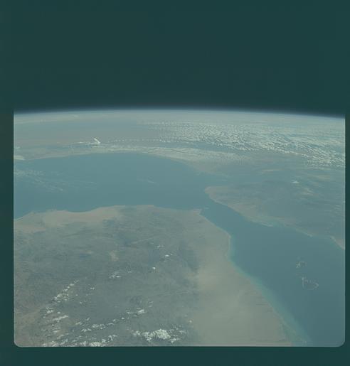
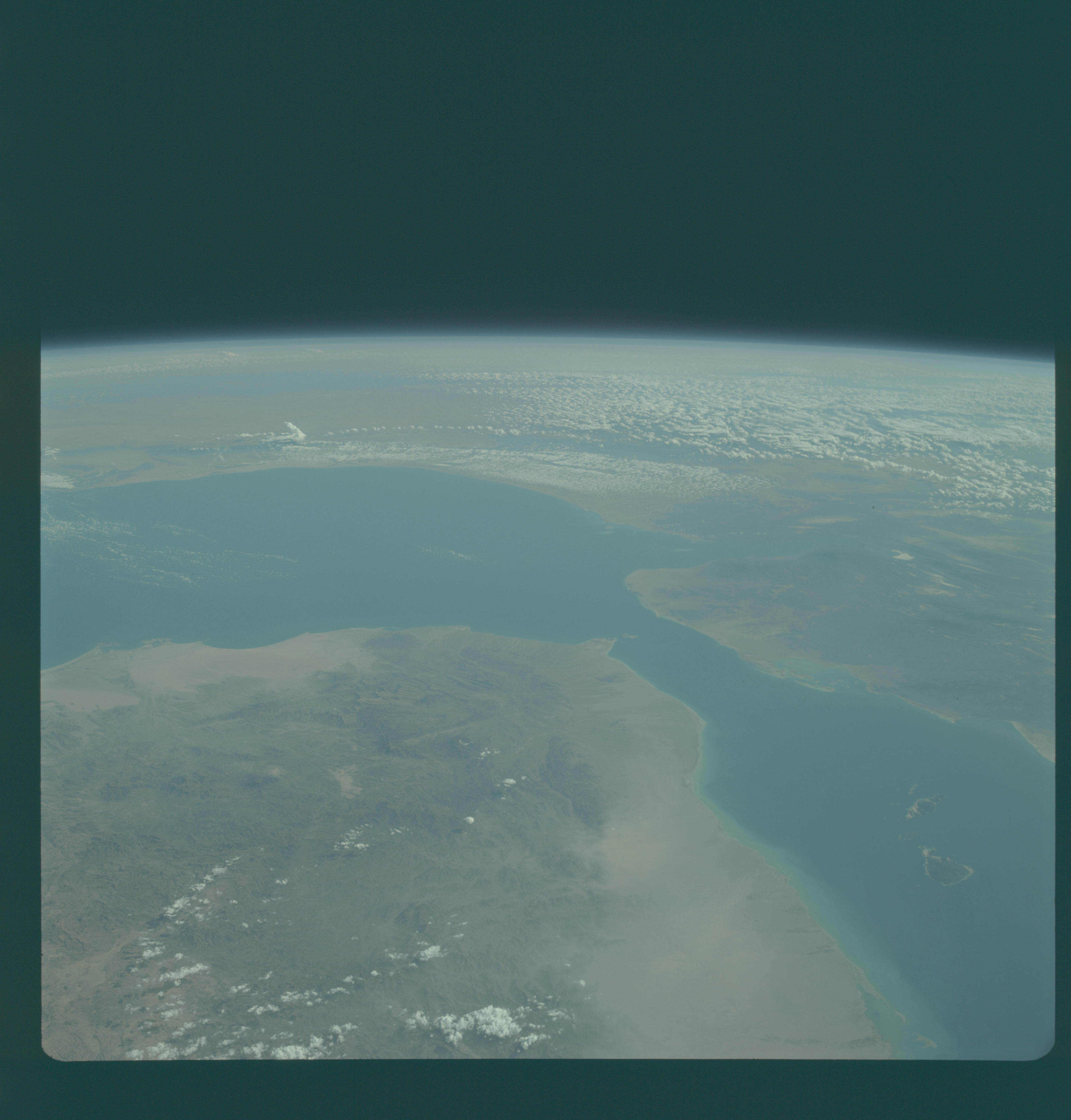
Photo center point: 12.0° N, 43.5° E
Photo center point by machine learning:
Photo center point: 12.0° N, 43.5° E
Photo center point by machine learning:
Nadir to Photo Center:
Spacecraft Altitude: 89 nautical miles (165km)
Country or Geographic Name: | YEMEN |
Features: | RED SEA, GULF OF ADEN |
| Features Found Using Machine Learning: | |
Cloud Cover Percentage: | 10 (1-10)% |
Sun Elevation Angle: | 51° |
Sun Azimuth: | ° |
Camera: | Hasselblad |
Focal Length: | 80mm |
Camera Tilt: | High Oblique |
Format: | SO368: Kodak Ektachrome MS, equivalent to 2448 Kodak Aerochrome, ASA64, thin base, fine grain |
Film Exposure: | Normal |
| Additional Information | |
| Width | Height | Annotated | Cropped | Purpose | Links |
|---|---|---|---|---|---|
| 4400 pixels | 4600 pixels | No | No | Download Image | |
| 492 pixels | 515 pixels | No | No | Download Image |
Download Packaged File
Download a Google Earth KML for this Image
View photo footprint information
Download a GeoTIFF for this photo
Image Caption: GEOGRAPHY/CARTOGRAPHY: YEMAN, ADEN PROTECTORATE, FRENCHSOMALILAND, ETHIOPIA, SOMALI REPUBLIC, RED SEA, GULF OF ADEN, CITIES OF, ZABID, TAIZZ, SHAYKH UTHMAN, DJIBOUTI AND BERBERA.
GEOLOGY/HYDROLOGY: SEDIMENTARY COASTAL PLAIN AND DISSECTED COMPLEX PLATEAU.
FORESTRY: SCATTERED DECIDUOUS SHRUBFORM.
METEOROLOGY: CUMULUS HUMILIS, CUMULUS FRACTUS, CUMULO-NIMBUS, ALTO CUMULUS.
OCEANOGRAPHY: DEPTH VARIATIONS VISIBLE IN NEARSHORE ZONE OF THE RED SEA.
GEOLOGY/HYDROLOGY: SEDIMENTARY COASTAL PLAIN AND DISSECTED COMPLEX PLATEAU.
FORESTRY: SCATTERED DECIDUOUS SHRUBFORM.
METEOROLOGY: CUMULUS HUMILIS, CUMULUS FRACTUS, CUMULO-NIMBUS, ALTO CUMULUS.
OCEANOGRAPHY: DEPTH VARIATIONS VISIBLE IN NEARSHORE ZONE OF THE RED SEA.
