AS09-23-3561
| NASA Photo ID | AS09-23-3561 |
| Focal Length | 80mm |
| Date taken | 1969.03.11 |
| Time taken | 16:17:00 GMT |
Cloud masks available for this image:
Spacecraft nadir point:
Photo center point: 33.4° N, 102.0° W
Photo center point by machine learning:
Photo center point: 33.4° N, 102.0° W
Photo center point by machine learning:
Nadir to Photo Center:
Spacecraft Altitude: 118 nautical miles (219km)
Country or Geographic Name: | USA-TEXAS |
Features: | LUBBOCK, BROWNFIELD |
| Features Found Using Machine Learning: | |
Cloud Cover Percentage: | 20 (11-25)% |
Sun Elevation Angle: | 36° |
Sun Azimuth: | ° |
Camera: | Hasselblad |
Focal Length: | 80mm |
Camera Tilt: | Near Vertical |
Format: | SO368: Kodak Ektachrome MS, equivalent to 2448 Kodak Aerochrome, ASA64, thin base, fine grain |
Film Exposure: | Normal |
| Additional Information | |
| Width | Height | Annotated | Cropped | Purpose | Links |
|---|---|---|---|---|---|
| 4400 pixels | 4600 pixels | No | No | Download Image | |
| 492 pixels | 515 pixels | No | No | Download Image |
Download Packaged File
Download a Google Earth KML for this Image
View photo footprint information
Download a GeoTIFF for this photo
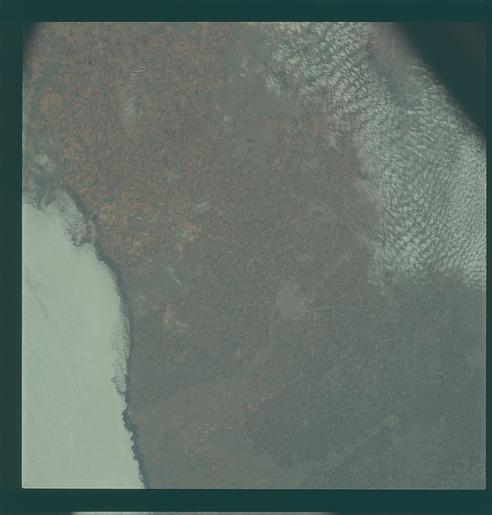
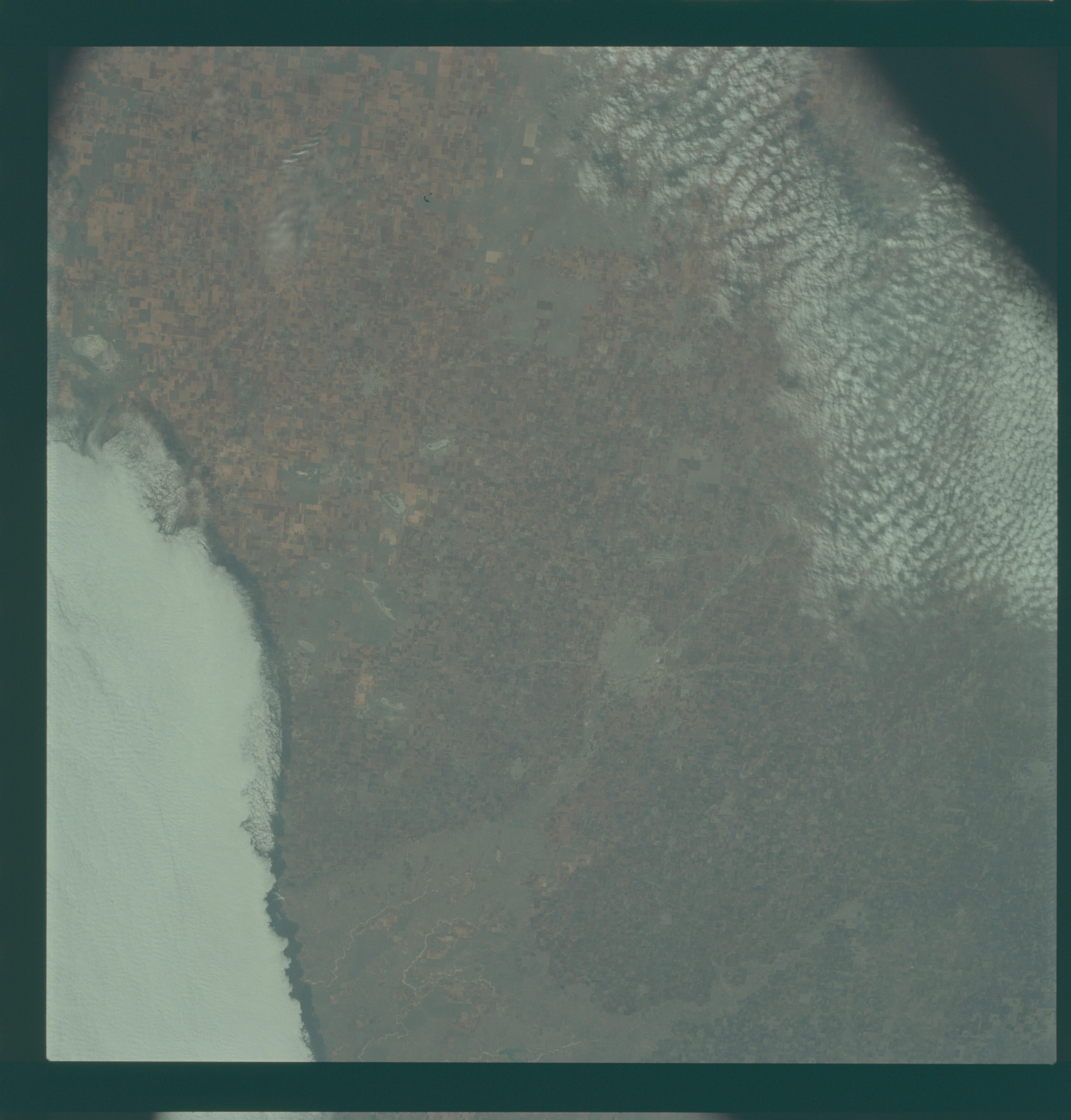
Image Caption: Hand-held, color; Lubbock and surrounding eastern edge of the southern Plains.
GEOGRAPHY/CARTOGRAPHY: TEXAS, LUBBOCK, BROWNFIELD.
GEOLOGY/HYDROLOGY: SEDIMENTARY PLAIN.
AGRICULTURE: VERY INTENSIVE CULTIVATION. FIELD PATTERN CLEARLY DISCERNIBLE.
METEOROLOGY: CUMULUS, ALTO-CUMULUS, STRATO-CUMULUS.
Near vertical view of the Lubbock area in west Texas as photographed from the Apollo 9 spacecraft during its earth-orbital mission. Conspicuous patterns of farmland surround the city and extend eastward (up) to the Caprock Escarpment. The Double Mountain fork of the Brazos River drains east (toward upper center); Leeland is at lower center; Brownfield at lower right. The sharp edge of a cloud disk cuts across the upper right corner.
