AS09-23-3560
| NASA Photo ID | AS09-23-3560 |
| Focal Length | 80mm |
| Date taken | 1969.03.11 |
| Time taken | 16:16:00 GMT |
Cloud masks available for this image:
Spacecraft nadir point:
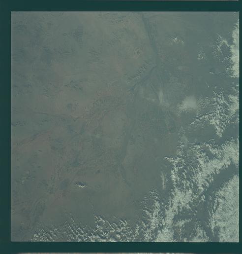
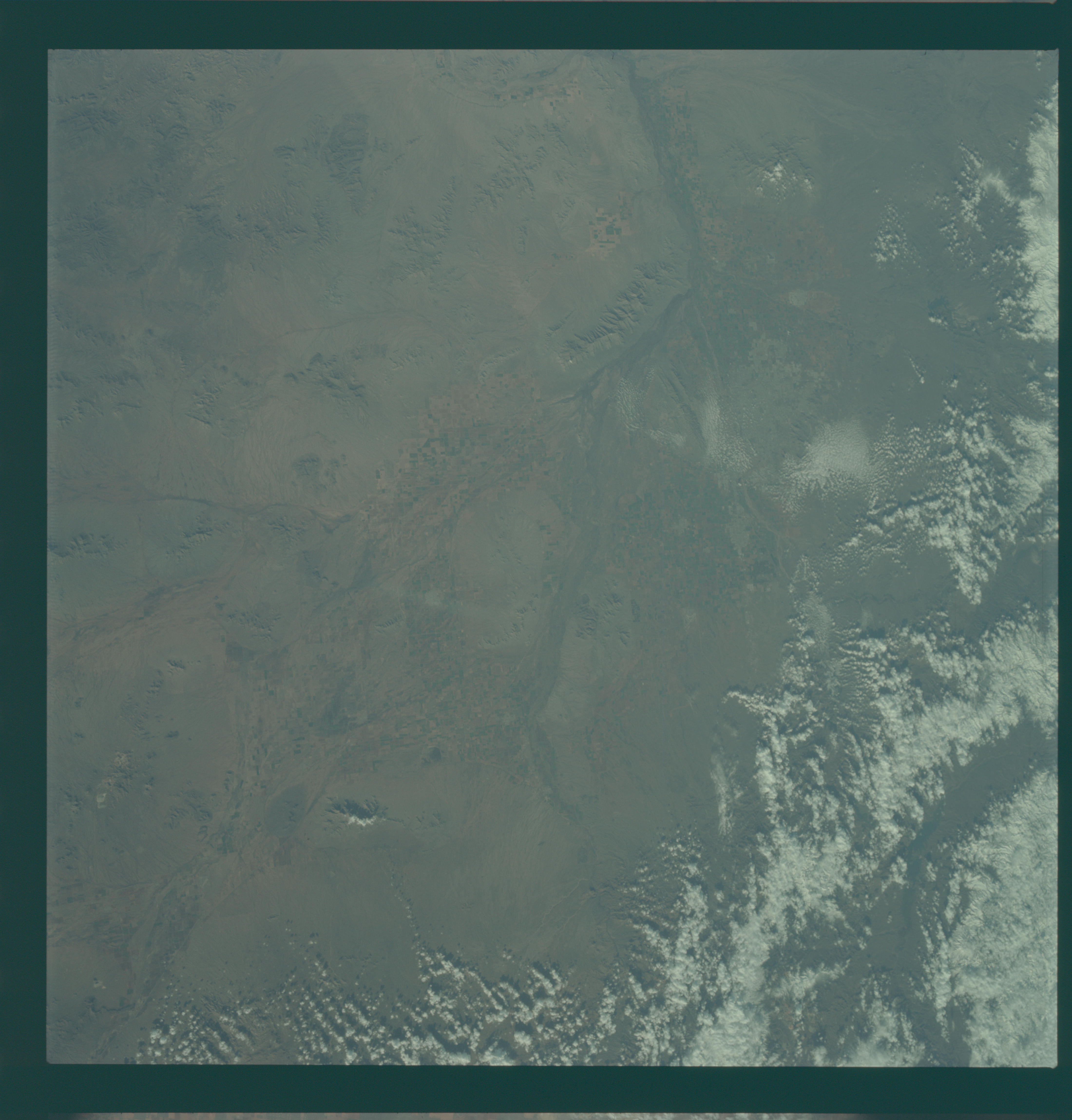
Photo center point: 33.1° N, 111.9° W
Photo center point by machine learning:
Photo center point: 33.1° N, 111.9° W
Photo center point by machine learning:
Nadir to Photo Center:
Spacecraft Altitude: 123 nautical miles (228km)
Country or Geographic Name: | USA-ARIZONA |
Features: | PHOENIX, GILA RIVER |
| Features Found Using Machine Learning: | |
Cloud Cover Percentage: | 25 (11-25)% |
Sun Elevation Angle: | 29° |
Sun Azimuth: | ° |
Camera: | Hasselblad |
Focal Length: | 80mm |
Camera Tilt: | Near Vertical |
Format: | SO368: Kodak Ektachrome MS, equivalent to 2448 Kodak Aerochrome, ASA64, thin base, fine grain |
Film Exposure: | Normal |
| Additional Information | |
| Width | Height | Annotated | Cropped | Purpose | Links |
|---|---|---|---|---|---|
| 4400 pixels | 4600 pixels | No | No | Download Image | |
| 492 pixels | 515 pixels | No | No | Download Image |
Download Packaged File
Download a Google Earth KML for this Image
View photo footprint information
Download a GeoTIFF for this photo
Image Caption: GEOGRAPHY/CARTOGRAPHY: ARIZONA, PHOENIX, TEMPLE, GILA RIVER.
GEOLOGY/HYDROLOGY: VOLCANIC AND COMPLEX MOUNTAIN RANGES AND QUATERNARY ALLUVIAL DEPOSITS.
AGRICULTURE: INTENSIVE IRRIGATED CULTIVATION.
FORESTRY: SCATTERED AND SPARSE DESERT SHRUBFORM. AND CONIFEROUS STANDS ON HIGHER ELEVATIONS. DESERT SHRUBFORM.
OCEANOGRAPHY:.
GEOLOGY/HYDROLOGY: VOLCANIC AND COMPLEX MOUNTAIN RANGES AND QUATERNARY ALLUVIAL DEPOSITS.
AGRICULTURE: INTENSIVE IRRIGATED CULTIVATION.
FORESTRY: SCATTERED AND SPARSE DESERT SHRUBFORM. AND CONIFEROUS STANDS ON HIGHER ELEVATIONS. DESERT SHRUBFORM.
OCEANOGRAPHY:.
