AS09-23-3502
| NASA Photo ID | AS09-23-3502 |
| Focal Length | 80mm |
| Date taken | 1969.03.10 |
| Time taken | 22:38:00 GMT |
Cloud masks available for this image:
Spacecraft nadir point:
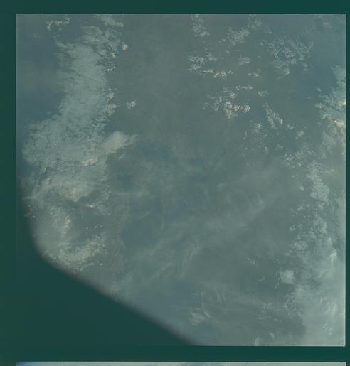
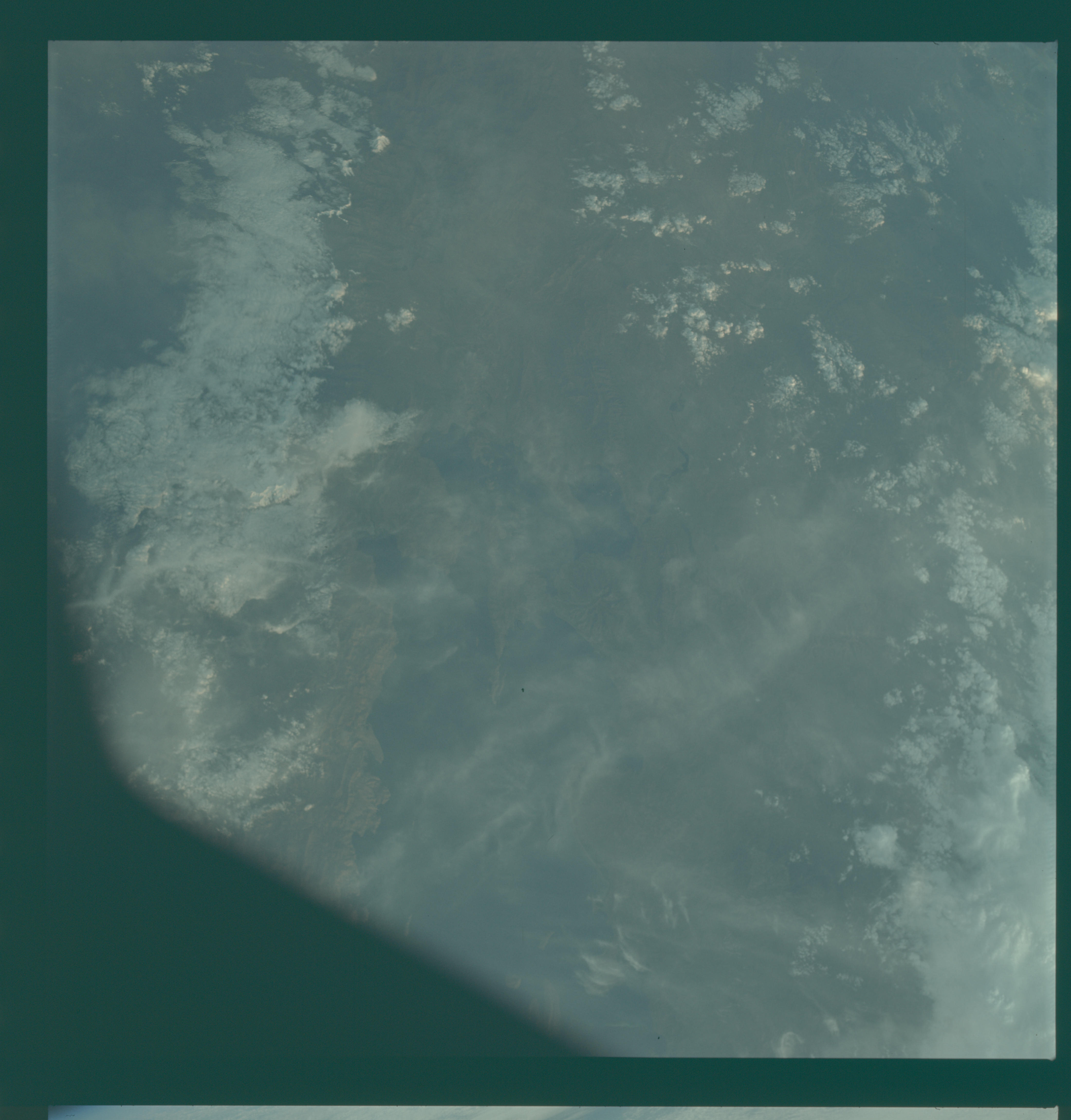
Photo center point: 17.8° S, 69.0° W
Photo center point by machine learning:
Photo center point: 17.8° S, 69.0° W
Photo center point by machine learning:
Nadir to Photo Center:
Spacecraft Altitude: 175 nautical miles (324km)
Country or Geographic Name: | BOLIVIA |
Features: | LAKE TITICACA |
| Features Found Using Machine Learning: | |
Cloud Cover Percentage: | 5 (1-10)% |
Sun Elevation Angle: | 5° |
Sun Azimuth: | ° |
Camera: | Hasselblad |
Focal Length: | 80mm |
Camera Tilt: | Near Vertical |
Format: | SO368: Kodak Ektachrome MS, equivalent to 2448 Kodak Aerochrome, ASA64, thin base, fine grain |
Film Exposure: | Under Exposed |
| Additional Information | |
| Width | Height | Annotated | Cropped | Purpose | Links |
|---|---|---|---|---|---|
| 4400 pixels | 4600 pixels | No | No | Download Image | |
| 492 pixels | 515 pixels | No | No | Download Image |
Download Packaged File
Download a Google Earth KML for this Image
View photo footprint information
Download a GeoTIFF for this photo
Image Caption: GEOGRAPHY/CARTOGRAPHY: BOLIVIA AND PERU, LAKE TITICACA, BORDER.
GEOLOGY/HYDROLOGY: COMPLEX MOUNTAINS AND SOME ALLUVIAL DEPOSITS.
AGRICULTURE: SCATTERED CULTIVATED AREAS.
FORESTRY: BROADLEAF, HARDWOOD FOREST STANDS.
METEOROLOGY: CUMULUS, STRATO-CUMULUS.
OCEANOGRAPHY:
GEOLOGY/HYDROLOGY: COMPLEX MOUNTAINS AND SOME ALLUVIAL DEPOSITS.
AGRICULTURE: SCATTERED CULTIVATED AREAS.
FORESTRY: BROADLEAF, HARDWOOD FOREST STANDS.
METEOROLOGY: CUMULUS, STRATO-CUMULUS.
OCEANOGRAPHY:
