AS09-23-3496
| NASA Photo ID | AS09-23-3496 |
| Focal Length | 80mm |
| Date taken | 1969.03.10 |
| Time taken | 19:23:00 GMT |
Cloud masks available for this image:
Spacecraft nadir point:
Photo center point: 11.3° N, 67.5° W
Photo center point by machine learning:
Photo center point: 11.3° N, 67.5° W
Photo center point by machine learning:
Nadir to Photo Center:
Spacecraft Altitude: 118 nautical miles (219km)
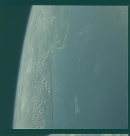
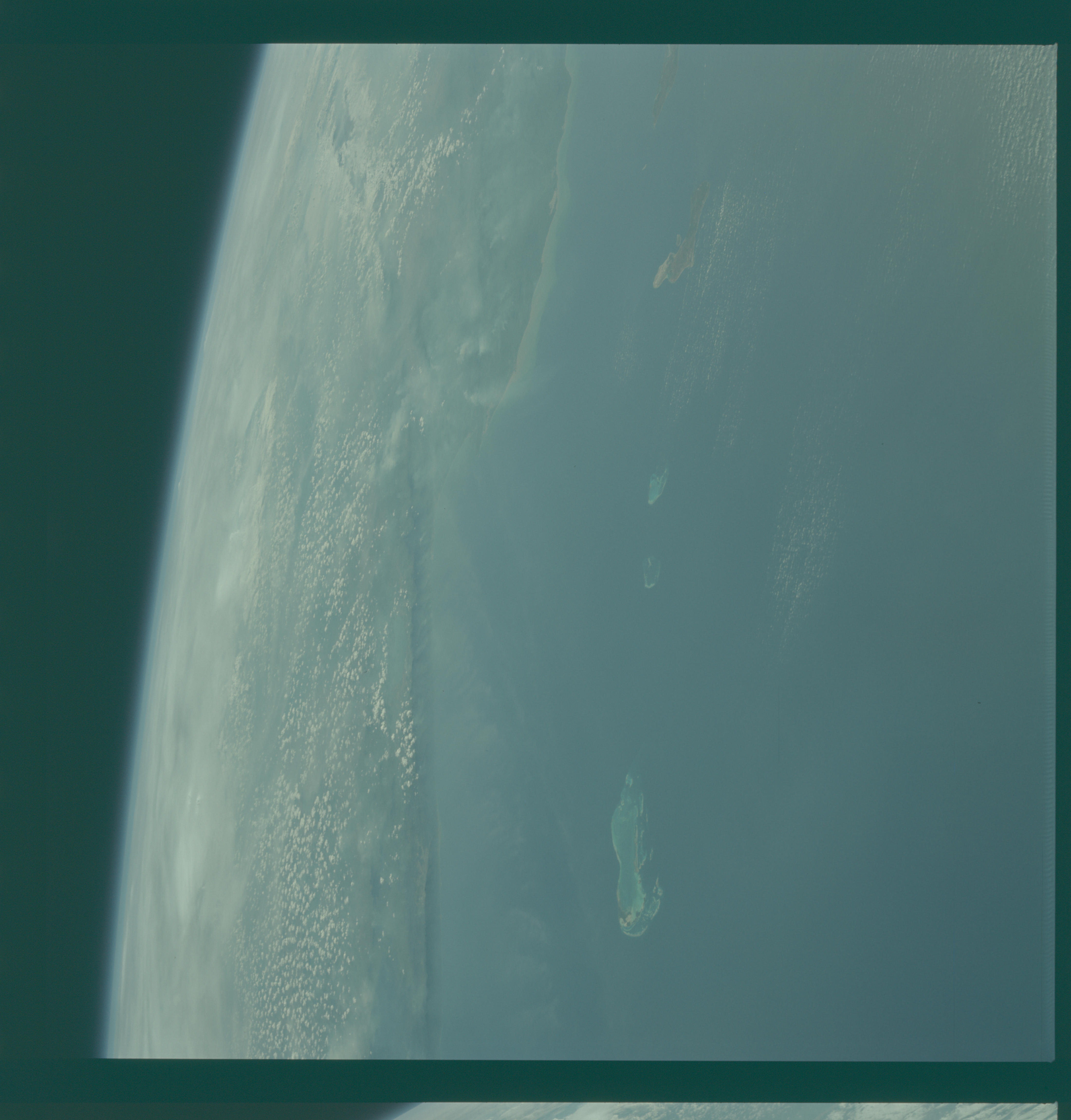
Country or Geographic Name: | LESSER ANTILLES |
Features: | ISLAS LOS ROQUES, BONAIRE |
| Features Found Using Machine Learning: | |
Cloud Cover Percentage: | 20 (11-25)% |
Sun Elevation Angle: | 47° |
Sun Azimuth: | ° |
Camera: | Hasselblad |
Focal Length: | 80mm |
Camera Tilt: | High Oblique |
Format: | SO368: Kodak Ektachrome MS, equivalent to 2448 Kodak Aerochrome, ASA64, thin base, fine grain |
Film Exposure: | Under Exposed |
| Additional Information | |
| Width | Height | Annotated | Cropped | Purpose | Links |
|---|---|---|---|---|---|
| 4400 pixels | 4600 pixels | No | No | Download Image | |
| 492 pixels | 515 pixels | No | No | Download Image |
Download Packaged File
Download a Google Earth KML for this Image
View photo footprint information
Download a GeoTIFF for this photo
Image Caption: GEOGRAPHY/CARTOGRAPHY: VENEZUELA, LAGO DE VALENCIA, ISLANDS OF CURACAO AND BONAIRE IN THE CARIBBEAN SEA.
GEOLOGY/HYDROLOGY: COASTAL PLAIN REGION.
FORESTRY: DENSE TO SEMI-DENSE STANDS OF HARDWOOD, BRADLEAF FOREST.
METEOROLOGY: CUMULUS, CIRRUS.
OCEANOGRAPHY: SHALLOW WATER OFF THE COASTLINE INDICATING THE EXTENT OF THE CONTINENTAL SHELF.
GEOLOGY/HYDROLOGY: COASTAL PLAIN REGION.
FORESTRY: DENSE TO SEMI-DENSE STANDS OF HARDWOOD, BRADLEAF FOREST.
METEOROLOGY: CUMULUS, CIRRUS.
OCEANOGRAPHY: SHALLOW WATER OFF THE COASTLINE INDICATING THE EXTENT OF THE CONTINENTAL SHELF.
