AS09-22-3466

| NASA Photo ID | AS09-22-3466 |
| Focal Length | 80mm |
| Date taken | 1969.03.09 |
| Time taken | 19:43:00 GMT |
Cloud masks available for this image:
Spacecraft nadir point:
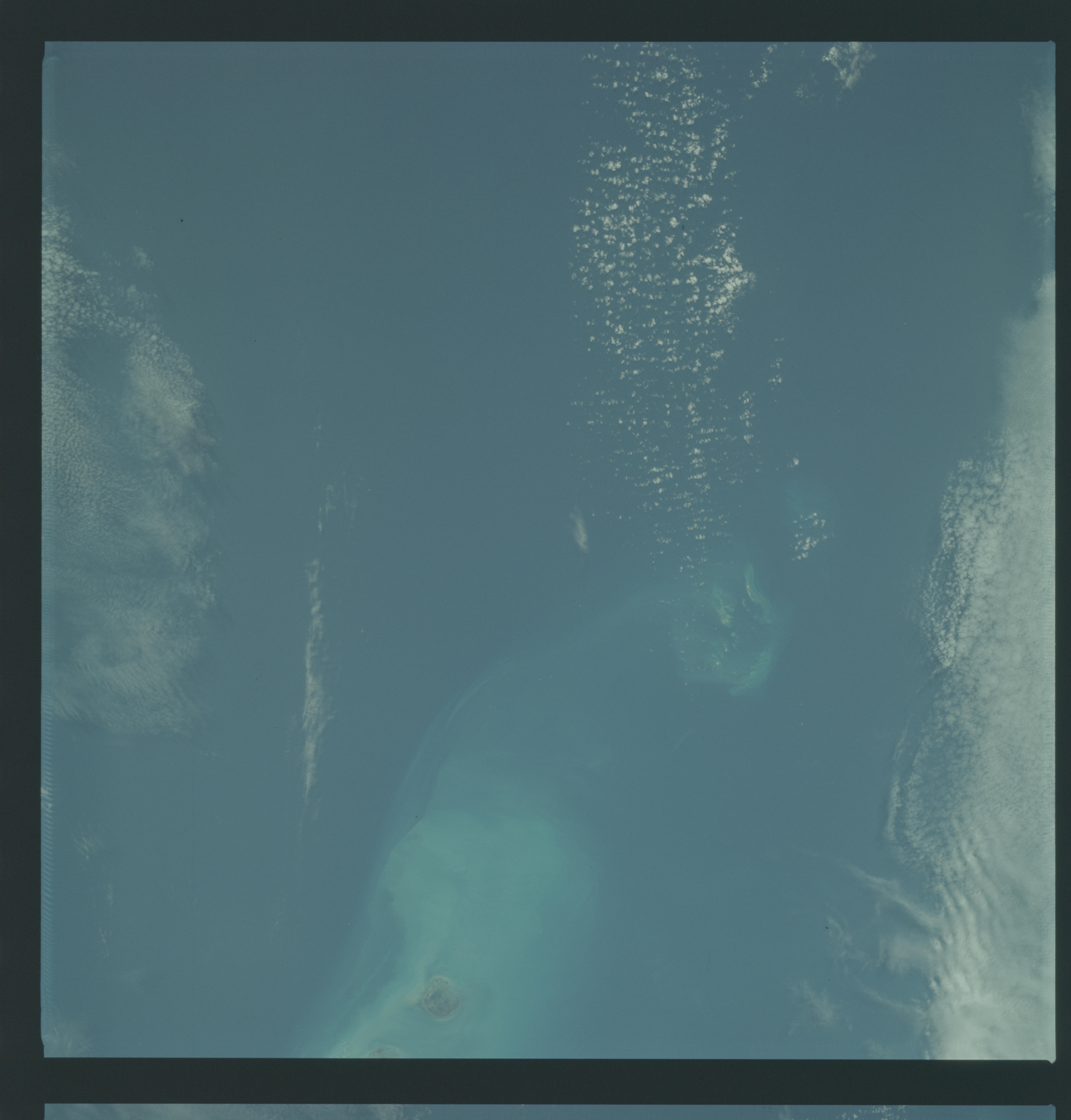
Photo center point: 24.5° N, 82.5° W
Photo center point by machine learning:
Photo center point: 24.5° N, 82.5° W
Photo center point by machine learning:
Nadir to Photo Center:
Spacecraft Altitude: 101 nautical miles (187km)
Country or Geographic Name: | USA-FLORIDA |
Features: | BOCA GRANDE CHANNEL |
| Features Found Using Machine Learning: | |
Cloud Cover Percentage: | 20 (11-25)% |
Sun Elevation Angle: | 49° |
Sun Azimuth: | ° |
Camera: | Hasselblad |
Focal Length: | 80mm |
Camera Tilt: | Near Vertical |
Format: | SO368: Kodak Ektachrome MS, equivalent to 2448 Kodak Aerochrome, ASA64, thin base, fine grain |
Film Exposure: | Normal |
| Additional Information | |
| Width | Height | Annotated | Cropped | Purpose | Links |
|---|---|---|---|---|---|
| 4400 pixels | 4600 pixels | No | No | Download Image | |
| 492 pixels | 515 pixels | No | No | Download Image |
Download Packaged File
Download a Google Earth KML for this Image
View photo footprint information
Download a GeoTIFF for this photo
Image Caption: GEOGRAPHY/CARTOGRAPHY: UNITED STATES, FLORIDA KEYS, GRAND BOCA CHANNEL, MARQUESAS KEYS.
GEOLOGY/HYDROLOGY: CORAL REEFS.
METEOROLOGY: CUMULUS HUMILIS, CIRRO-CUMULUS.
OCEANOGRAPHY: CORAL REEFS AND CORAL HEADS AND WATER COLOR CHANGES IN RELATION TO DEPTHS.
GEOLOGY/HYDROLOGY: CORAL REEFS.
METEOROLOGY: CUMULUS HUMILIS, CIRRO-CUMULUS.
OCEANOGRAPHY: CORAL REEFS AND CORAL HEADS AND WATER COLOR CHANGES IN RELATION TO DEPTHS.
