AS09-22-3463
| NASA Photo ID | AS09-22-3463 |
| Focal Length | 80mm |
| Date taken | 1969.03.09 |
| Time taken | 19:39:00 GMT |
Cloud masks available for this image:
Spacecraft nadir point:
Photo center point: 29.6° N, 95.7° W
Photo center point by machine learning:
Photo center point: 29.6° N, 95.7° W
Photo center point by machine learning:
Nadir to Photo Center:
Spacecraft Altitude: 103 nautical miles (191km)
Country or Geographic Name: | USA-TEXAS |
Features: | HOUSTON, GALVESTON BAY |
| Features Found Using Machine Learning: | |
Cloud Cover Percentage: | 15 (11-25)% |
Sun Elevation Angle: | 55° |
Sun Azimuth: | ° |
Camera: | Hasselblad |
Focal Length: | 80mm |
Camera Tilt: | High Oblique |
Format: | SO368: Kodak Ektachrome MS, equivalent to 2448 Kodak Aerochrome, ASA64, thin base, fine grain |
Film Exposure: | Normal |
| Additional Information | |
| Width | Height | Annotated | Cropped | Purpose | Links |
|---|---|---|---|---|---|
| 4400 pixels | 4600 pixels | No | No | Download Image | |
| 492 pixels | 515 pixels | No | No | Download Image |
Download Packaged File
Download a Google Earth KML for this Image
View photo footprint information
Download a GeoTIFF for this photo
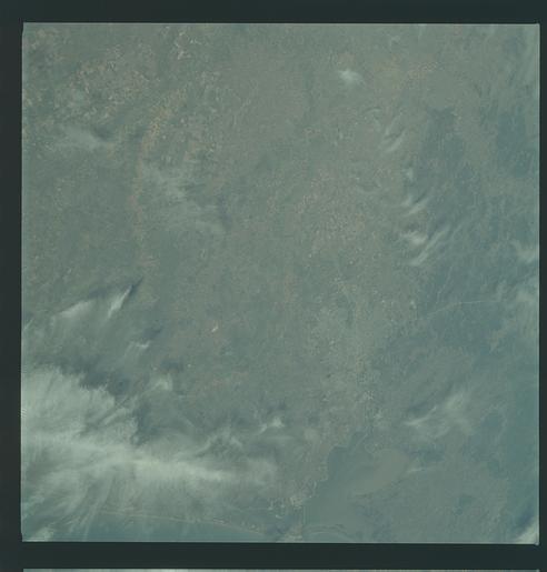
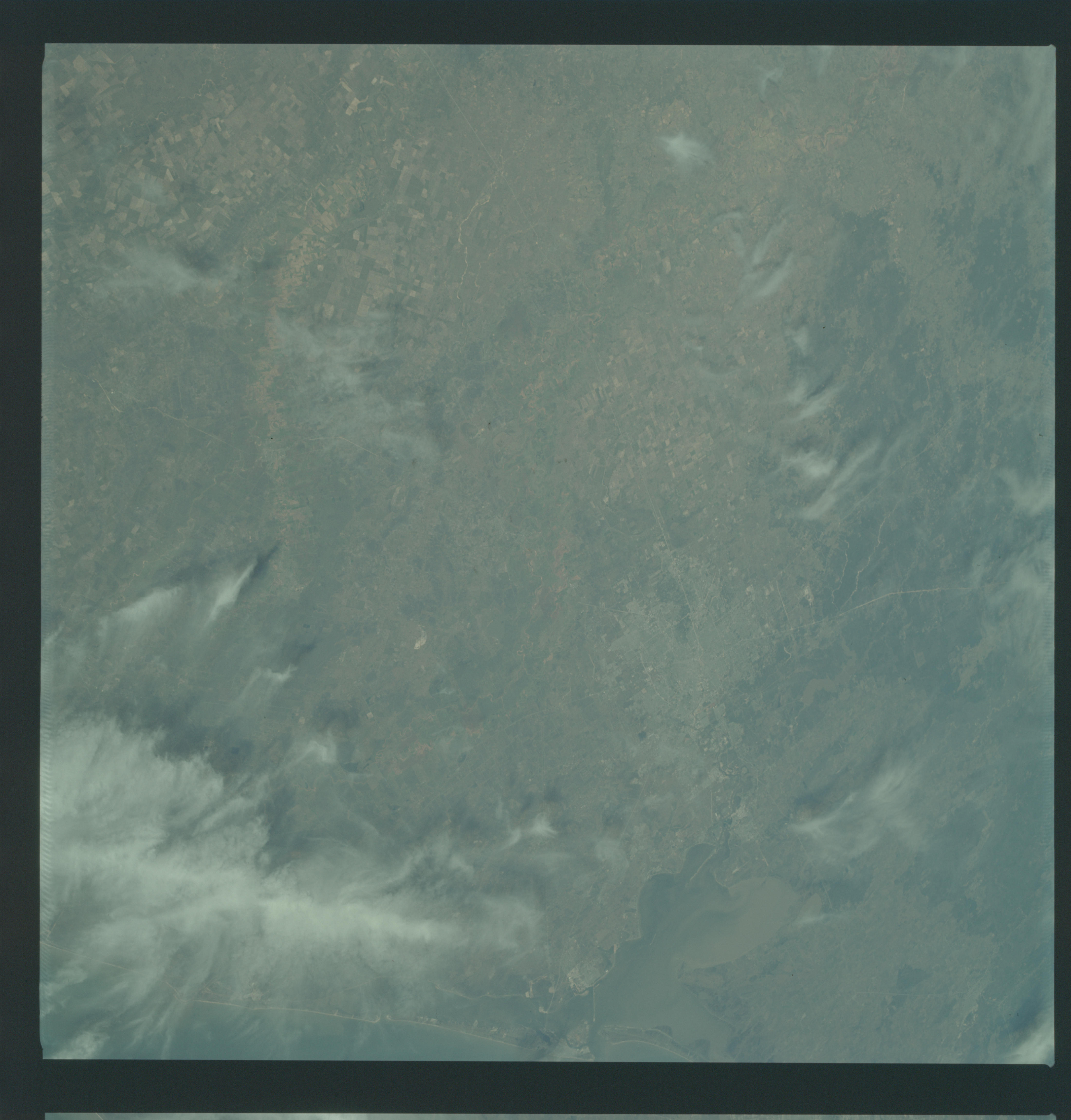
Image Caption: Southeastern Texas Coastal Plain from the Brazos River to the Trinity River, including Houston, in March, 1969. Excellent color contrast for land use.
GEOGRAPHY/CARTOGRAPHY: UNITED STATES, TEXAS, HOUSTON AND GALVESTON METROPOLITAN AREAS, GALVESTON AND TRINITY BAYS.
GEOLOGY/HYDROLOGY: GULF COAST PLAIN.
FORESTRY: RANGE LAND WITH DECIDUOUS STANDS ALONG DRAINAGE, CHANGING TO MIXED PINE/HARDWOOD FORESTS.
AGRICULTURE: HEAVY CONCENTRATION OF FIELD PATTERNS, SOME UNDER WINTER CULTIVATION.
METEOROLOGY: CIRRUS FIBRATUS.
Oblique view of the Houston, Texas area as photographed from the Apollo 9 spacecraft during its earth-orbital mission. This picture was taken from an altitude of 103 nautical miles, at about 1:40 p.m., on March 9, 1969. Prominent features visible include highways leading out of the city, Lake Houston, San Jacinto River, Trinity Bay, Galveston Bay, Brazos River, Baytown, and Texas City.
