AS09-22-3441

| NASA Photo ID | AS09-22-3441 |
| Focal Length | 80mm |
| Date taken | 1969.03.09 |
| Time taken | 18:04:00 GMT |
Cloud masks available for this image:
Spacecraft nadir point:
Photo center point: 33.6° N, 112.3° W
Photo center point by machine learning:
Photo center point: 33.6° N, 112.3° W
Photo center point by machine learning:
Nadir to Photo Center:
Spacecraft Altitude: 106 nautical miles (196km)
Country or Geographic Name: | USA-ARIZONA |
Features: | PHOENIX |
| Features Found Using Machine Learning: | |
Cloud Cover Percentage: | 37 (26-50)% |
Sun Elevation Angle: | 46° |
Sun Azimuth: | ° |
Camera: | Hasselblad |
Focal Length: | 80mm |
Camera Tilt: | Near Vertical |
Format: | SO368: Kodak Ektachrome MS, equivalent to 2448 Kodak Aerochrome, ASA64, thin base, fine grain |
Film Exposure: | Normal |
| Additional Information | |
| Width | Height | Annotated | Cropped | Purpose | Links |
|---|---|---|---|---|---|
| 4400 pixels | 4600 pixels | No | No | Download Image | |
| 492 pixels | 515 pixels | No | No | Download Image |
Download Packaged File
Download a Google Earth KML for this Image
View photo footprint information
Download a GeoTIFF for this photo
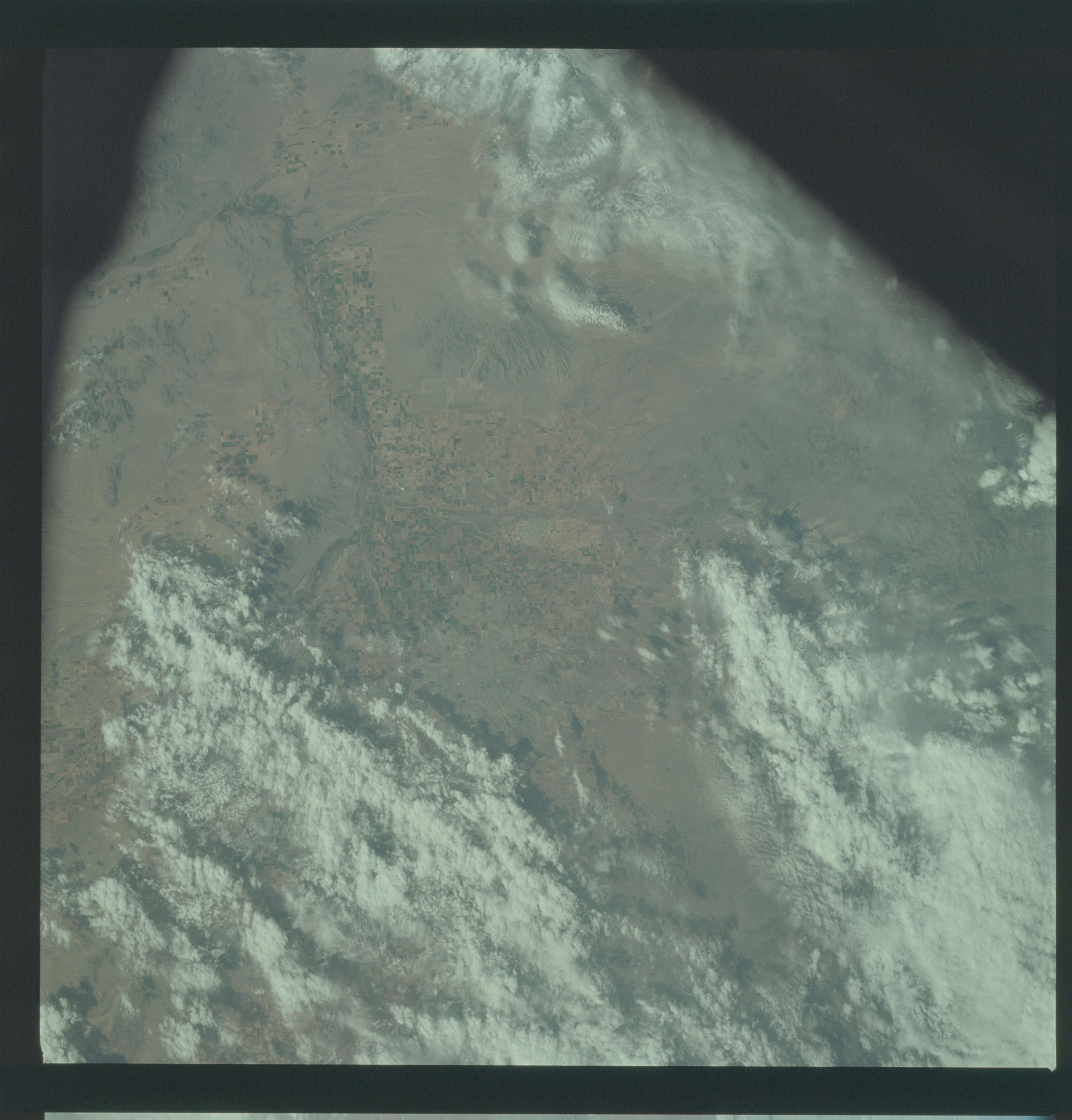
Image Caption: GEOGRAPHY/CARTOGRAPHY: UNITED STATES, ARIZONA, PHOENIX METROPOLITAN AREA.
GEOLOGY/HYDROLOGY: BASIN AND RANGE PROVINCE.
AGRICULTURE: HEAVY CONCENTRATION OF FIELD PATTERNS.
METEOROLOGY: STRATO-CUMULUS, ALTO-STRATUS, SNOW COVER IN MOUNTAIN AND HIGH PLATEAU AREAS, CIRRUS.
OCEANOGRAPHY:
Near vertical view of the Phoenix, Arizona area as photographed from the Apollo 9 spacecraft during its earth-orbital mission. Farmland patterns checkerboard the area along the Gila River. Phoenix is located right of center near the clouds.
