AS09-22-3385

| NASA Photo ID | AS09-22-3385 |
| Focal Length | 80mm |
| Date taken | 1969.03.09 |
| Time taken | 13:24:00 GMT |
Cloud masks available for this image:
Spacecraft nadir point:
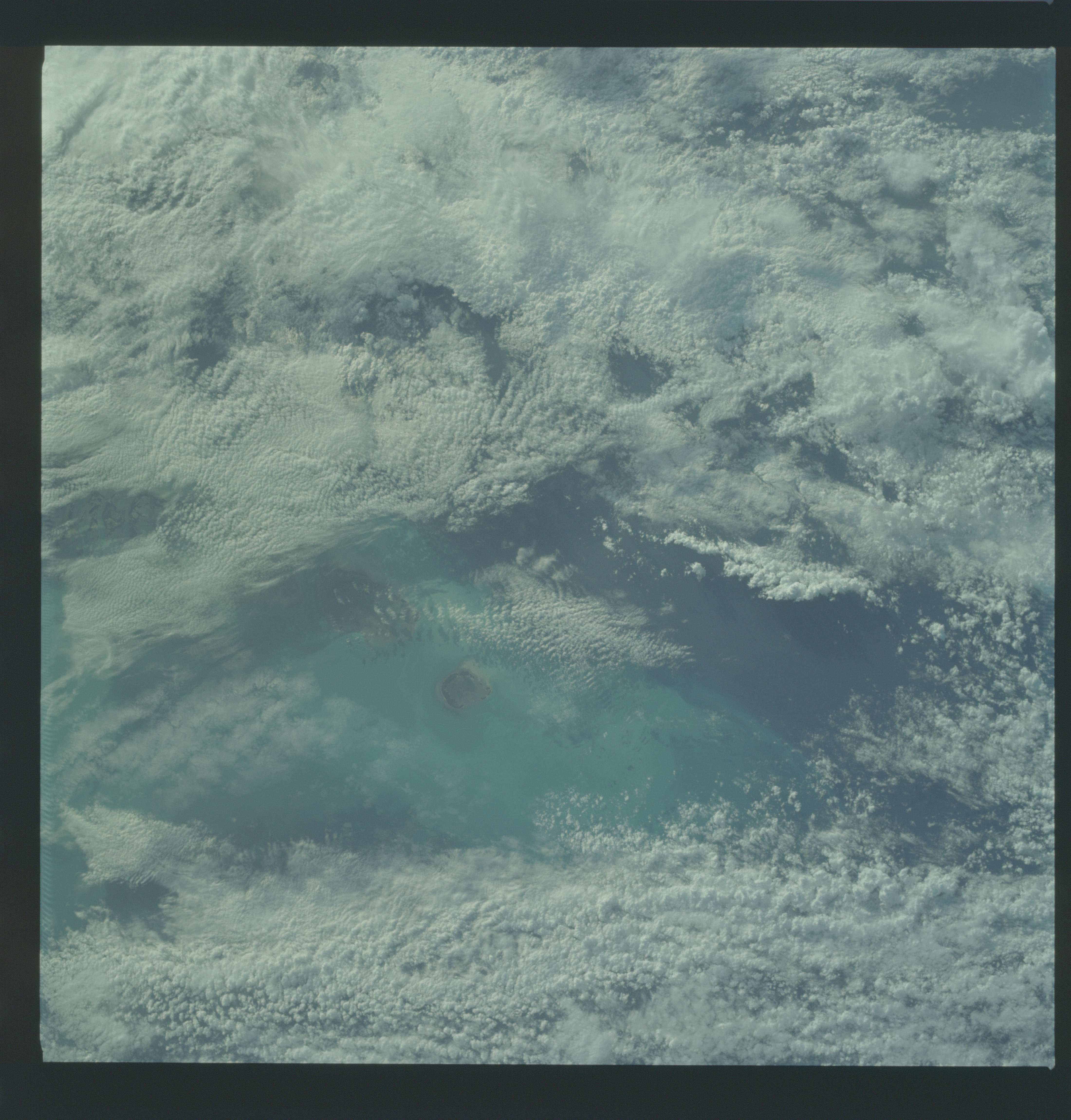
Photo center point: 24.3° N, 82.3° W
Photo center point by machine learning:
Photo center point: 24.3° N, 82.3° W
Photo center point by machine learning:
Nadir to Photo Center:
Spacecraft Altitude: 97 nautical miles (180km)
Country or Geographic Name: | USA-FLORIDA |
Features: | FLORIDA KEYS |
| Features Found Using Machine Learning: | |
Cloud Cover Percentage: | 90 (76-100)% |
Sun Elevation Angle: | 21° |
Sun Azimuth: | ° |
Camera: | Hasselblad |
Focal Length: | 80mm |
Camera Tilt: | Near Vertical |
Format: | SO368: Kodak Ektachrome MS, equivalent to 2448 Kodak Aerochrome, ASA64, thin base, fine grain |
Film Exposure: | Under Exposed |
| Additional Information | |
| Width | Height | Annotated | Cropped | Purpose | Links |
|---|---|---|---|---|---|
| 4400 pixels | 4600 pixels | No | No | Download Image | |
| 492 pixels | 515 pixels | No | No | Download Image |
Download Packaged File
Download a Google Earth KML for this Image
View photo footprint information
Download a GeoTIFF for this photo
Image Caption: GEOGRAPHY/CARTOGRAPHY: UNITED STATES, FLORIDA KEYS, MARQUESAS KEYS, BOCA GRANDE KEY.
GEOLOGY/HYDROLOGY: LOW PLAINS REGION..
FORESTRY: FOREST FIRES,
METEOROLOGY: ALTO-CUMULUS, CUMULUS CONGESTUS, CUMULO-NIMBUS.
OCEANOGRAPHY: GULF OF MEXICO, SOME CURRENT PATTERNS VISIBLE NEAR ISLAND.
GEOLOGY/HYDROLOGY: LOW PLAINS REGION..
FORESTRY: FOREST FIRES,
METEOROLOGY: ALTO-CUMULUS, CUMULUS CONGESTUS, CUMULO-NIMBUS.
OCEANOGRAPHY: GULF OF MEXICO, SOME CURRENT PATTERNS VISIBLE NEAR ISLAND.
