AS09-22-3374
| NASA Photo ID | AS09-22-3374 |
| Focal Length | 80mm |
| Date taken | 1969.03.08 |
| Time taken | 21:46:00 GMT |
Cloud masks available for this image:
Spacecraft nadir point:
Photo center point:
Photo center point by machine learning:
Photo center point:
Photo center point by machine learning:
Nadir to Photo Center:
Spacecraft Altitude: 121 nautical miles (224km)
Country or Geographic Name: | CLOUDS |
Features: | CUMULO-NIMBUS |
| Features Found Using Machine Learning: | |
Cloud Cover Percentage: | 95 (76-100)% |
Sun Elevation Angle: | 20° |
Sun Azimuth: | ° |
Camera: | Hasselblad |
Focal Length: | 80mm |
Camera Tilt: | Near Vertical |
Format: | SO368: Kodak Ektachrome MS, equivalent to 2448 Kodak Aerochrome, ASA64, thin base, fine grain |
Film Exposure: | Normal |
| Additional Information | |
| Width | Height | Annotated | Cropped | Purpose | Links |
|---|---|---|---|---|---|
| 2303 pixels | 2407 pixels | No | Apollo Image Gallery | Download Image | |
| 4400 pixels | 4600 pixels | No | No | Download Image | |
| 492 pixels | 515 pixels | No | No | Download Image |
Download Packaged File
Download a Google Earth KML for this Image
View photo footprint information
Download a GeoTIFF for this photo
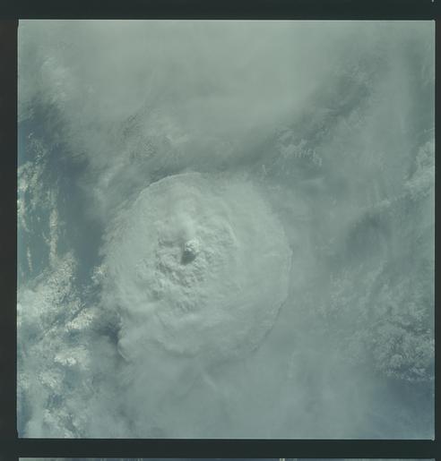
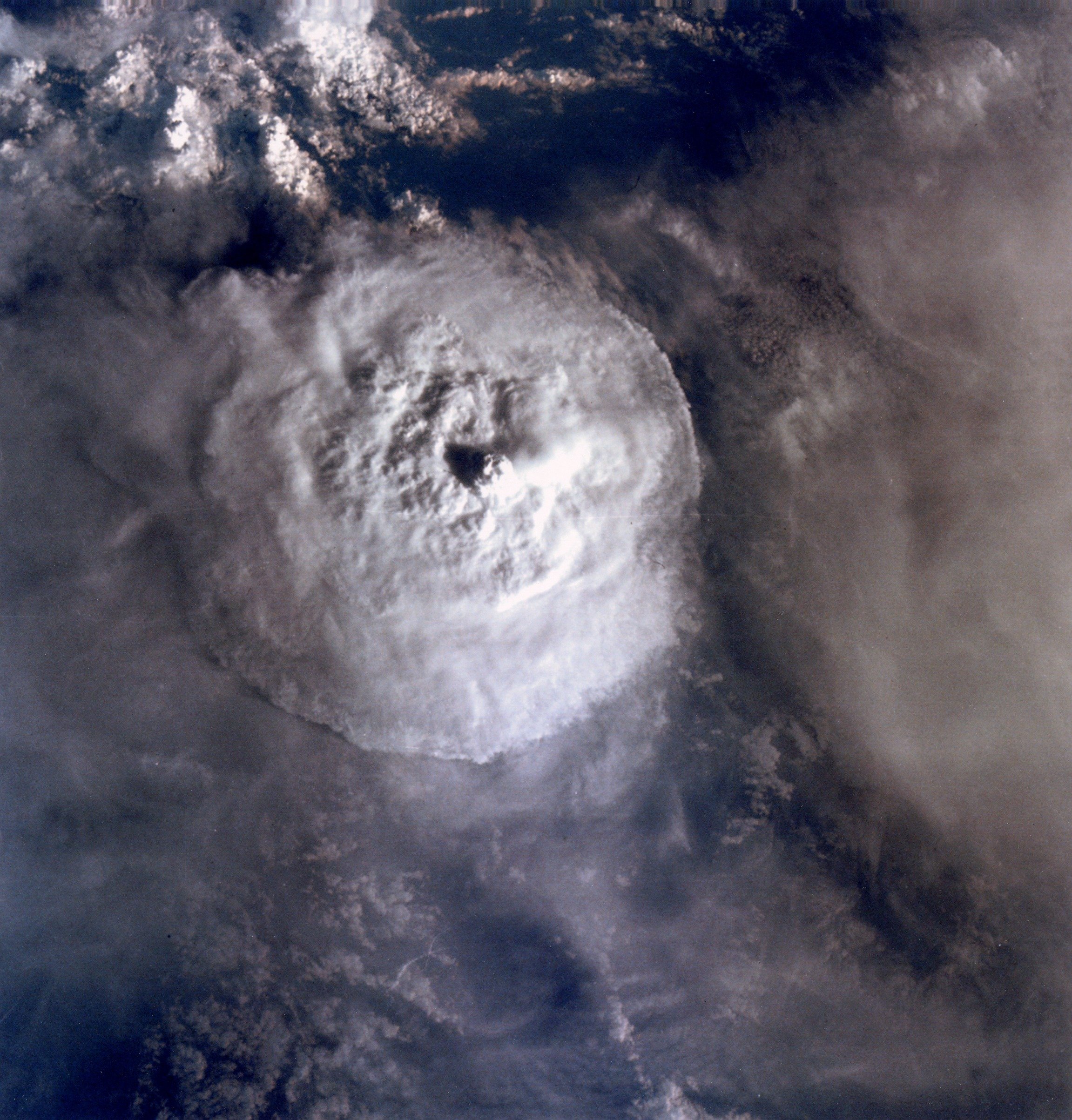
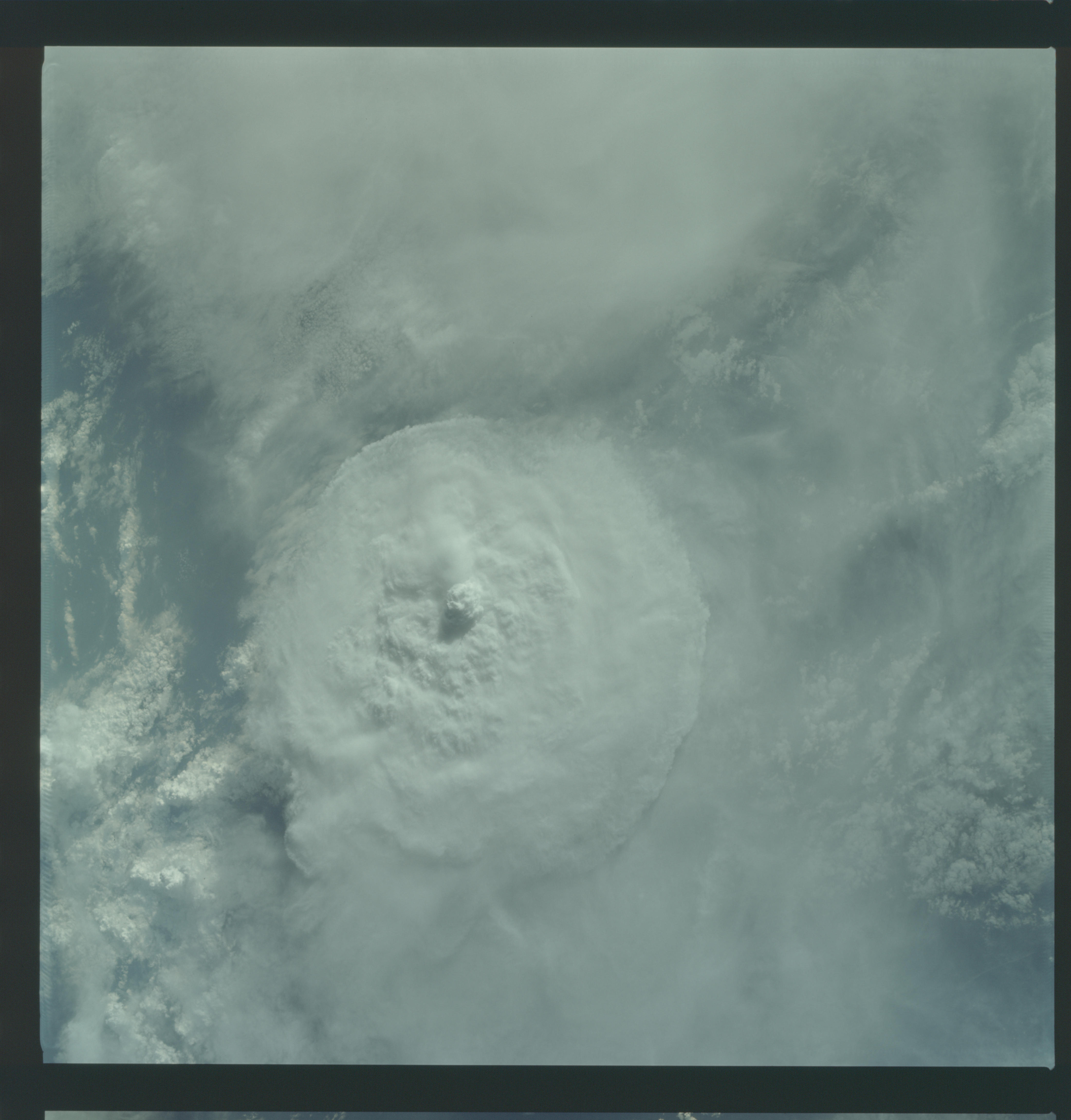
Image Caption: Top structure of a thunderstorm appears prominently above a heavy layer of cirrus clouds. The anvil forms a near-circle at the boundary of the troposphere. Vigorous updrafts appear as overshooting tops and penetrate the stratosphere. Cirrus trailing from the left side of the anvil indicates upper-level wind direction. This near-vertical photograph was taken over Colombia.
GEOGRAPHY/GEOLOGY/METEOROLOGY: LARGE CUMULO-NIMBUS, CIRRUS-SPISSATUS, CUMULUS CONGESTUS.
Near vertical view of thunderhead over South America as photographed from the Apollo 9 spacecraft during its earth-orbital mission.
GEOGRAPHY/GEOLOGY/METEOROLOGY: LARGE CUMULO-NIMBUS, CIRRUS-SPISSATUS, CUMULUS CONGESTUS.
Near vertical view of thunderhead over South America as photographed from the Apollo 9 spacecraft during its earth-orbital mission.
