AS09-22-3329

| NASA Photo ID | AS09-22-3329 |
| Focal Length | 80mm |
| Date taken | 1969.03.08 |
| Time taken | 20:03:00 GMT |
Cloud masks available for this image:
Spacecraft nadir point:
Photo center point: 33.0° N, 106.7° W
Photo center point by machine learning:
Photo center point: 33.0° N, 106.7° W
Photo center point by machine learning:
Nadir to Photo Center:
Spacecraft Altitude: 105 nautical miles (194km)
Country or Geographic Name: | USA-NEW MEXICO |
Features: | WHITE SANDS, EL BUTTE RES |
| Features Found Using Machine Learning: | |
Cloud Cover Percentage: | 13 (11-25)% |
Sun Elevation Angle: | 50° |
Sun Azimuth: | ° |
Camera: | Hasselblad |
Focal Length: | 80mm |
Camera Tilt: | High Oblique |
Format: | SO368: Kodak Ektachrome MS, equivalent to 2448 Kodak Aerochrome, ASA64, thin base, fine grain |
Film Exposure: | Normal |
| Additional Information | |
| Width | Height | Annotated | Cropped | Purpose | Links |
|---|---|---|---|---|---|
| 4400 pixels | 4600 pixels | No | No | Download Image | |
| 492 pixels | 515 pixels | No | No | Download Image |
Download Packaged File
Download a Google Earth KML for this Image
View photo footprint information
Download a GeoTIFF for this photo
Image Caption: Cloud wake
The lines of cumulus clouds seen in this nearvertical view of the Cape Verde Islands are one type of cloud wake (cloud wake seen at the top of the picture is formed behind an island just off the top of the photograph).
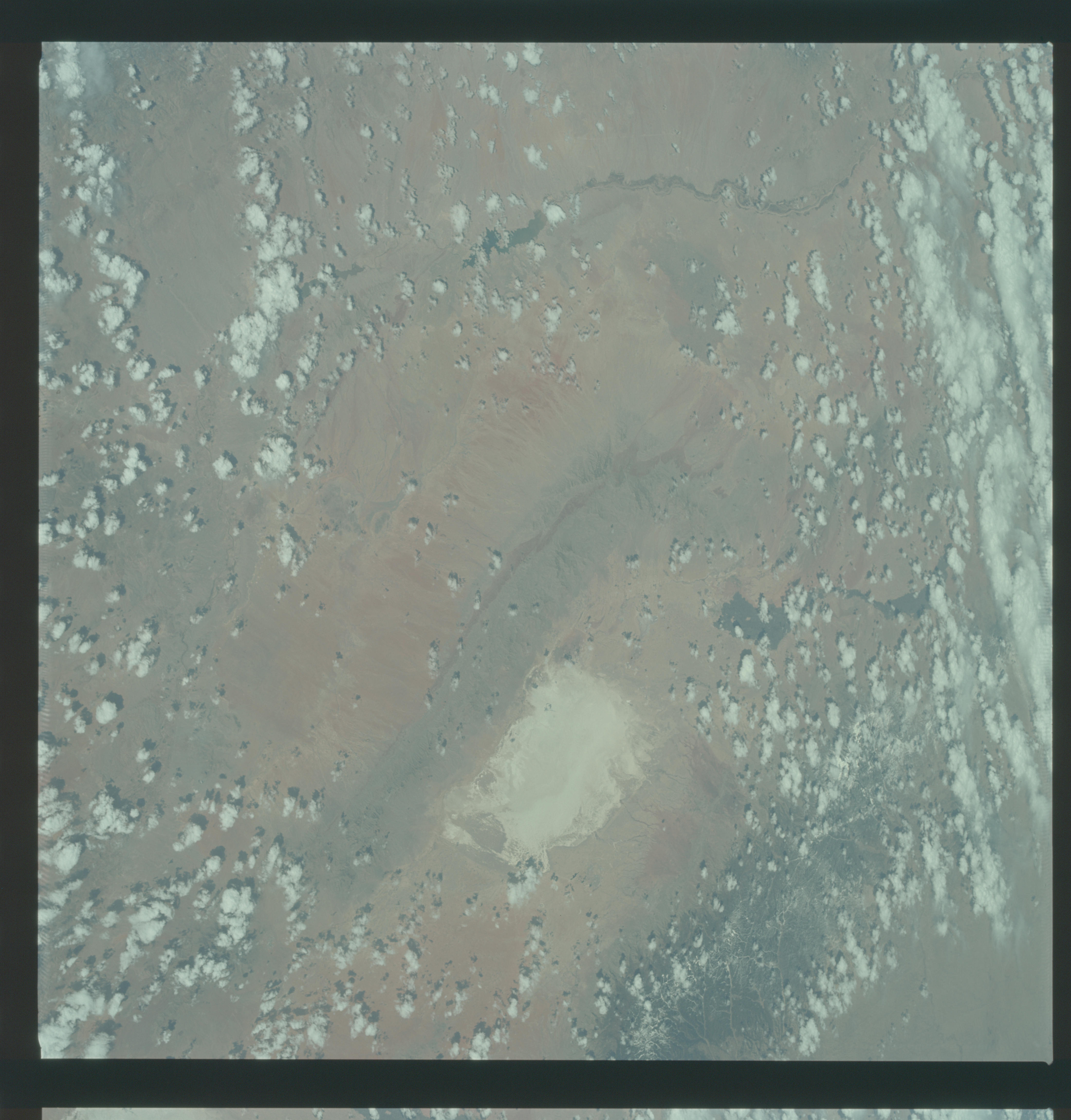
GEOGRAPHY/CARTOGRAPHY: UNITED STATES, NEW MEXICO, COLORADO, WHITE SANDS, RIO GRANDE, ELEPHANT BUTTE RESERVOIR, SAN ADRES AND SACREMENTO MOUNTAINS, TULAROSA VALLEY, TOWN OF ALAMOGORDO.
GEOLOGY/HYDROLOGY: BASIN AND RANGE PROVINCE OF SEDIMENTARY MOUNTAINS AND ALLUVIUM DEPOSITS.
AGRICULTURE: CULTIVATION PATTERNS ALONG RIO GRANDE RIVER.
FORESTRY: CONIFERS IN SACREMENTO MOUNTAINS,, SCATTERED DESERT SHRUBFORM AT LOWER ELEVATIONS.
METEOROLOGY: CUMULUS HUMILIS, CUMULUS CONGESTUS.
The lines of cumulus clouds seen in this nearvertical view of the Cape Verde Islands are one type of cloud wake (cloud wake seen at the top of the picture is formed behind an island just off the top of the photograph).
GEOGRAPHY/CARTOGRAPHY: UNITED STATES, NEW MEXICO, COLORADO, WHITE SANDS, RIO GRANDE, ELEPHANT BUTTE RESERVOIR, SAN ADRES AND SACREMENTO MOUNTAINS, TULAROSA VALLEY, TOWN OF ALAMOGORDO.
GEOLOGY/HYDROLOGY: BASIN AND RANGE PROVINCE OF SEDIMENTARY MOUNTAINS AND ALLUVIUM DEPOSITS.
AGRICULTURE: CULTIVATION PATTERNS ALONG RIO GRANDE RIVER.
FORESTRY: CONIFERS IN SACREMENTO MOUNTAINS,, SCATTERED DESERT SHRUBFORM AT LOWER ELEVATIONS.
METEOROLOGY: CUMULUS HUMILIS, CUMULUS CONGESTUS.
