AS09-21-3321
| NASA Photo ID | AS09-21-3321 |
| Focal Length | 80mm |
| Date taken | 1969.03.09 |
| Time taken | 19:49:00 GMT |
Cloud masks available for this image:
Spacecraft nadir point:
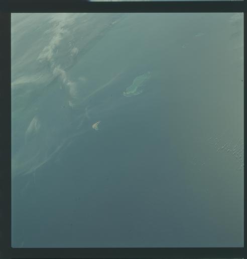
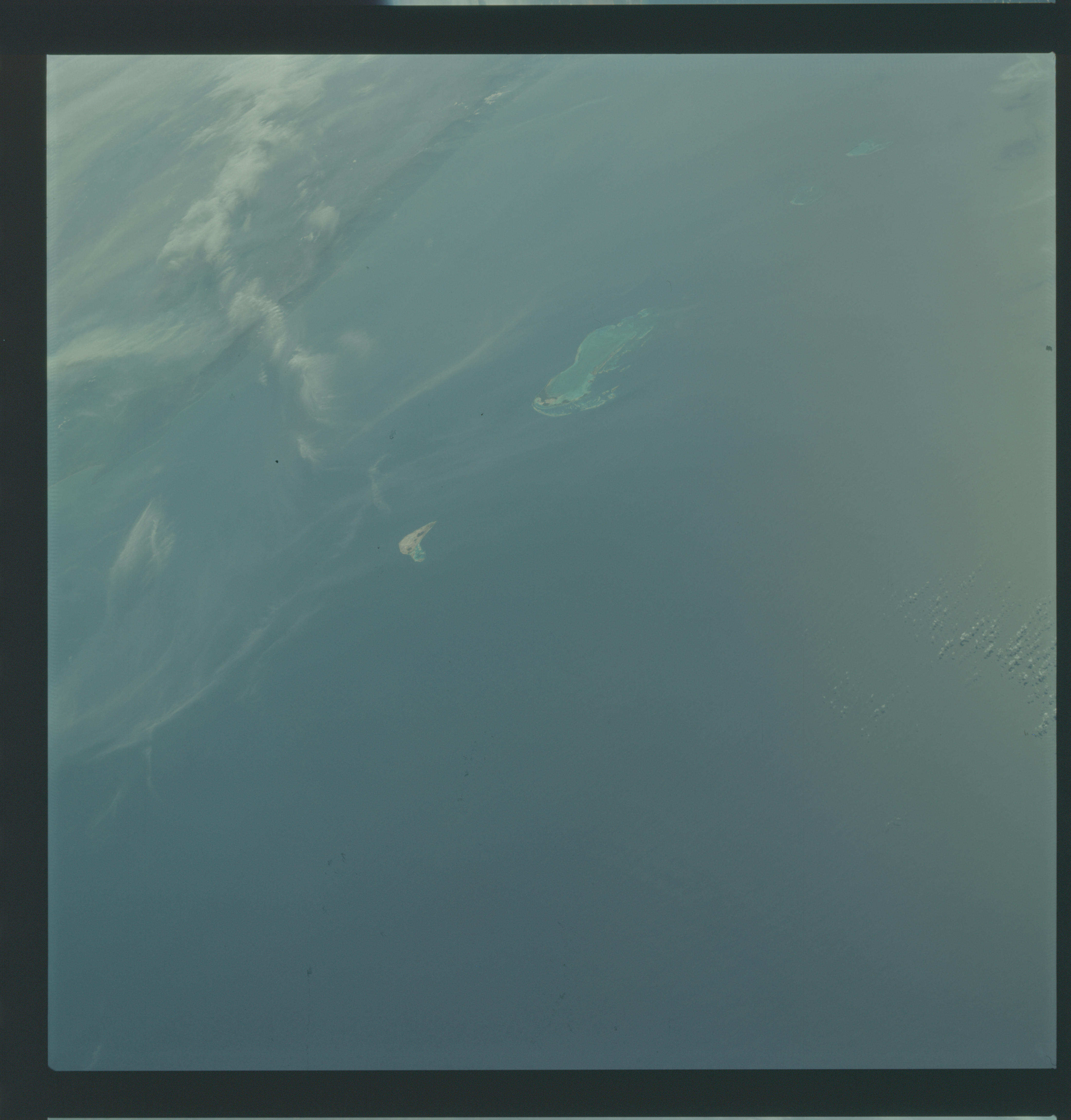
Photo center point: 12.0° N, 66.5° W
Photo center point by machine learning:
Photo center point: 12.0° N, 66.5° W
Photo center point by machine learning:
Nadir to Photo Center:
Spacecraft Altitude: 101 nautical miles (187km)
Country or Geographic Name: | LESSER ANTILLES |
Features: | ORCHILA & LOS ROQUES IS. |
| Features Found Using Machine Learning: | |
Cloud Cover Percentage: | 4 (1-10)% |
Sun Elevation Angle: | 20° |
Sun Azimuth: | ° |
Camera: | Hasselblad |
Focal Length: | 80mm |
Camera Tilt: | High Oblique |
Format: | SO368: Kodak Ektachrome MS, equivalent to 2448 Kodak Aerochrome, ASA64, thin base, fine grain |
Film Exposure: | Normal |
| Additional Information | |
| Width | Height | Annotated | Cropped | Purpose | Links |
|---|---|---|---|---|---|
| 4400 pixels | 4600 pixels | No | No | Download Image | |
| 492 pixels | 515 pixels | No | No | Download Image |
Download Packaged File
Download a Google Earth KML for this Image
View photo footprint information
Download a GeoTIFF for this photo
Image Caption: GEOGRAPHY/CARTOGRAPHY: LESSER ANTILLES, LOS ROQUES ISLANDS, ORCHILA ISLAND, VENZUELAN COAST NEAR CARACAS ALSO VISIBLE.
GEOLOGY/HYDROLOGY: VOLCANIC AND CORAL ISLANDS.
METEOROLOGY: CIRRUS FIBRATUS, ALTO-STRATUS
OCEANOGRAPHY: CARIBBEAN SEA, CORAL REEFS AND ISLANDS, SUNGLINT.
GEOLOGY/HYDROLOGY: VOLCANIC AND CORAL ISLANDS.
METEOROLOGY: CIRRUS FIBRATUS, ALTO-STRATUS
OCEANOGRAPHY: CARIBBEAN SEA, CORAL REEFS AND ISLANDS, SUNGLINT.
