AS09-21-3256
| NASA Photo ID | AS09-21-3256 |
| Focal Length | 80mm |
| Date taken | 1969.03.08 |
| Time taken | 15:22:00 GMT |
Cloud masks available for this image:
Spacecraft nadir point:
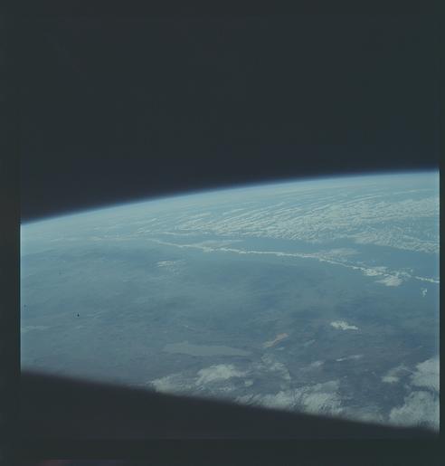
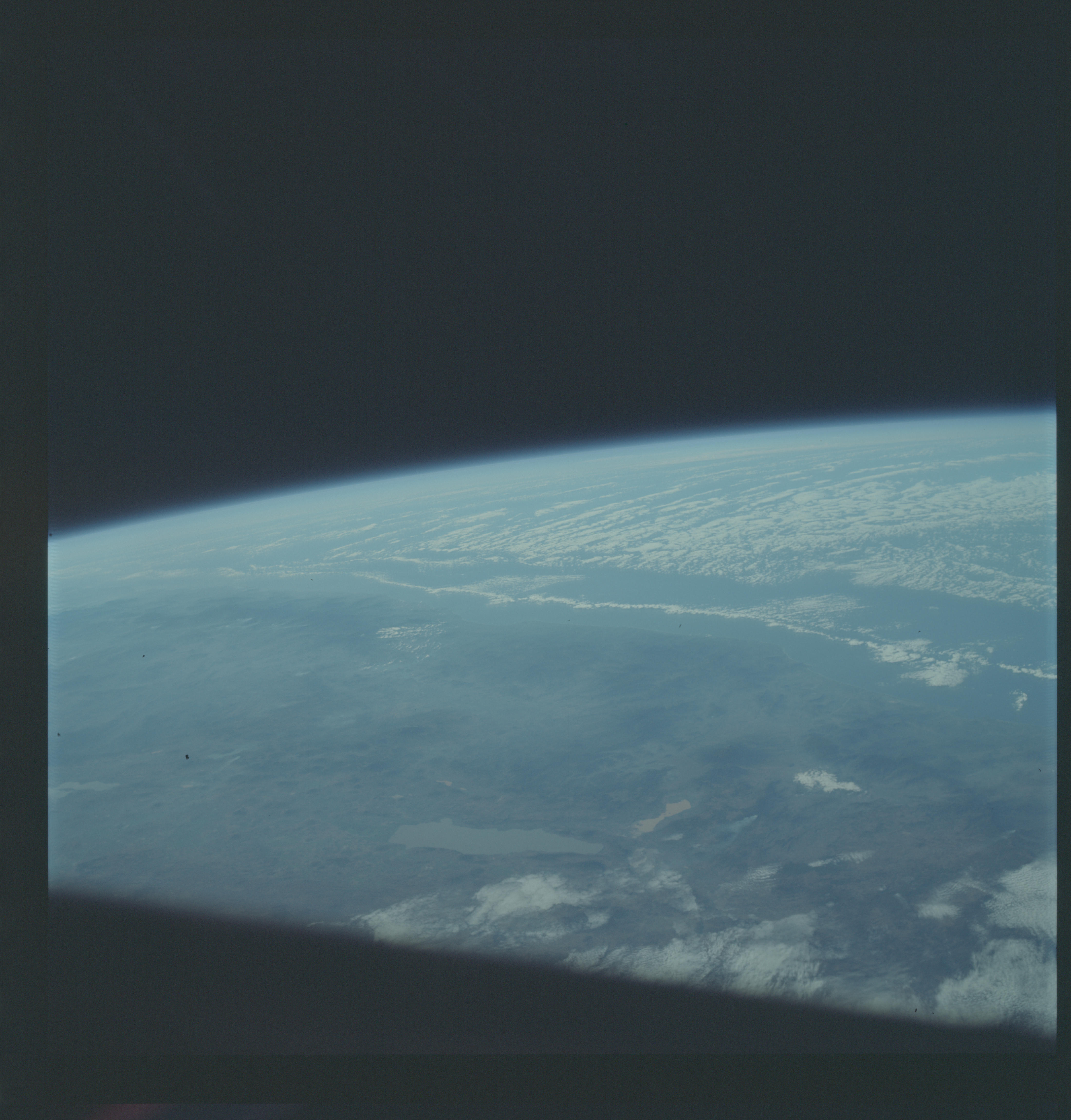
Photo center point: 19.0° N, 103.0° W
Photo center point by machine learning:
Photo center point: 19.0° N, 103.0° W
Photo center point by machine learning:
Nadir to Photo Center:
Spacecraft Altitude: 121 nautical miles (224km)
Country or Geographic Name: | MEXICO |
Features: | LAGUNA DE CHAPALA |
| Features Found Using Machine Learning: | |
Cloud Cover Percentage: | 20 (11-25)% |
Sun Elevation Angle: | 30° |
Sun Azimuth: | ° |
Camera: | Hasselblad |
Focal Length: | 80mm |
Camera Tilt: | High Oblique |
Format: | SO368: Kodak Ektachrome MS, equivalent to 2448 Kodak Aerochrome, ASA64, thin base, fine grain |
Film Exposure: | Normal |
| Additional Information | |
| Width | Height | Annotated | Cropped | Purpose | Links |
|---|---|---|---|---|---|
| 4400 pixels | 4600 pixels | No | No | Download Image | |
| 492 pixels | 515 pixels | No | No | Download Image |
Download Packaged File
Download a Google Earth KML for this Image
View photo footprint information
Download a GeoTIFF for this photo
Image Caption: GEOGRAPHY/CARTOGRAPHY: MEXICO, LAKE OF THE CHAPAL, TOWNS OF SHAUAYO, JIQUILPEN, LA BARCA, AND SAYULA, CITH OF GUADALAJARA UNDER CLOUDS.
GEOLOGY/HYDROLOGY: COMPLEX MOUNTAIN REGION.
METEOROLOGY: STRATO-CUMULUS, ALTO-CUMULUS.
GEOLOGY/HYDROLOGY: COMPLEX MOUNTAIN REGION.
METEOROLOGY: STRATO-CUMULUS, ALTO-CUMULUS.
