AS09-20-3137
| NASA Photo ID | AS09-20-3137 |
| Focal Length | 80mm |
| Date taken | 1969.03.12 |
| Time taken | 16:28:00 GMT |
Cloud masks available for this image:
Spacecraft nadir point:
Photo center point: 35.5° N, 112.6° W
Photo center point by machine learning:
Photo center point: 35.5° N, 112.6° W
Photo center point by machine learning:
Nadir to Photo Center:
Spacecraft Altitude: 126 nautical miles (233km)
Country or Geographic Name: | USA-ARIZONA |
Features: | GRAND CANYON, SNOW COVER |
| Features Found Using Machine Learning: | |
Cloud Cover Percentage: | 0 (no clouds present) |
Sun Elevation Angle: | 37° |
Sun Azimuth: | ° |
Camera: | Hasselblad |
Focal Length: | 80mm |
Camera Tilt: | High Oblique |
Format: | SO368: Kodak Ektachrome MS, equivalent to 2448 Kodak Aerochrome, ASA64, thin base, fine grain |
Film Exposure: | Normal |
| Additional Information | |
| Width | Height | Annotated | Cropped | Purpose | Links |
|---|---|---|---|---|---|
| 4400 pixels | 4600 pixels | No | No | Download Image | |
| 492 pixels | 515 pixels | No | No | Download Image |
Download Packaged File
Download a Google Earth KML for this Image
View photo footprint information
Download a GeoTIFF for this photo
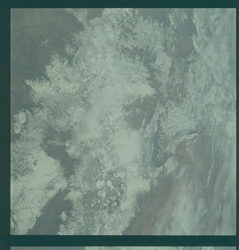
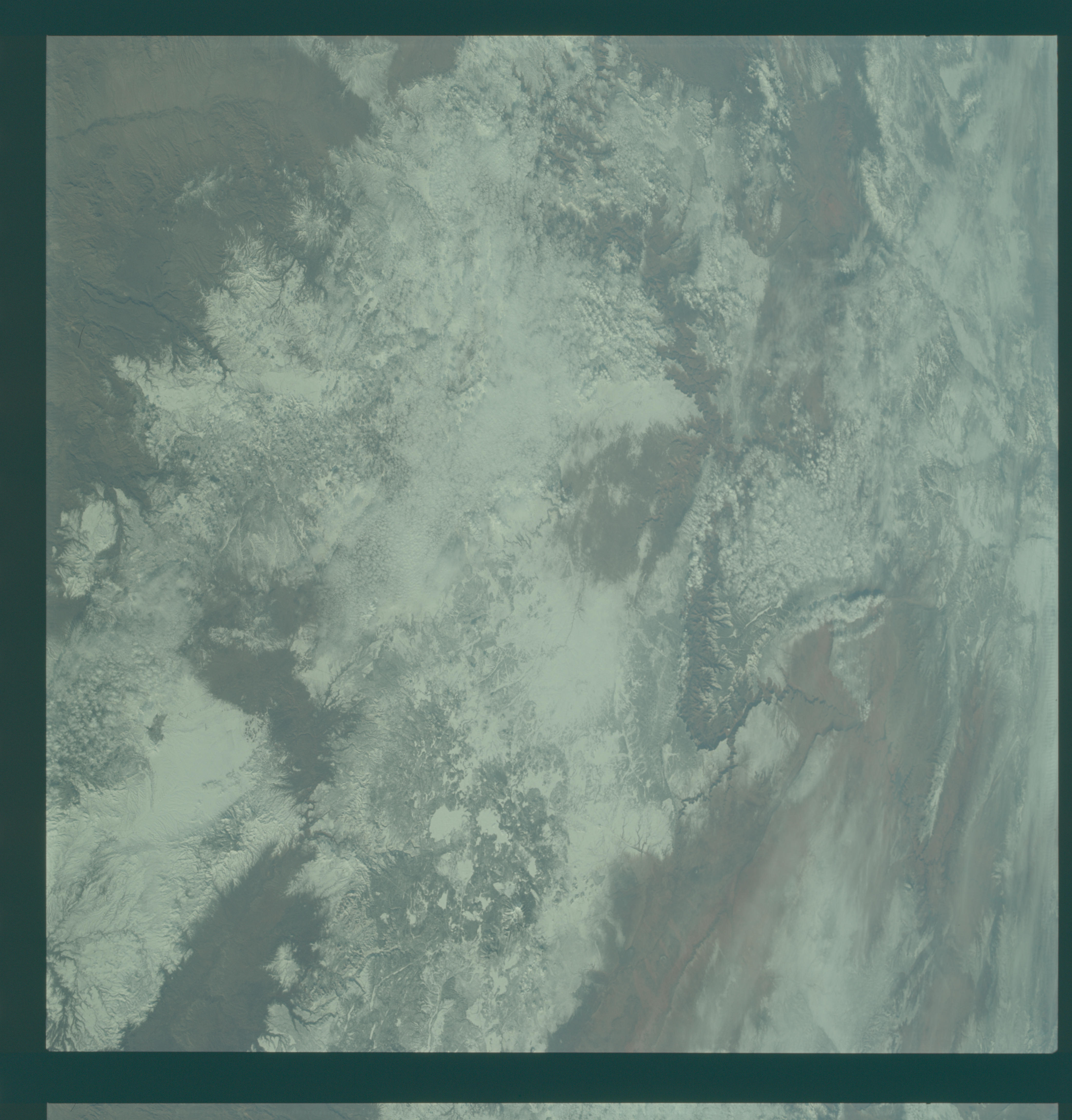
Image Caption: GEOGRAPHY/CARTOGRAPHY: UNITED STATES, ARIZONA, UTAH, COLORADO RIVER, GRAND CANYON, COCONINO PLATEAU, JUNIPER MOUNTAINS, TOWN OF PRESCOTT.
GEOLOGY/HYDROLOGY: BASEMENT COMPLEX MOUNTAINS, TERTIARY VOLCANICS,AND ALLUVIAL DEPOSITS.
AGRICULTURE:RANGE LANDS.
FORESTRY: MIXED CONIFERS.
METEOROLOGY: STRATO-CUMULUS.
The Grand Canyon is sharply etched on the snow-covered Colorado Plateau in Arizona as photographed from the Apollo 9 spacecraft during its earth-orbital mission. Lake Powell behind Glen Canyon Dam is in the upper right corner. Humphreys Peak and the many volcanic craters around the San Francisco Mountains near Flagstaff are right of center. Prescott is under clouds at lower center.
