AS07-5-1660

| NASA Photo ID | AS07-5-1660 |
| Focal Length | 80mm |
| Date taken | 1968.10.__ |
| Time taken | GMT |
Cloud masks available for this image:
Spacecraft nadir point:
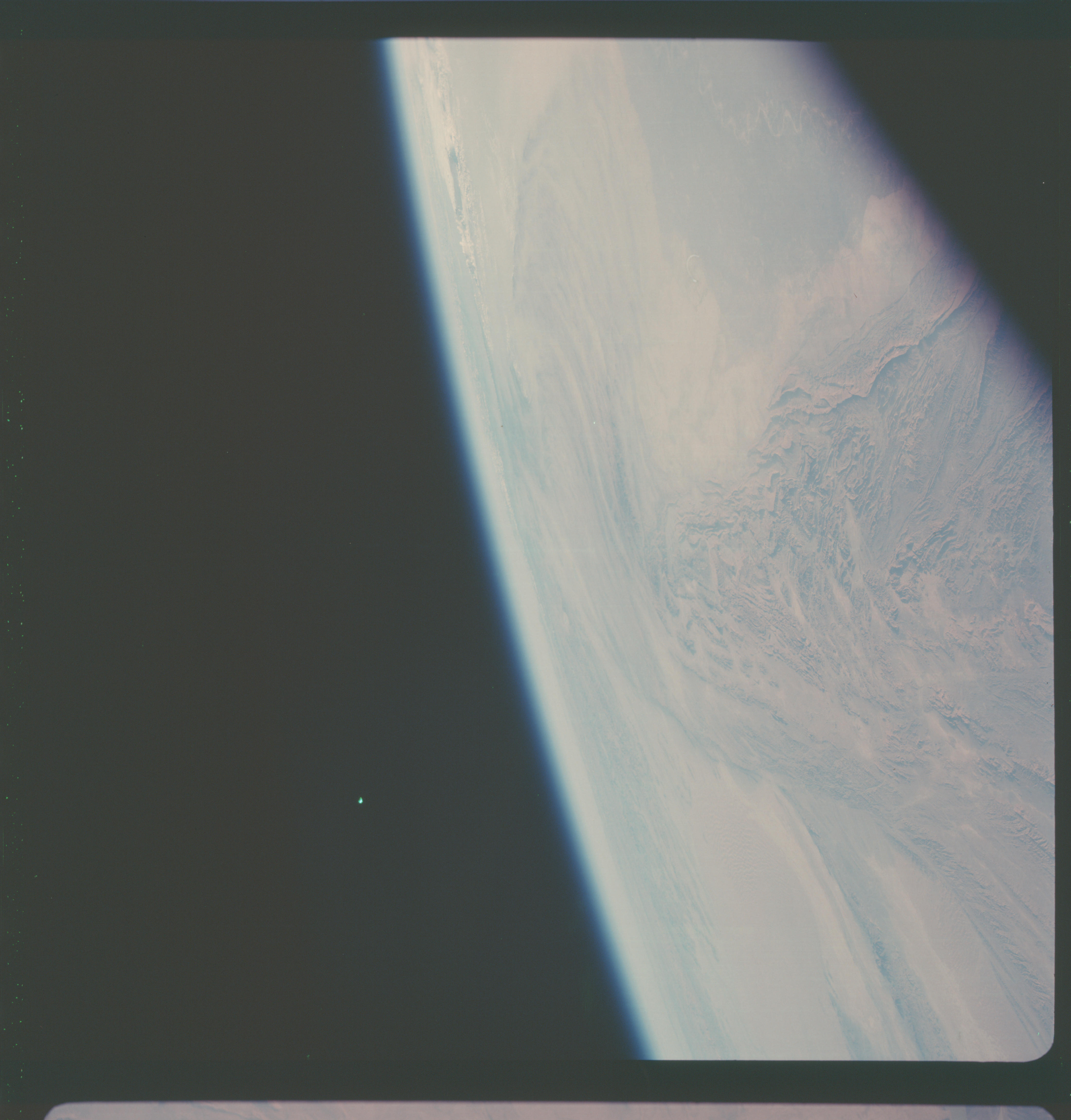
Photo center point: 32.0° N, 67.0° E
Photo center point by machine learning:
Photo center point: 32.0° N, 67.0° E
Photo center point by machine learning:
Nadir to Photo Center:
Spacecraft Altitude: nautical miles (0km)
Country or Geographic Name: | AFGHANISTAN |
Features: | KIRTHAR & MAKRAN RANGES |
| Features Found Using Machine Learning: | |
Cloud Cover Percentage: | 5 (1-10)% |
Sun Elevation Angle: | ° |
Sun Azimuth: | ° |
Camera: | Hasselblad |
Focal Length: | 80mm |
Camera Tilt: | High Oblique |
Format: | SO121: Kodak Ektachrome 64 |
Film Exposure: | Normal |
| Additional Information | |
| Width | Height | Annotated | Cropped | Purpose | Links |
|---|---|---|---|---|---|
| 4400 pixels | 4600 pixels | No | No | Download Image | |
| 492 pixels | 515 pixels | No | No | Download Image |
Download Packaged File
Download a Google Earth KML for this Image
View photo footprint information
Download a GeoTIFF for this photo
Image Caption: Central Makran Range/Karakoram Range T101
The spine of the Central Makran Range is composed of convoluted
folds on the eastern side and bound by a major strike-slip fault
on the western side. The snowcapped Karakoram Range lies on the
horizon at a distance of over 1000 kilometers. The Indus River
is confined by the Makran Ranges along the Makran Ranges along
the right-hand side of this photo. (AS7-5-1660)
