AS07-11-1999
| NASA Photo ID | AS07-11-1999 |
| Focal Length | 80mm |
| Date taken | 1968.10.__ |
| Time taken | GMT |

Cloud masks available for this image:
Spacecraft nadir point:
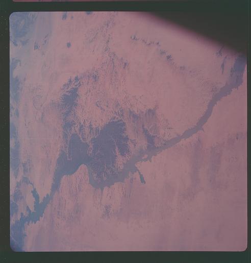
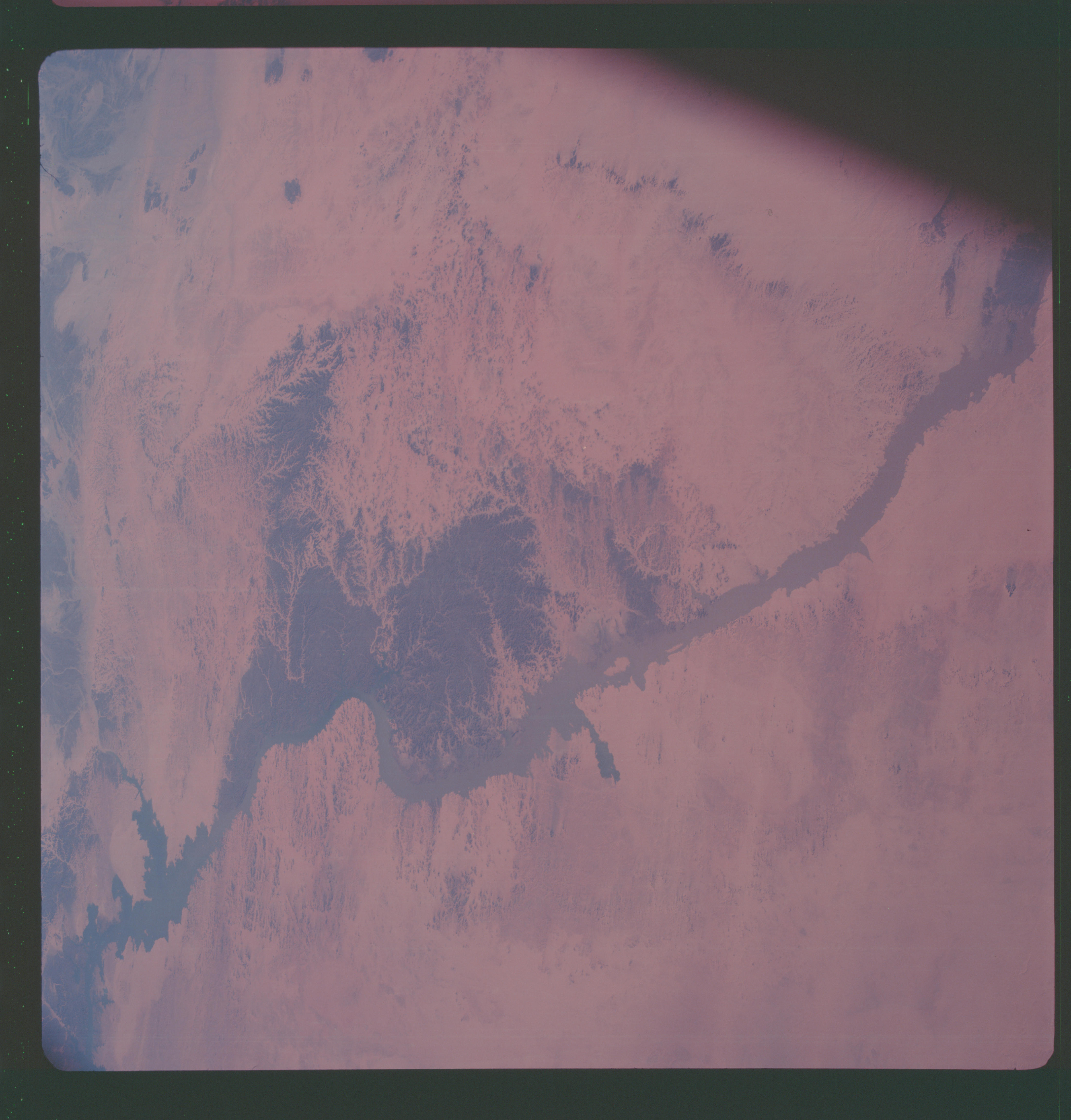
Photo center point: 22.5° N, 32.0° E
Photo center point by machine learning:
Photo center point: 22.5° N, 32.0° E
Photo center point by machine learning:
Nadir to Photo Center:
Spacecraft Altitude: nautical miles (0km)
Country or Geographic Name: | EGYPT |
Features: | NILE RIVER, LAKE NASSER |
| Features Found Using Machine Learning: | |
Cloud Cover Percentage: | |
Sun Elevation Angle: | ° |
Sun Azimuth: | ° |
Camera: | Hasselblad |
Focal Length: | 80mm |
Camera Tilt: | Low Oblique |
Format: | SO121: Kodak Ektachrome 64 |
Film Exposure: | Normal |
| Additional Information | |
| Width | Height | Annotated | Cropped | Purpose | Links |
|---|---|---|---|---|---|
| 4400 pixels | 4600 pixels | No | No | Download Image | |
| 492 pixels | 515 pixels | No | No | Download Image | |
| 2636 pixels | 2603 pixels | No | No | Download Image |
Download Packaged File
Download a Google Earth KML for this Image
View photo footprint information
Download a GeoTIFF for this photo
Image Caption: Lake Nasser on the Nile River in southeastern United Arab Republic (Egypt) as seen from the Apollo 7 spacecraft during its 10th revolution of the earth. Photographed from an altitude of 130 nautical miles, at ground elapsed time of 14 hours and 56 minutes. Lake Nasser was created by the contruction of the Aswan Dam on the Nile.
