AS06-2-1448

| NASA Photo ID | AS06-2-1448 |
| Focal Length | 76mm |
| Date taken | 1968.04.04 |
| Time taken | GMT |
Cloud masks available for this image:
Spacecraft nadir point:
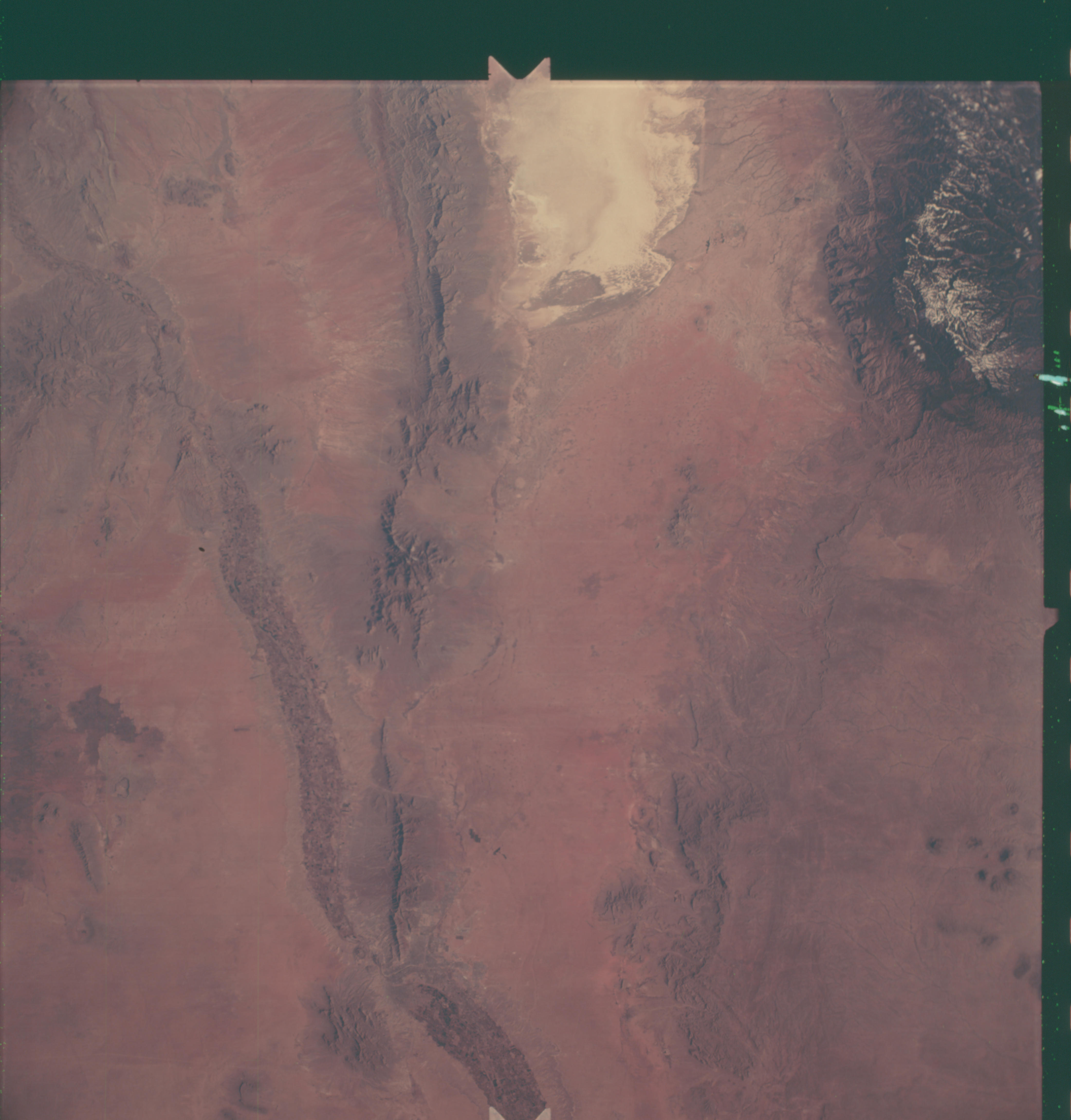
Photo center point: 32.5° N, 106.5° W
Photo center point by machine learning:
Photo center point: 32.5° N, 106.5° W
Photo center point by machine learning:
Nadir to Photo Center:
Spacecraft Altitude: nautical miles (0km)
Country or Geographic Name: | USA-NEW MEXICO |
Features: | RIO GRANDE, WHITE SANDS |
| Features Found Using Machine Learning: | |
Cloud Cover Percentage: | |
Sun Elevation Angle: | ° |
Sun Azimuth: | ° |
Camera: | Maurer model 220G |
Focal Length: | 76mm |
Camera Tilt: | Near Vertical |
Format: | SO121: Kodak Ektachrome 64 |
Film Exposure: | Normal |
| Additional Information | |
| Width | Height | Annotated | Cropped | Purpose | Links |
|---|---|---|---|---|---|
| 4400 pixels | 4600 pixels | No | No | Download Image | |
| 492 pixels | 515 pixels | No | No | Download Image |
Download Packaged File
Download a Google Earth KML for this Image
View photo footprint information
Download a GeoTIFF for this photo
Image Caption: The El Paso and White Sands area are photographed from the Apollo 6 (Spacecraft 020/Saturn 502) unmanned space mission three hours and eight minutes after liftoff. North is toward top of picture. Near bottom center of picture is the El Paso-Ciudad Juarez, Mexico metropolitan area. At the top is the White Sands National Monument area. Note Rio Grande River on left side of picture. The snow-covered Sacremento Mountains are seen in the upper right corner. The altitude of the spacecraft when this photograph was taken was 115 nautical miles.
