< STS089-705-Q >
| NASA Photo ID | STS089-705-Q |
| Focal Length | 100mm |
| Date taken | 1998.01.__ |
| Time taken | GMT |
Cloud masks available for this image:
Spacecraft nadir point:
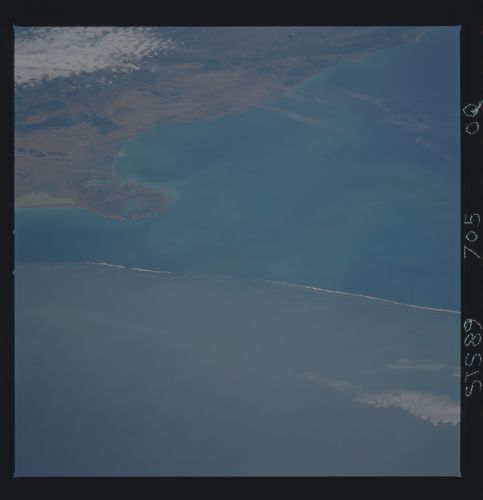
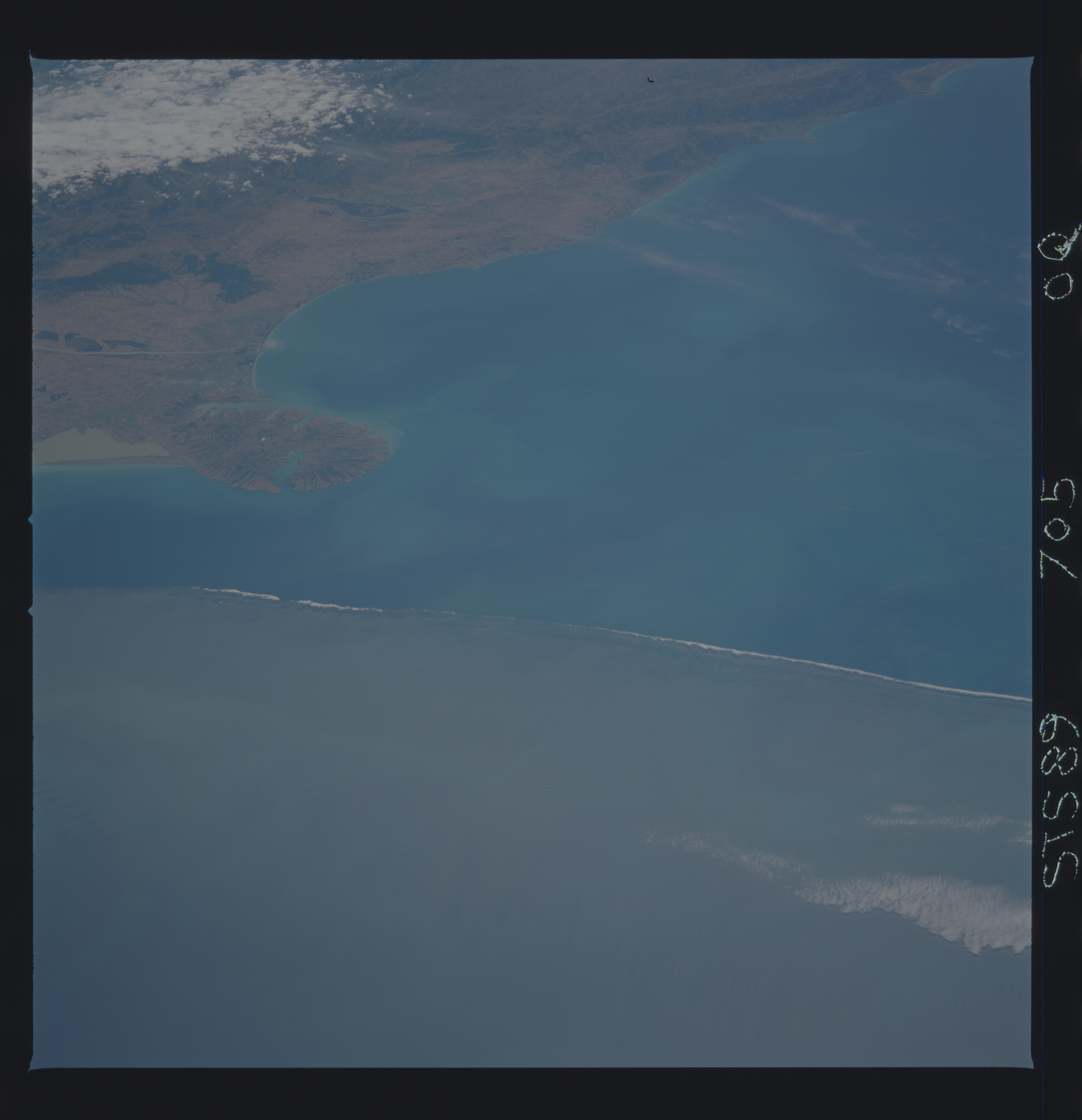
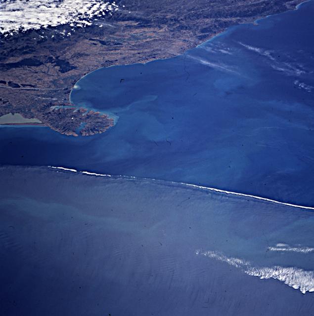
Photo center point: 44.5° S, 173.5° E
Photo center point by machine learning:
Photo center point: 44.5° S, 173.5° E
Photo center point by machine learning:
Nadir to Photo Center:
Spacecraft Altitude: nautical miles (0km)
Country or Geographic Name: | NEW ZEALAND-SI |
Features: | BANKS PENINSULA |
| Features Found Using Machine Learning: | |
Cloud Cover Percentage: | 10 (1-10)% |
Sun Elevation Angle: | ° |
Sun Azimuth: | ° |
Camera: | Hasselblad |
Focal Length: | 100mm |
Camera Tilt: | Low Oblique |
Format: | 5069: Kodak Elite 100S, E6 Reversal, Replaces Lumiere, Warmer in tone vs. Lumiere |
Film Exposure: | Normal |
| Additional Information | |
| Width | Height | Annotated | Cropped | Purpose | Links |
|---|---|---|---|---|---|
| 5700 pixels | 5900 pixels | No | No | Download Image Download Color Calibration Image for this Image |
|
| 483 pixels | 500 pixels | No | No | Download Image Download Color Calibration Image for this Image |
|
| 635 pixels | 640 pixels | No | No | Photographic Highlights | Download Image |
Download Packaged File
Download a Google Earth KML for this Image
View photo footprint information
No GeoTIFF is available for this photo.Image Caption: A line perpendicular to the coast south of Banks Peninsula, New Zealand. This very visible line is probably
caused by a wind associated with a weather system changing the surface reflectance for this sun angle. At
the north edge of the plankton bloom is the subtropical convergence zone where subtropical (productive)
waters from the north meet sub-Antarctic (much less productive) waters from the south. The two currents
meet and flow outwards from the shore in an eastward direction over the Chatham Rise, where water
depths decrease from 2,500 m to 125 m over a relatively short distance. This bathy- metrically locked
feature is seen in many images (including AVHRR) and marks an area of very productive water, high in
phytoplankton. Communique to S. Runco from Richard Murphy, National Institute of Water and
Atmospheric Research, Wellington, New Zealand.
