< STS043-152-B >
| NASA Photo ID | STS043-152-B |
| Focal Length | 250mm |
| Date taken | 1991.08.__ |
| Time taken | GMT |
Resolutions offered for this image:
640 x 480 pixels
640 x 480 pixels
Cloud masks available for this image:
Spacecraft nadir point:
Photo center point: 2.0° S, 55.0° W
Photo center point by machine learning:
Photo center point: 2.0° S, 55.0° W
Photo center point by machine learning:
Nadir to Photo Center:
Spacecraft Altitude: nautical miles (0km)Body: Earth
Country or Geographic Name: | BRAZIL |
Features: | RIOS AMAZON, TAPAJOS |
| Features Found Using Machine Learning: | |
Cloud Cover Percentage: | 50 (26-50)% |
Sun Elevation Angle: | ° |
Sun Azimuth: | ° |
Camera: | Linhof |
Focal Length: | 250mm |
Camera Tilt: | Low Oblique |
Format: | QX868: Kodak, natural color positive, Ektachrome QX868(5017 emulsion), ASA 64, thin base |
Film Exposure: | Normal |
| Additional Information | |
| Width | Height | Annotated | Cropped | Purpose | Links |
|---|---|---|---|---|---|
| 640 pixels | 480 pixels | No | No | ISD 1 | Download Image |
Download Packaged File
Download a Google Earth KML for this Image
View photo footprint information
No GeoTIFF is available for this photo.Image Caption:
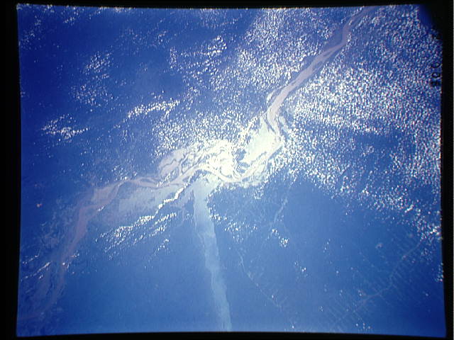
S43-152-0B - Amazon River, Brazil
Junction of the Amazon and Tapajos Rivers at Santarem, Brazil.
The Amazon runs from lower left to upper right of the photograph.
Below the juncture of the Amazon and Tapajos, forest clearing
along the Trans-Amazon Highway can be seen. Linhof Camera, 250mm
lens, no time
This view shows the confluence of the Amazon and the Topajos Rivers at Santarem, Brazil (2.0S, 55.0W). The Am,azon flows from lower left to upper right of the photo. Below the river juncture of the Amazon and Tapajos, there is considerable deforestation activity along the Trans-Amazon Highway.
S43-152-0B - Amazon River, Brazil
Junction of the Amazon and Tapajos Rivers at Santarem, Brazil.
The Amazon runs from lower left to upper right of the photograph.
Below the juncture of the Amazon and Tapajos, forest clearing
along the Trans-Amazon Highway can be seen. Linhof Camera, 250mm
lens, no time
This view shows the confluence of the Amazon and the Topajos Rivers at Santarem, Brazil (2.0S, 55.0W). The Am,azon flows from lower left to upper right of the photo. Below the river juncture of the Amazon and Tapajos, there is considerable deforestation activity along the Trans-Amazon Highway.

