< STS043-96-96 >
| NASA Photo ID | STS043-96-96 |
| Focal Length | 250mm |
| Date taken | 1991.08.08 |
| Time taken | 07:13:07 GMT |
Resolutions offered for this image:
4396 x 4600 pixels 500 x 523 pixels 640 x 480 pixels 2633 x 2582 pixels
4396 x 4600 pixels 500 x 523 pixels 640 x 480 pixels 2633 x 2582 pixels

Cloud masks available for this image:
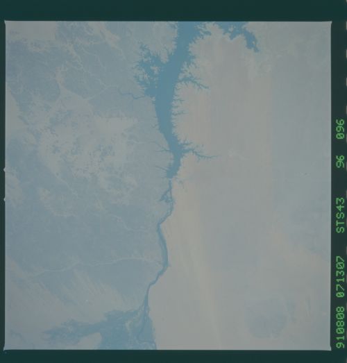
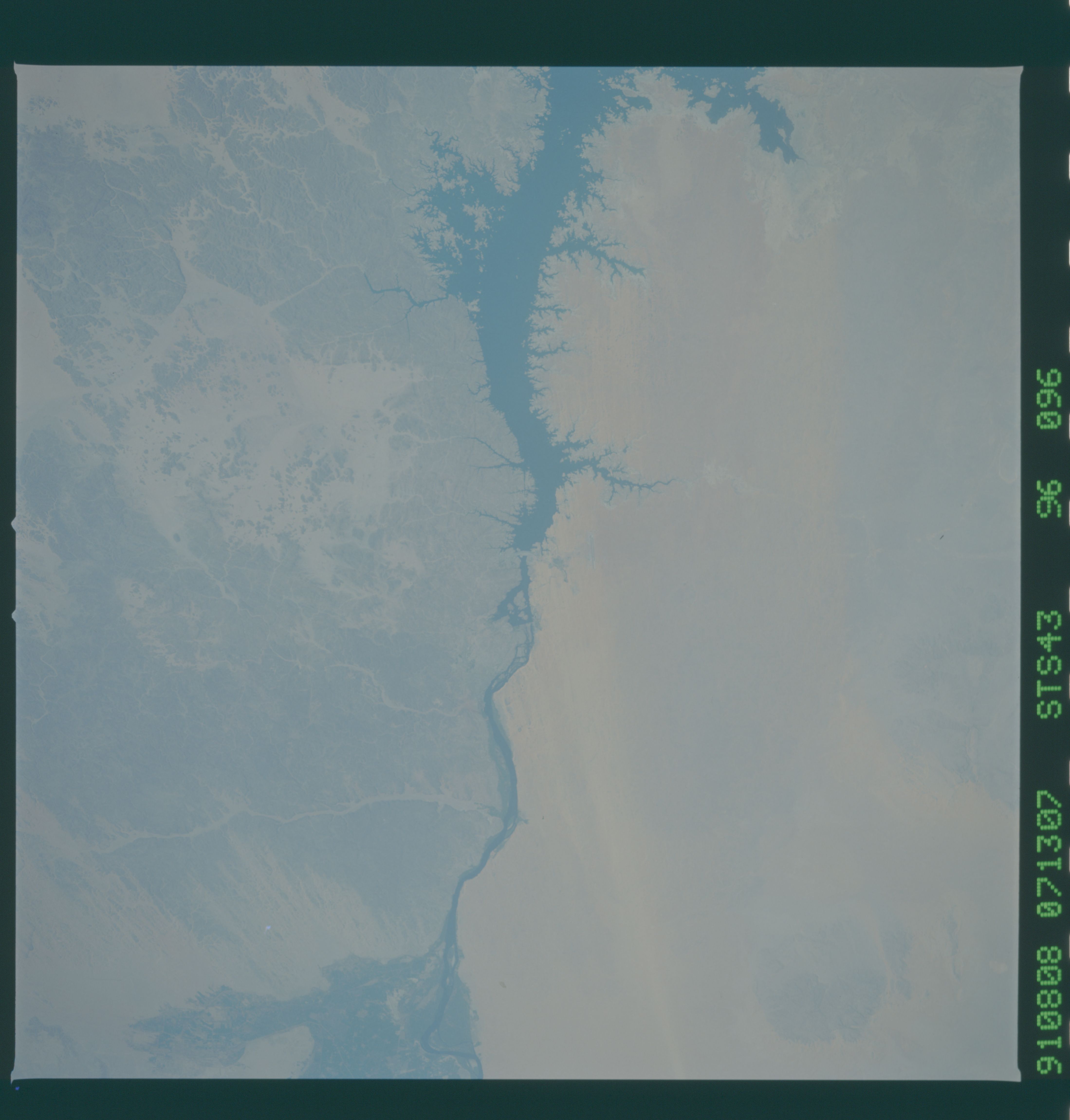
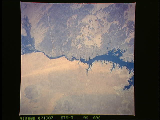
Spacecraft nadir point: 22.1° N, 33.1° E
Photo center point: 24.0° N, 33.0° E
Photo center point by machine learning:
Photo center point: 24.0° N, 33.0° E
Photo center point by machine learning:
Nadir to Photo Center: North
Spacecraft Altitude: 175 nautical miles (324km)
Camera: | Hasselblad |
Focal Length: | 250mm |
Camera Tilt: | 33 degrees |
Format: | 5017: Kodak, natural color positive, Ektachrome, X Professional, ASA 64, standard base |
Film Exposure: | Normal |
| Additional Information | |
| Width | Height | Annotated | Cropped | Purpose | Links |
|---|---|---|---|---|---|
| 4396 pixels | 4600 pixels | No | No | Download Image Download Color Calibration Image for this Image |
|
| 500 pixels | 523 pixels | No | No | Download Image Download Color Calibration Image for this Image |
|
| 640 pixels | 480 pixels | No | No | Download Image | |
| 2633 pixels | 2582 pixels | No | No | Download Image |
Download Packaged File
Download a Google Earth KML for this Image
View photo footprint information
No GeoTIFF is available for this photo.Image Caption: Egypt's High Aswan Dam on the Nile River at the first cataracts, Nile River, (24.0N, 33.0E) was completed in 1971 to provide cheap hydroelectric power and to regulate the historically uneven flow of the Nile River. The contrast between the largely base rock desert east of the Nile versus the sand covered desert west of the river and the ancient irrigated floodplain downstream from the damsite is clearly shown.
