< STS047-85-95 >
| NASA Photo ID | STS047-85-95 |
| Focal Length | 250mm |
| Date taken | 1992.09.13 |
| Time taken | 10:08:31 GMT |
Resolutions offered for this image:
5194 x 5300 pixels 627 x 640 pixels 5700 x 6000 pixels 500 x 526 pixels 640 x 480 pixels
5194 x 5300 pixels 627 x 640 pixels 5700 x 6000 pixels 500 x 526 pixels 640 x 480 pixels


Cloud masks available for this image:
Spacecraft nadir point: 37.8° N, 10.8° W
Photo center point: 38.5° N, 9.0° W
Photo center point by machine learning:
Photo center point: 38.5° N, 9.0° W
Photo center point by machine learning:
Nadir to Photo Center: East
Spacecraft Altitude: 168 nautical miles (311km)
Country or Geographic Name: | PORTUGAL |
Features: | LISBON AREA |
| Features Found Using Machine Learning: | |
Cloud Cover Percentage: | 0 (no clouds present) |
Sun Elevation Angle: | 43° |
Sun Azimuth: | 125° |
Camera: | Hasselblad |
Focal Length: | 250mm |
Camera Tilt: | 35 degrees |
Format: | VELVI: Fuji, natural color positive, Velvia 50, CS 135-36, ASA 32, standard base |
Film Exposure: | Normal |
| Additional Information | |
| Width | Height | Annotated | Cropped | Purpose | Links |
|---|---|---|---|---|---|
| 5194 pixels | 5300 pixels | No | No | Earth From Space collection | Download Image |
| 627 pixels | 640 pixels | No | No | Earth From Space collection | Download Image |
| 5700 pixels | 6000 pixels | No | No | Download Image Download Color Calibration Image for this Image |
|
| 500 pixels | 526 pixels | No | No | Download Image Download Color Calibration Image for this Image |
|
| 640 pixels | 480 pixels | No | No | Download Image |
Download Packaged File
Download a Google Earth KML for this Image
View photo footprint information
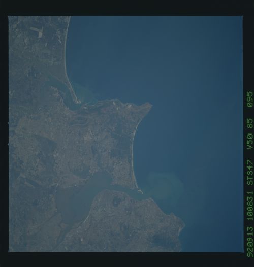
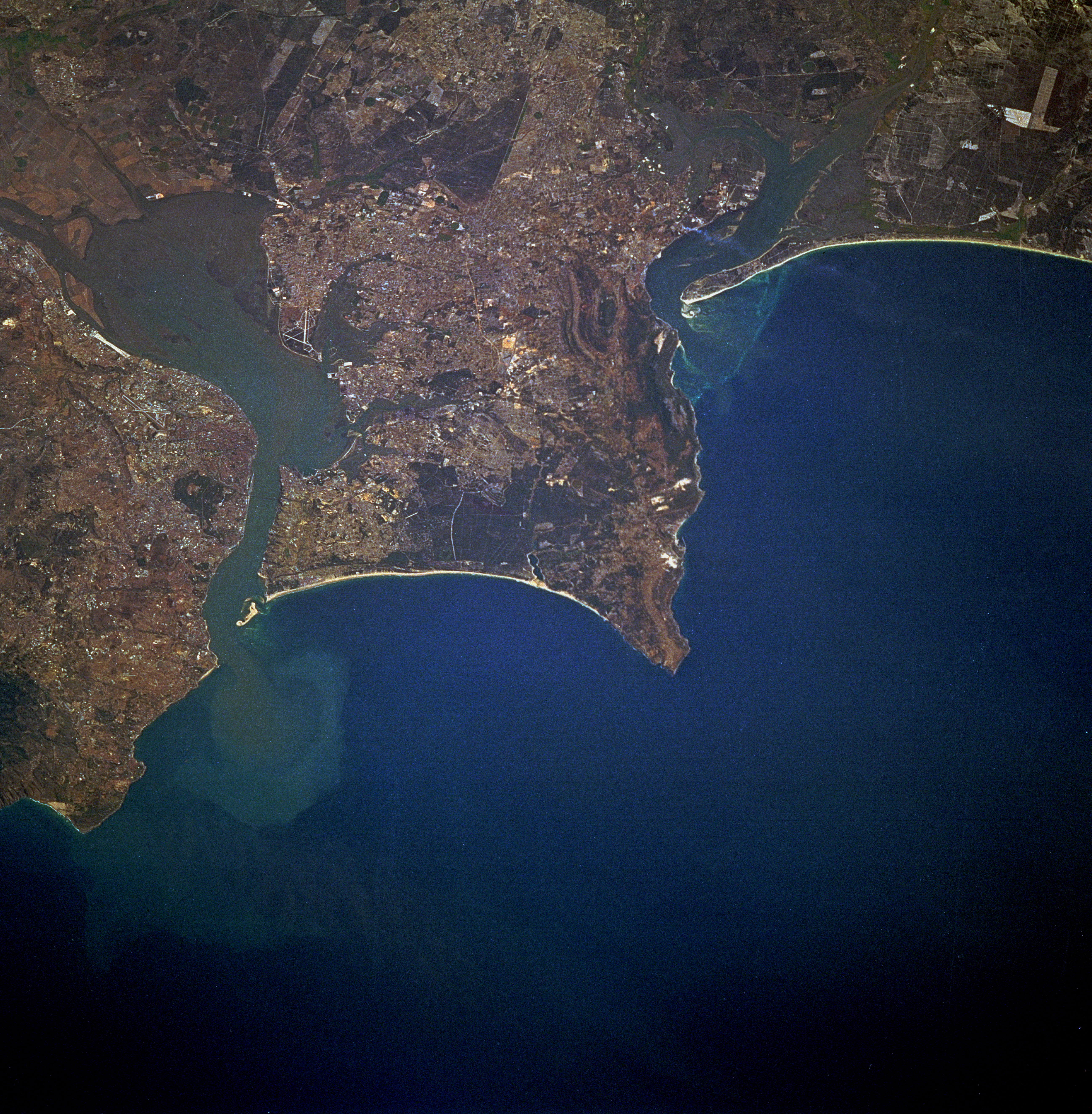
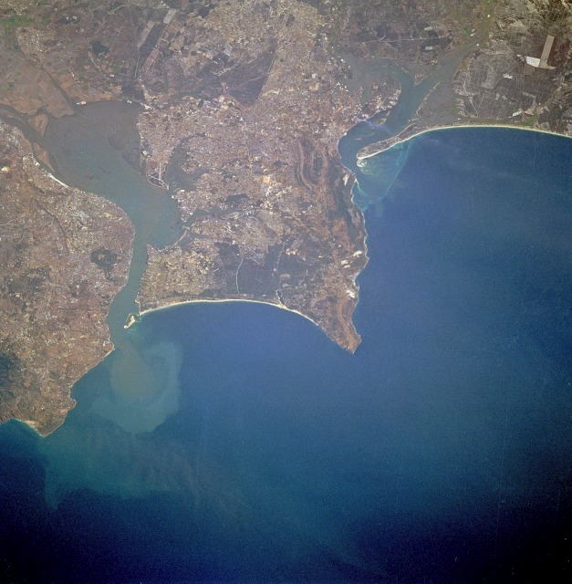
No GeoTIFF is available for this photo.Image Caption: STS047-085-095 Lisbon and Tagus River Estuary, Portugal September 1992
Lisbon, the capital of Portugal, is observable north of the Tagus River estuary in this low-oblique, northeast-looking photograph. The estuary of the Tagus River, the longest river in the Iberian Peninsula, is 12 miles (19 kilometers) long and is considered one of the best harbors in Europe. Lisbon is set on seven terraced hills and has a population of almost 900 000. Industries include textiles, chemicals, steel, oil and sugar refining, shipbuilding, soap and flour production, and tourism. A massive earthquake almost destroyed the city in 1755. Loss of life exceeded 50 000 people, and many buildings, some over 1000 years old, were destroyed. The city was rebuilt, and no subsequent major earthquakes have occurred. Visible south of the Tagus River estuary are the cites (west to east) of Almada, Barreiro, and Montijo; farther south are Setúbal Bay and the Sado River estuary.
Lisbon, the capital of Portugal, is observable north of the Tagus River estuary in this low-oblique, northeast-looking photograph. The estuary of the Tagus River, the longest river in the Iberian Peninsula, is 12 miles (19 kilometers) long and is considered one of the best harbors in Europe. Lisbon is set on seven terraced hills and has a population of almost 900 000. Industries include textiles, chemicals, steel, oil and sugar refining, shipbuilding, soap and flour production, and tourism. A massive earthquake almost destroyed the city in 1755. Loss of life exceeded 50 000 people, and many buildings, some over 1000 years old, were destroyed. The city was rebuilt, and no subsequent major earthquakes have occurred. Visible south of the Tagus River estuary are the cites (west to east) of Almada, Barreiro, and Montijo; farther south are Setúbal Bay and the Sado River estuary.
