< STS046-74-94 >
| NASA Photo ID | STS046-74-94 |
| Focal Length | 250mm |
| Date taken | 1992.__.__ |
| Time taken | GMT |
Resolutions offered for this image:
3940 x 3955 pixels 637 x 640 pixels 5700 x 6000 pixels 500 x 526 pixels 640 x 480 pixels
3940 x 3955 pixels 637 x 640 pixels 5700 x 6000 pixels 500 x 526 pixels 640 x 480 pixels

Cloud masks available for this image:
Spacecraft nadir point:
Photo center point: 29.5° N, 48.5° E
Photo center point by machine learning:
Photo center point: 29.5° N, 48.5° E
Photo center point by machine learning:
Nadir to Photo Center:
Spacecraft Altitude: nautical miles (0km)
Country or Geographic Name: | PERSIAN GULF |
Features: | KUWAIT CITY, FIRE SCARS |
| Features Found Using Machine Learning: | |
Cloud Cover Percentage: | 0 (no clouds present) |
Sun Elevation Angle: | ° |
Sun Azimuth: | ° |
Camera: | Hasselblad |
Focal Length: | 250mm |
Camera Tilt: | Low Oblique |
Format: | 5017: Kodak, natural color positive, Ektachrome, X Professional, ASA 64, standard base |
Film Exposure: | Normal |
| Additional Information | |
| Width | Height | Annotated | Cropped | Purpose | Links |
|---|---|---|---|---|---|
| 3940 pixels | 3955 pixels | No | No | Earth From Space collection | Download Image |
| 637 pixels | 640 pixels | No | No | Earth From Space collection | Download Image |
| 5700 pixels | 6000 pixels | No | No | Download Image Download Color Calibration Image for this Image |
|
| 500 pixels | 526 pixels | No | No | Download Image Download Color Calibration Image for this Image |
|
| 640 pixels | 480 pixels | No | No | Download Image |
Download Packaged File
Download a Google Earth KML for this Image
View photo footprint information
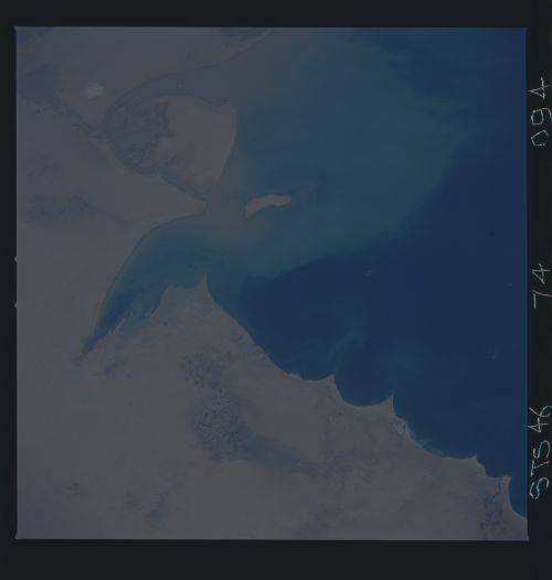
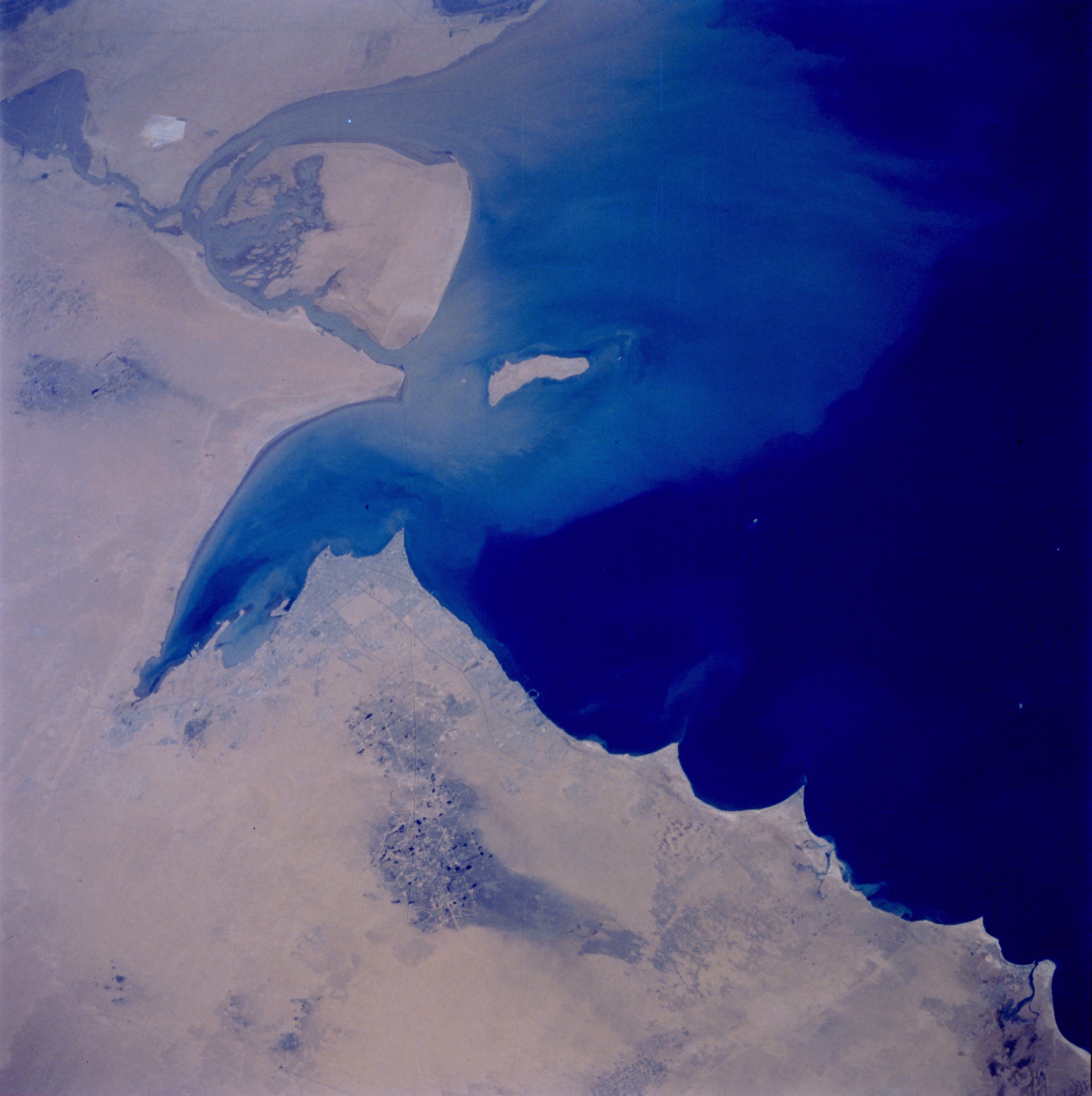
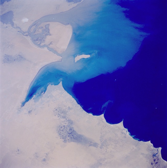
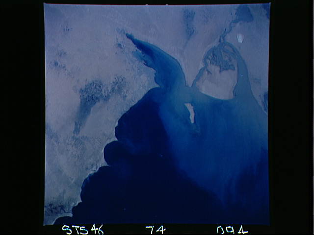
No GeoTIFF is available for this photo.Image Caption: STS046-74-94 Kuwait City, Kuwait August 1992
This photograph provides evidence that the reclamation process created by the naturally occurring desert winds is well under way just 1.5 years after Saddam Hussein ordered all oil wells in Kuwait to be set on fire. The large dark spots in the photograph are standing pools of oil. Kuwait City is clearly visible on the south side of Kuwait Bay. The sediment plume surrounding Bubiyan and Faylaka Islands is mostly coming from the joint Euphrates and Tigris River Delta, the main body of which is outside the photo. (Refer to STS-037-152-091 for a photograph of the same area taken in April 1991, two months after the oil wells were ignited.)
This view of the northern Persian Gulf shows Kuwait City and the Tigris and Euphrates River Deltas (29.5N, 48.5E). The oil laden sands and oil lakes of the Kuwait Oil Fields to the north and south of the city are clearly visible as dark patches surrounded by oil free desert sands. Comparison with earlier photos indicate that the oil laden sands are slowly being covered with clean sand carried by strong NW winds called Shmals.
