< STS080-707-93 >
| NASA Photo ID | STS080-707-93 |
| Focal Length | 250mm |
| Date taken | 1996.11.22 |
| Time taken | 07:23:07 GMT |
Cloud masks available for this image:
Spacecraft nadir point: 28.4° N, 80.0° E
Photo center point: 29.0° N, 80.0° E
Photo center point by machine learning:
Photo center point: 29.0° N, 80.0° E
Photo center point by machine learning:
Nadir to Photo Center: North
Spacecraft Altitude: 190 nautical miles (352km)
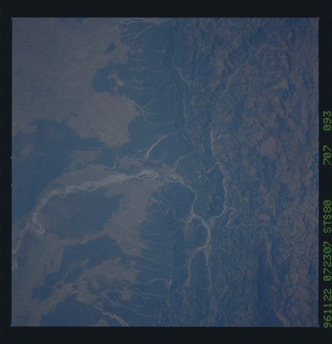
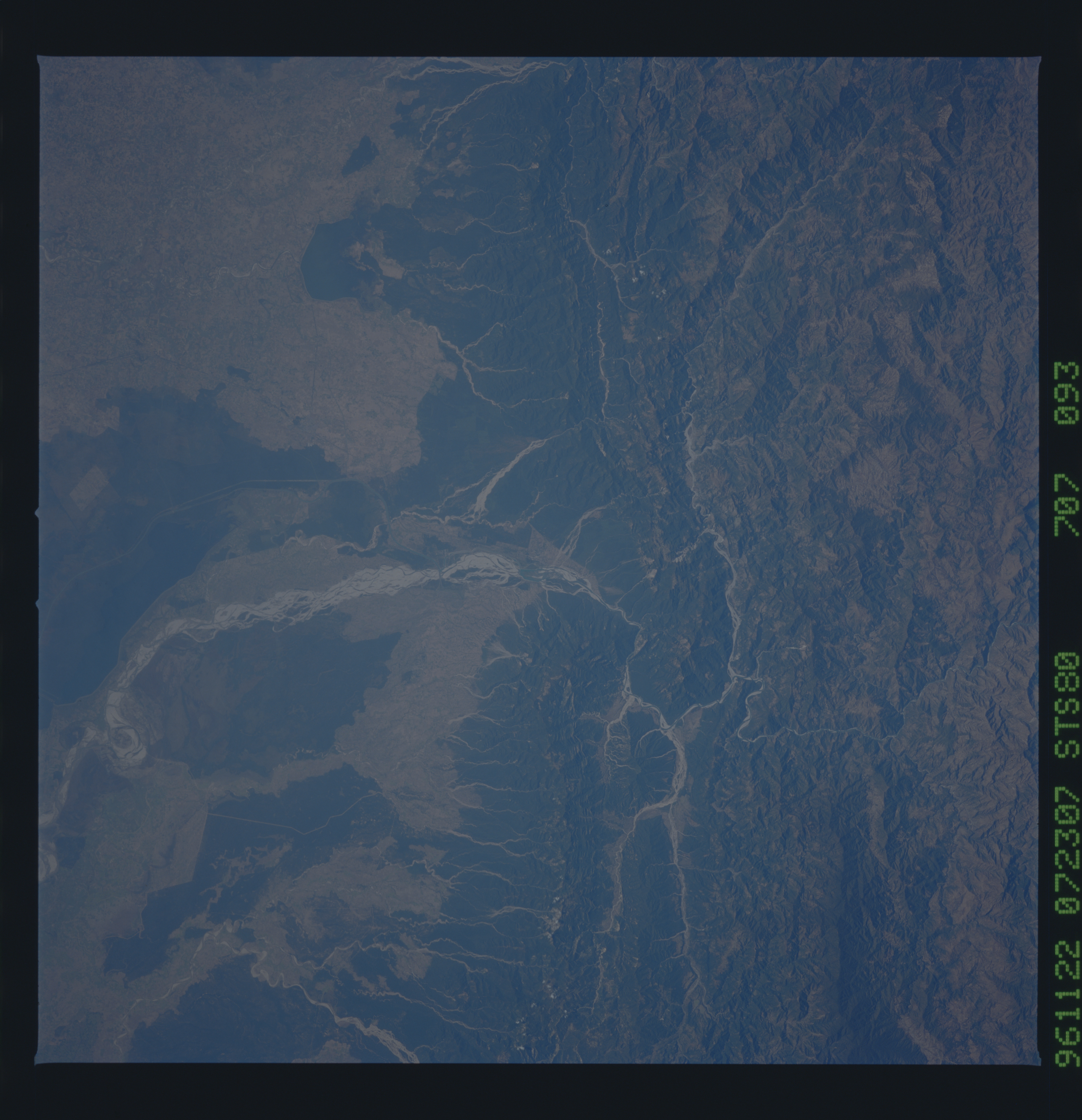
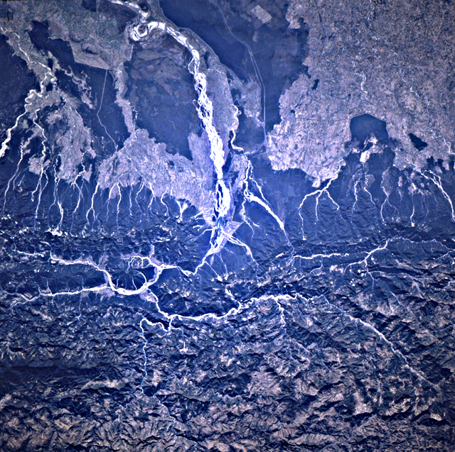
Country or Geographic Name: | INDIA |
Features: | SARDA CANAL, KALI RIVER |
| Features Found Using Machine Learning: | |
Cloud Cover Percentage: | 0 (no clouds present) |
Sun Elevation Angle: | 40° |
Sun Azimuth: | 197° |
Camera: | Hasselblad |
Focal Length: | 250mm |
Camera Tilt: | 11 degrees |
Format: | 5046: Kodak, natural color positive, Lumiere 100/5046, ASA 100, standard base |
Film Exposure: | Normal |
| Additional Information | |
| Width | Height | Annotated | Cropped | Purpose | Links |
|---|---|---|---|---|---|
| 5700 pixels | 5900 pixels | No | No | Download Image Download Color Calibration Image for this Image |
|
| 483 pixels | 500 pixels | No | No | Download Image Download Color Calibration Image for this Image |
|
| 640 pixels | 637 pixels | No | No | Photographic Highlights | Download Image |
Download Packaged File
Download a Google Earth KML for this Image
View photo footprint information
No GeoTIFF is available for this photo.Image Caption: Uncommonly sharp view of the southern Himalayan foothills that
illustrate drainage adjustments to the ongoing uplift of the mountains
and clearly delineate deforested areas.
illustrate drainage adjustments to the ongoing uplift of the mountains
and clearly delineate deforested areas.
