< ISS029-E-9232 >
| NASA Photo ID | ISS029-E-9232 |
| Focal Length | 1200mm |
| Date taken | 2011.09.24 |
| Time taken | 08:31:59 GMT |


Spacecraft nadir point: 47.7° N, 10.8° E
Photo center point: 48.1° N, 11.6° E
Photo center point by machine learning: 48.13° N, 11.55° E
Photo center point: 48.1° N, 11.6° E
Photo center point by machine learning: 48.13° N, 11.55° E
Nadir to Photo Center: East
Spacecraft Altitude: 206 nautical miles (382km)

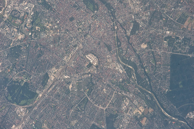
Country or Geographic Name: | GERMANY |
Features: | THERESIENWIESE, OKTOBERFEST SITE, CENTRAL MUNICH, ISAR R., NYMPHENBURG |
| Features Found Using Machine Learning: | |
Cloud Cover Percentage: | 0 (no clouds present) |
Sun Elevation Angle: | 31° |
Sun Azimuth: | 132° |
Camera: | Nikon D3 Electronic Still Camera |
Focal Length: | 1200mm |
Camera Tilt: | 15 degrees |
Format: | 4256E: 4256 x 2832 pixel CMOS sensor, 36.0mm x 23.9mm, total pixels: 12.87 million, Nikon FX format |
Film Exposure: | |
| Additional Information | |
| Width | Height | Annotated | Cropped | Purpose | Links |
|---|---|---|---|---|---|
| 4256 pixels | 2832 pixels | No | No | Download Image | |
| 640 pixels | 426 pixels | No | No | Download Image |
Download Packaged File
Download a Google Earth KML for this Image
View photo footprint information
No GeoTIFF is available for this photo.Image Caption: ISS029-E-009232 (24 Sept. 2011) --- This image of the central area of Munich, Germany was photographed from approximately 220 miles above Earth by one of the Expedition 29 crew members onboard the Earth-orbiting International Space Station at 08:31:59 GMT, Sept. 24, 2011. Theresienwiese, site of Oktoberfest, is in the center of the metropolitan area. The Isar River is clearly visible running along the right hand side of the photograph. A 1200-mm focal length was used to capture the image.
