< ISS030-E-9186 >
| NASA Photo ID | ISS030-E-9186 |
| Focal Length | 80mm |
| Date taken | 2011.12.03 |
| Time taken | 01:52:55 GMT |
Resolutions offered for this image:
1000 x 664 pixels 540 x 359 pixels 720 x 480 pixels 4288 x 2848 pixels 640 x 425 pixels
1000 x 664 pixels 540 x 359 pixels 720 x 480 pixels 4288 x 2848 pixels 640 x 425 pixels


Spacecraft nadir point: 32.0° S, 140.6° E
Photo center point: 32.5° S, 142.5° E
Photo center point by machine learning:
Photo center point: 32.5° S, 142.5° E
Photo center point by machine learning:
Nadir to Photo Center: East
Spacecraft Altitude: 216 nautical miles (400km)
Country or Geographic Name: | AUSTRALIA-NSW |
Features: | MENINDEE, LAKE MENINDEE, LAKE TANDOU, LAKE WETHERELL |
| Features Found Using Machine Learning: | |
Cloud Cover Percentage: | 10 (1-10)% |
Sun Elevation Angle: | 78° |
Sun Azimuth: | 40° |
Camera: | Nikon D2Xs Electronic Still Camera |
Focal Length: | 80mm |
Camera Tilt: | 29 degrees |
Format: | 4288E: 4288 x 2848 pixel CMOS sensor, RGBG imager color filter |
Film Exposure: | |
| Additional Information | |
| Width | Height | Annotated | Cropped | Purpose | Links |
|---|---|---|---|---|---|
| 1000 pixels | 664 pixels | No | Yes | Earth From Space collection | Download Image |
| 540 pixels | 359 pixels | Yes | Yes | Earth From Space collection | Download Image |
| 720 pixels | 480 pixels | Yes | Yes | NASA's Earth Observatory web site | Download Image |
| 4288 pixels | 2848 pixels | No | No | Download Image | |
| 640 pixels | 425 pixels | No | No | Download Image |
Download Packaged File
Download a Google Earth KML for this Image
View photo footprint information
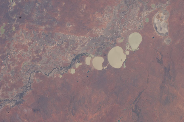
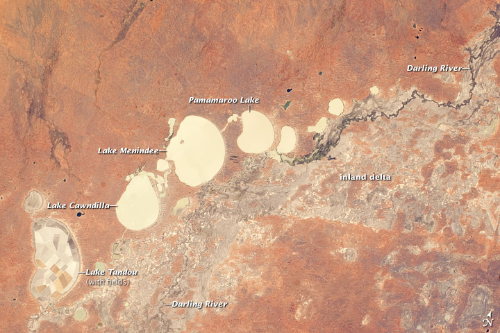
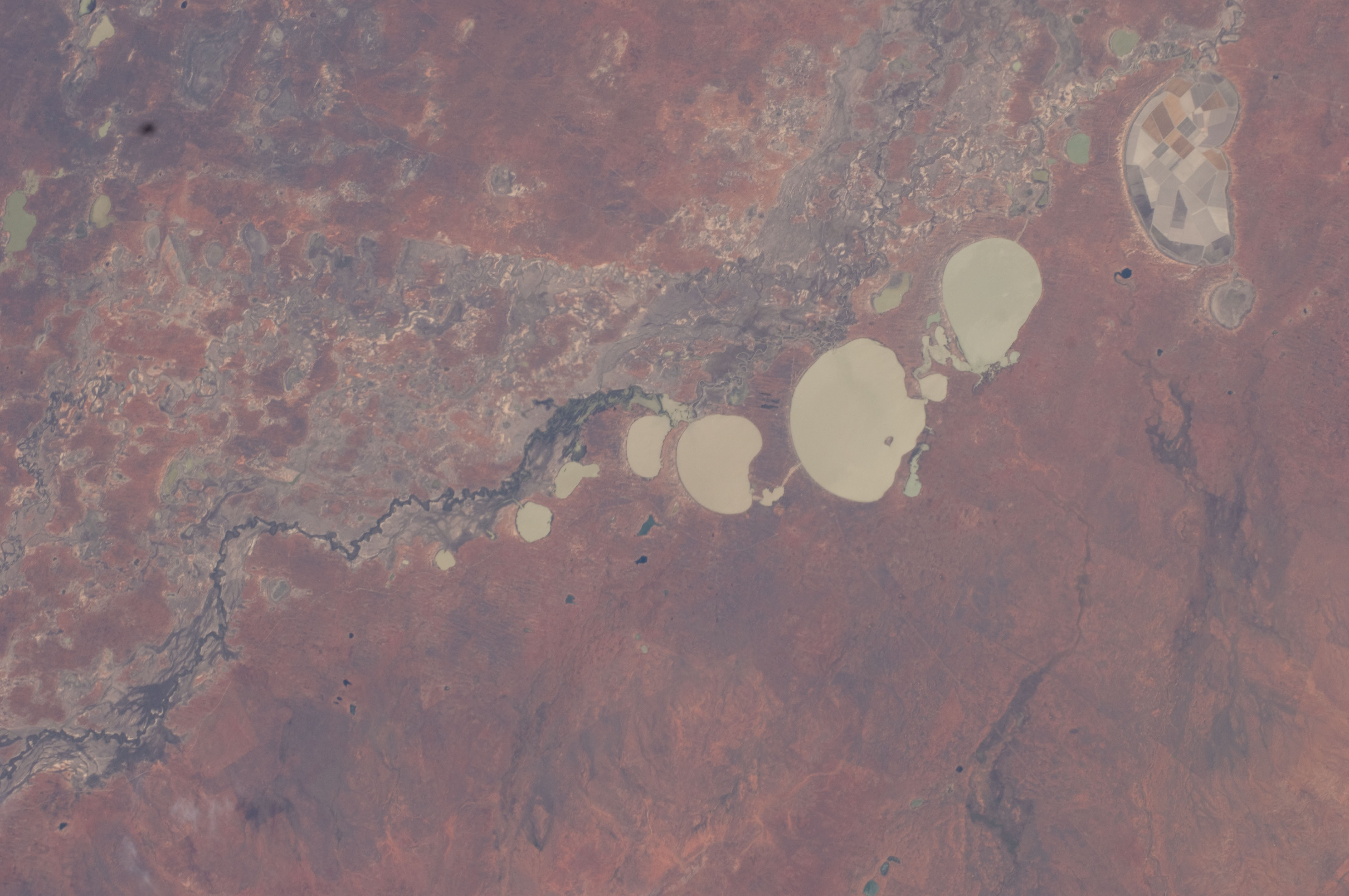
No GeoTIFF is available for this photo.Image Caption: Menindee Lakes, New South Wales, Australia
Note: This caption refers to the image versions labeled "NASA's Earth Observatory web site".
The Menindee Lakes comprise a system of ephemeral, freshwater lakes fed by the Darling River when it floods. The lakes lie in the far west of New South Wales, Australia, near the town of Menindee. The longest is Lake Tandou (18.6 km north-south dimension), visible at the lower left of this astronaut photograph. The lakes appear to have a small amount of water flooding them. The Darling River itself was flowing, as indicated by the dark water and blackened mud along its course (image right).
The Darling River flows southwest in tortuous fashion (top right to lower left in this image). In the flat landscapes of this part of Australia, the river has created several inland deltas in its course to the sea, with characteristic diverging channel patterns, marked by younger sediments, which appear grayer than the surrounding ancient red soils and rocks. One such inland delta appears at image right where minor channels wind across the countryside. The apex of another inland delta appears at image lower left.
Some of the Menindee Lakes have been incorporated in an artificially regulated overflow system providing for flood control, water storage for domestic use and livestock, as well as downstream irrigation. The lakes are also important as wetlands supporting a rich diversity of birds. The floor of one lake, Lake Tandou, is also used as prime agricultural land, as can be seen by its patchwork of irrigated fields, and is protected from flooding.
