< SL4-52-9 >
| NASA Photo ID | SL4-52-9 |
| Focal Length | 152mm |
| Date taken | 1973.11.29 |
| Time taken | 18:55:35 GMT |
Cloud masks available for this image:
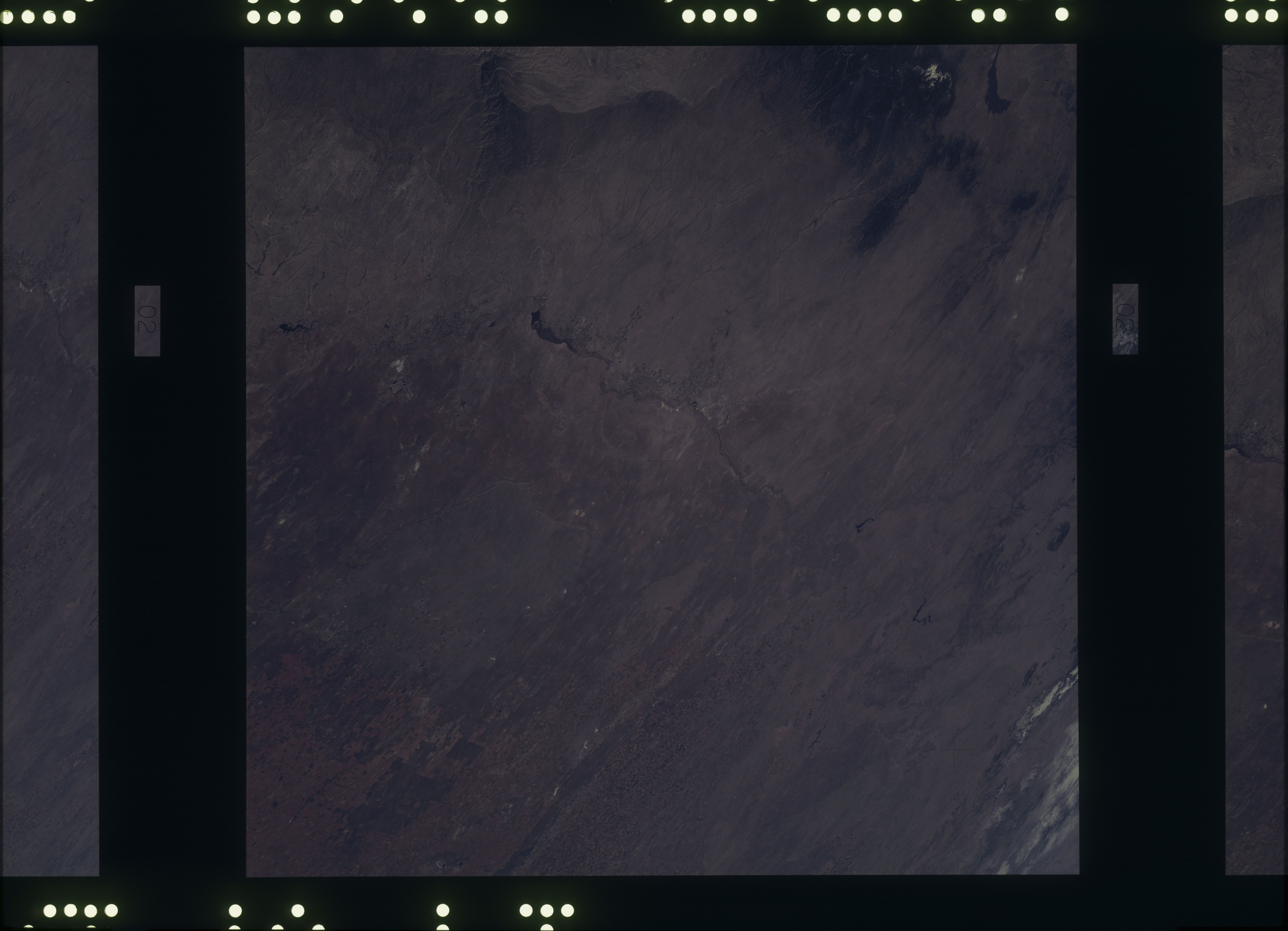
Spacecraft nadir point: 33.6° N, 104.2° W
Photo center point: 33.6° N, 104.2° W
Photo center point by machine learning:
Photo center point: 33.6° N, 104.2° W
Photo center point by machine learning:
Nadir to Photo Center:
Spacecraft Altitude: 239 nautical miles (443km)
Camera: | Skylab Multispectral (S190A) |
Focal Length: | 152mm |
Camera Tilt: | 0 degrees |
Format: | SO356: Unknown SkyLab |
Film Exposure: | |
| Additional Information | |
| Width | Height | Annotated | Cropped | Purpose | Links |
|---|---|---|---|---|---|
| 6830 pixels | 4937 pixels | No | No | Download Image | |
| 500 pixels | 361 pixels | No | No | Download Image |
Download Packaged File
Download a Google Earth KML for this Image
View photo footprint information
No GeoTIFF is available for this photo.Image Caption: Western edge of the southern High Plains; Pecos Valley from Red Bluff Lake and the Guadalupe Mtns. to Alamagordo Reservoir, upper Canadian drainage including Concho Lake.
