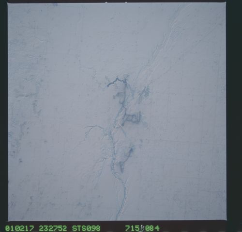
< STS098-715B-84 >
| NASA Photo ID | STS098-715B-84 |
| Focal Length | 250mm |
| Date taken | 2001.02.17 |
| Time taken | 23:27:52 GMT |
Resolutions offered for this image:
540 x 410 pixels 2210 x 1677 pixels 1030 x 1024 pixels 2063 x 2048 pixels 4127 x 4096 pixels 4600 x 4400 pixels 515 x 512 pixels 500 x 478 pixels 2210 x 1677 pixels
540 x 410 pixels 2210 x 1677 pixels 1030 x 1024 pixels 2063 x 2048 pixels 4127 x 4096 pixels 4600 x 4400 pixels 515 x 512 pixels 500 x 478 pixels 2210 x 1677 pixels


Cloud masks available for this image:
Spacecraft nadir point: 49.1° N, 104.4° W
Photo center point: 49.0° N, 103.0° W
Photo center point by machine learning:
Photo center point: 49.0° N, 103.0° W
Photo center point by machine learning:
Nadir to Photo Center: East
Spacecraft Altitude: 196 nautical miles (363km)
Country or Geographic Name: | CANADA-S |
Features: | ESTEVAN, POWER PLANTS |
| Features Found Using Machine Learning: | |
Cloud Cover Percentage: | 10 (1-10)% |
Sun Elevation Angle: | 7° |
Sun Azimuth: | 243° |
Camera: | Hasselblad |
Focal Length: | 250mm |
Camera Tilt: | 23 degrees |
Format: | 5069: Kodak Elite 100S, E6 Reversal, Replaces Lumiere, Warmer in tone vs. Lumiere |
Film Exposure: | |
| Additional Information | |
| Width | Height | Annotated | Cropped | Purpose | Links |
|---|---|---|---|---|---|
| 540 pixels | 410 pixels | Yes | Yes | Earth From Space collection | Download Image |
| 2210 pixels | 1677 pixels | No | Yes | NASA's Earth Observatory web site | Download Image |
| 1030 pixels | 1024 pixels | No | No | Download Image | |
| 2063 pixels | 2048 pixels | No | No | Download Image | |
| 4127 pixels | 4096 pixels | No | No | Download Image | |
| 4600 pixels | 4400 pixels | No | No | Download Image | |
| 515 pixels | 512 pixels | No | No | Download Image | |
| 500 pixels | 478 pixels | No | No | Download Image | |
| 2210 pixels | 1677 pixels | No | Yes | NASA's Earth Observatory web site | Download Image |
Download Packaged File
Download a Google Earth KML for this Image
View photo footprint information
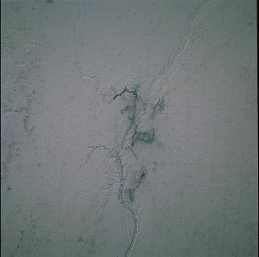
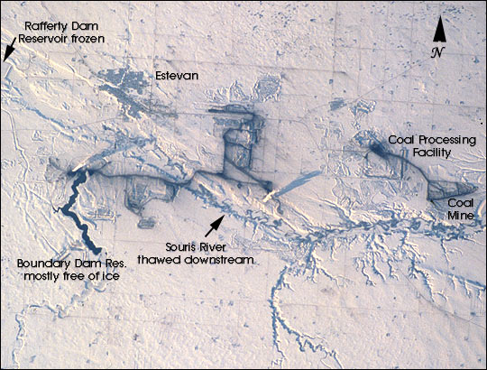
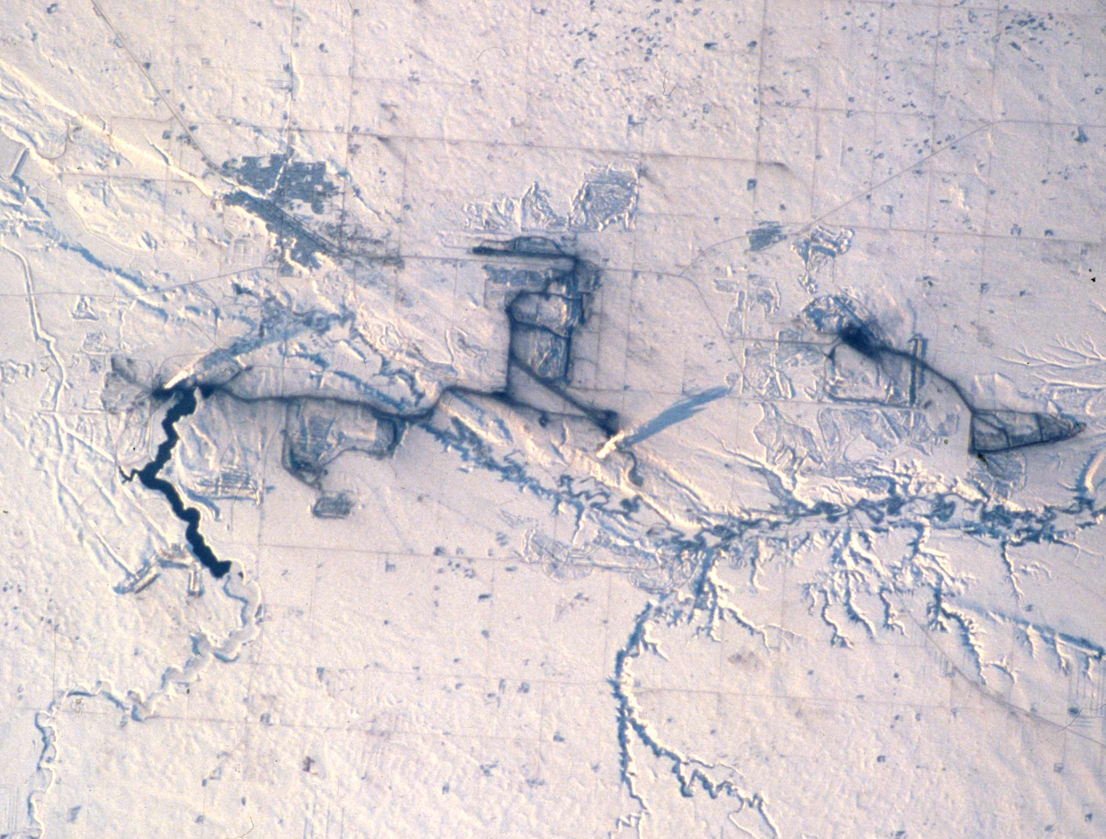
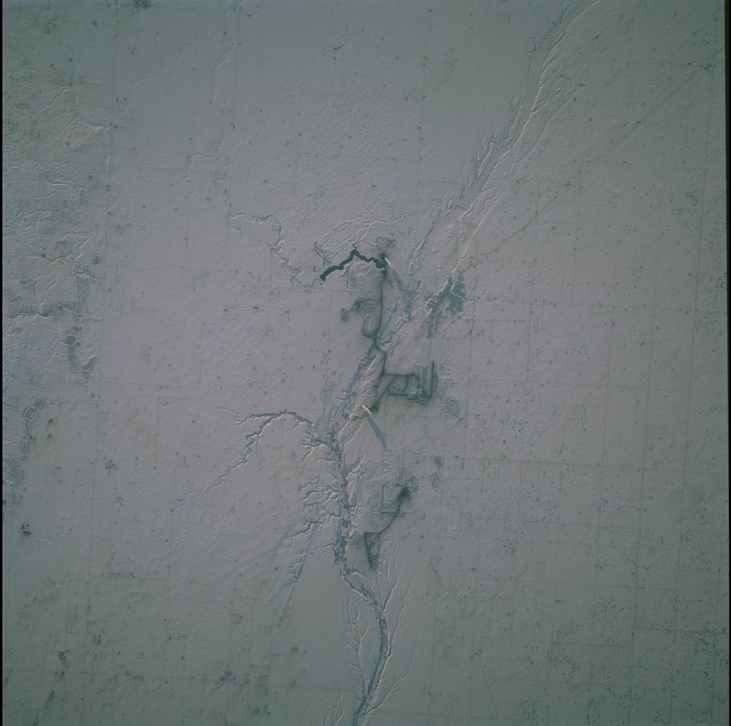
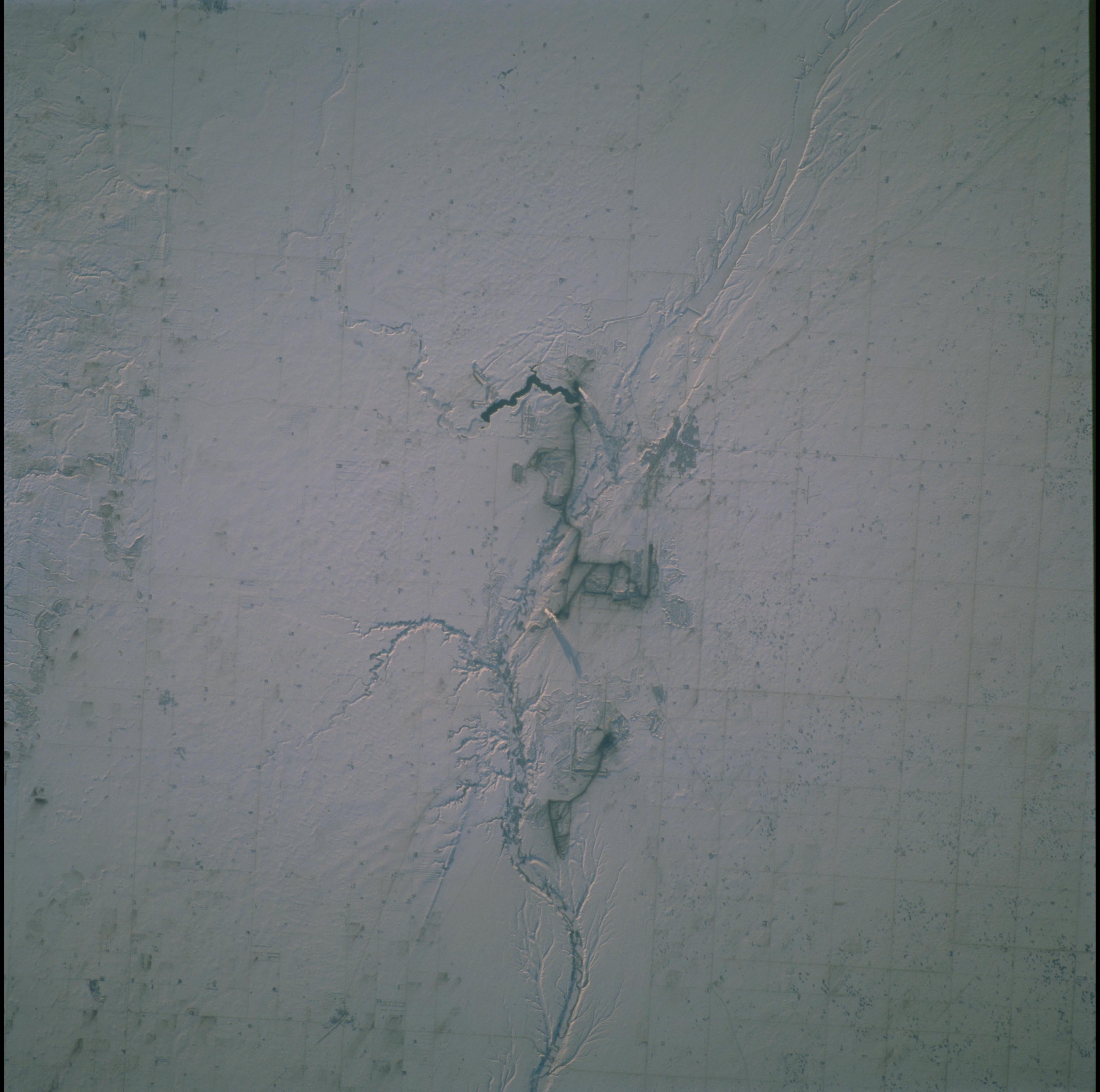
No GeoTIFF is available for this photo.Image Caption: Snow and ice serve to accent human activities in this photograph taken by the Space Shuttle mission STS-98 crewmembers on February 17, 2001 (STS098-715B-84). The Souris River stretches across the photograph from left to right, with the upstream Rafferty Dam Reservoir frozen over on the far left. Two power plants, the Boundary Dam Power Station and the Shand Power Station, can be identified by the smoke plumes and shadows of those plumes. The river is frozen over upstream of the Boundary Dam Power Station, but thermal loading from the plants has warmed the water in the Boundary Dam Reservoir so that it remains nearly ice free. Downstream of the reservoirs, thermal loading is sufficient to maintain open flow in the Souris River.
The Estevan Coalfield is a formation of about 1500 square km that accounts for most of Saskatchewan's coal production. The coal is mined from a trench at the surface, processed, and then used to fire the two power plants. These plants provide almost half of Saskatchewan's electricity. Areas of active surface mining and processing appear black in the photograph; roads used for transporting the coal are also dusted black. Around the areas of the mines, a rough texture reveals other spoil piles and areas where underground mining used to take place. The city of Estevan (population about 12,000) is the medium-gray gridded area in the upper left of the photo.
The Estevan Coalfield is a formation of about 1500 square km that accounts for most of Saskatchewan's coal production. The coal is mined from a trench at the surface, processed, and then used to fire the two power plants. These plants provide almost half of Saskatchewan's electricity. Areas of active surface mining and processing appear black in the photograph; roads used for transporting the coal are also dusted black. Around the areas of the mines, a rough texture reveals other spoil piles and areas where underground mining used to take place. The city of Estevan (population about 12,000) is the medium-gray gridded area in the upper left of the photo.
