< STS073-725-82 >
| NASA Photo ID | STS073-725-82 |
| Focal Length | 250mm |
| Date taken | 1995.10.24 |
| Time taken | 20:01:42 GMT |
Resolutions offered for this image:
3904 x 3913 pixels 638 x 639 pixels 5700 x 5900 pixels 500 x 518 pixels 640 x 480 pixels
3904 x 3913 pixels 638 x 639 pixels 5700 x 5900 pixels 500 x 518 pixels 640 x 480 pixels
Cloud masks available for this image:
Spacecraft nadir point: 33.8° N, 121.4° W
Photo center point: 36.5° N, 122.0° W
Photo center point by machine learning:
Photo center point: 36.5° N, 122.0° W
Photo center point by machine learning:
Nadir to Photo Center: North
Spacecraft Altitude: 145 nautical miles (269km)
Country or Geographic Name: | USA-CALIFORNIA |
Features: | MONTEREY BAY, MOUNTAINS |
| Features Found Using Machine Learning: | |
Cloud Cover Percentage: | 0 (no clouds present) |
Sun Elevation Angle: | 45° |
Sun Azimuth: | 184° |
Camera: | Hasselblad |
Focal Length: | 250mm |
Camera Tilt: | 49 degrees |
Format: | 5046: Kodak, natural color positive, Lumiere 100/5046, ASA 100, standard base |
Film Exposure: | Normal |
| Additional Information | |
| Width | Height | Annotated | Cropped | Purpose | Links |
|---|---|---|---|---|---|
| 3904 pixels | 3913 pixels | No | No | Earth From Space collection | Download Image |
| 638 pixels | 639 pixels | No | No | Earth From Space collection | Download Image |
| 5700 pixels | 5900 pixels | No | No | Download Image Download Color Calibration Image for this Image |
|
| 500 pixels | 518 pixels | No | No | Download Image Download Color Calibration Image for this Image |
|
| 640 pixels | 480 pixels | No | No | Download Image |
Download Packaged File
Download a Google Earth KML for this Image
View photo footprint information
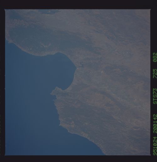
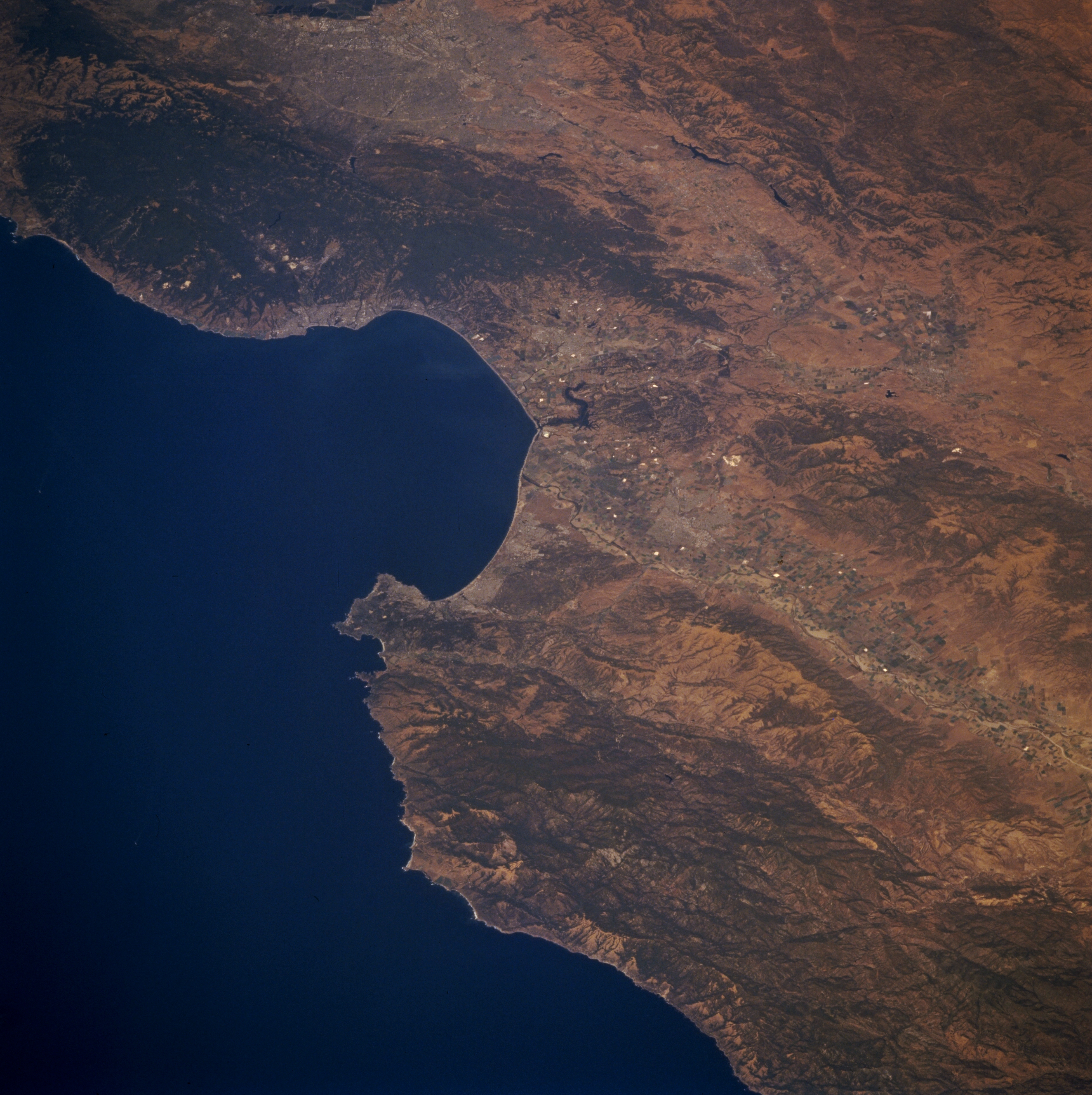
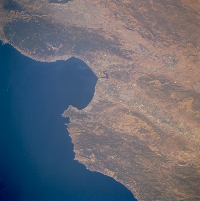
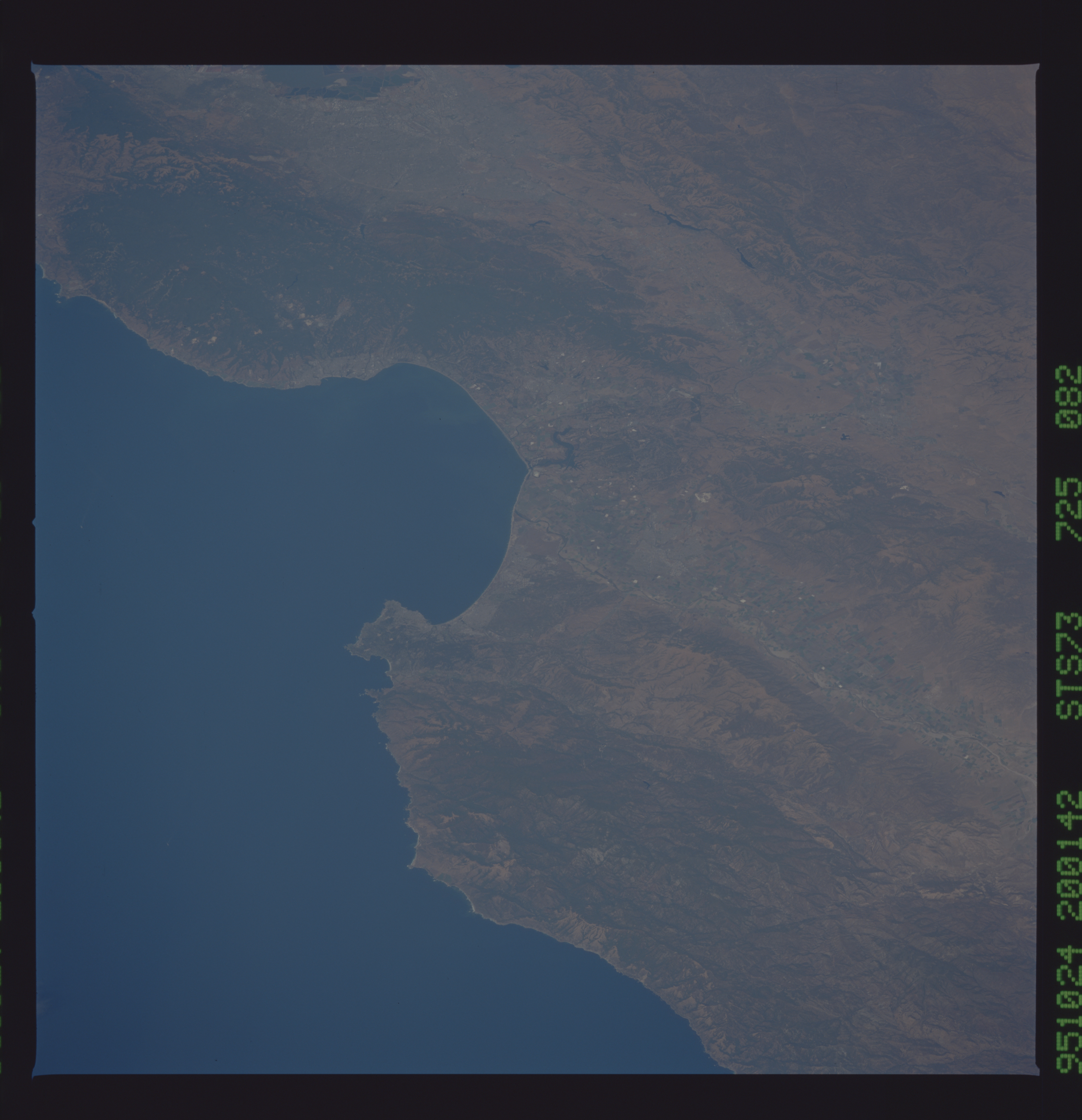
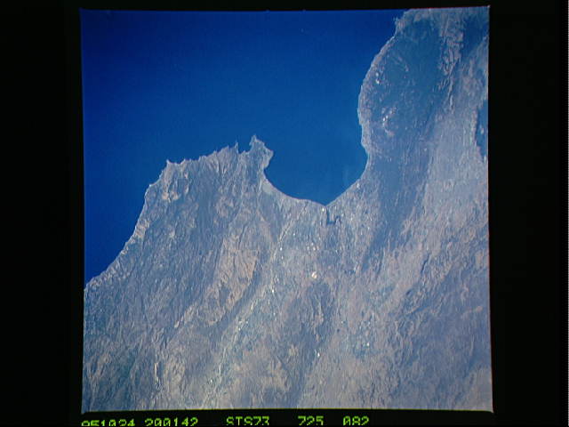
No GeoTIFF is available for this photo.Image Caption: STS073-725-082 Monterey Bay, Santa Lucia Range, and Santa Cruz Mountains, California, U.S.A. September 1995
Monterey Bay, an inlet of the Pacific Ocean, is featured in this synoptic, low-oblique, north-looking photograph. Monterey, located at the southern end of the bay, is one of the oldest cities in California and the site of the first published newspaper in California. South of Monterey lies the rugged Santa Lucia Range. East of the Santa Lucia Range is the Salinas River Valley with numerous agricultural field patterns. North of Monterey Bay are the forested Santa Cruz Mountains; San Jose, located at the south end of San Francisco Bay; and the western portion of the rugged Diablo Range.
Monterey Bay, an inlet of the Pacific Ocean, is featured in this synoptic, low-oblique, north-looking photograph. Monterey, located at the southern end of the bay, is one of the oldest cities in California and the site of the first published newspaper in California. South of Monterey lies the rugged Santa Lucia Range. East of the Santa Lucia Range is the Salinas River Valley with numerous agricultural field patterns. North of Monterey Bay are the forested Santa Cruz Mountains; San Jose, located at the south end of San Francisco Bay; and the western portion of the rugged Diablo Range.
