< STS062-81-81 >
| NASA Photo ID | STS062-81-81 |
| Focal Length | 250mm |
| Date taken | 1994.03.05 |
| Time taken | 14:07:20 GMT |
Resolutions offered for this image:
3904 x 3904 pixels 639 x 639 pixels 5700 x 5900 pixels 500 x 518 pixels 640 x 480 pixels
3904 x 3904 pixels 639 x 639 pixels 5700 x 5900 pixels 500 x 518 pixels 640 x 480 pixels


Cloud masks available for this image:
Spacecraft nadir point: 33.8° N, 77.3° W
Photo center point: 34.0° N, 78.0° W
Photo center point by machine learning:
Photo center point: 34.0° N, 78.0° W
Photo center point by machine learning:
Nadir to Photo Center: West
Spacecraft Altitude: 161 nautical miles (298km)
Country or Geographic Name: | USA-NORTH CAROLINA |
Features: | WILMINGTON, CAPE FEAR, SED |
| Features Found Using Machine Learning: | |
Cloud Cover Percentage: | 0 (no clouds present) |
Sun Elevation Angle: | 29° |
Sun Azimuth: | 121° |
Camera: | Hasselblad |
Focal Length: | 250mm |
Camera Tilt: | 15 degrees |
Format: | 5046: Kodak, natural color positive, Lumiere 100/5046, ASA 100, standard base |
Film Exposure: | Normal |
| Additional Information | |
| Width | Height | Annotated | Cropped | Purpose | Links |
|---|---|---|---|---|---|
| 3904 pixels | 3904 pixels | No | No | Earth From Space collection | Download Image |
| 639 pixels | 639 pixels | No | No | Earth From Space collection | Download Image |
| 5700 pixels | 5900 pixels | No | No | Download Image Download Color Calibration Image for this Image |
|
| 500 pixels | 518 pixels | No | No | Download Image Download Color Calibration Image for this Image |
|
| 640 pixels | 480 pixels | No | No | Download Image |
Download Packaged File
Download a Google Earth KML for this Image
View photo footprint information
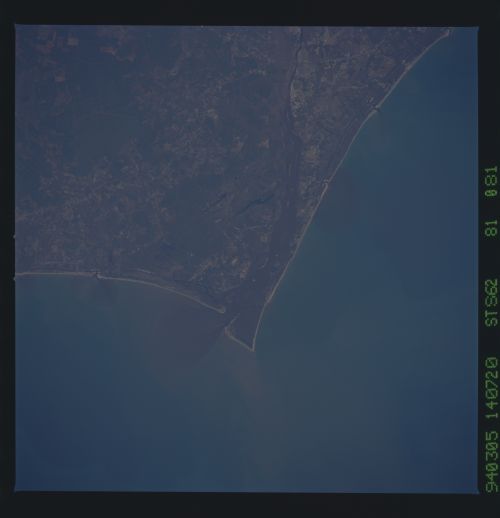
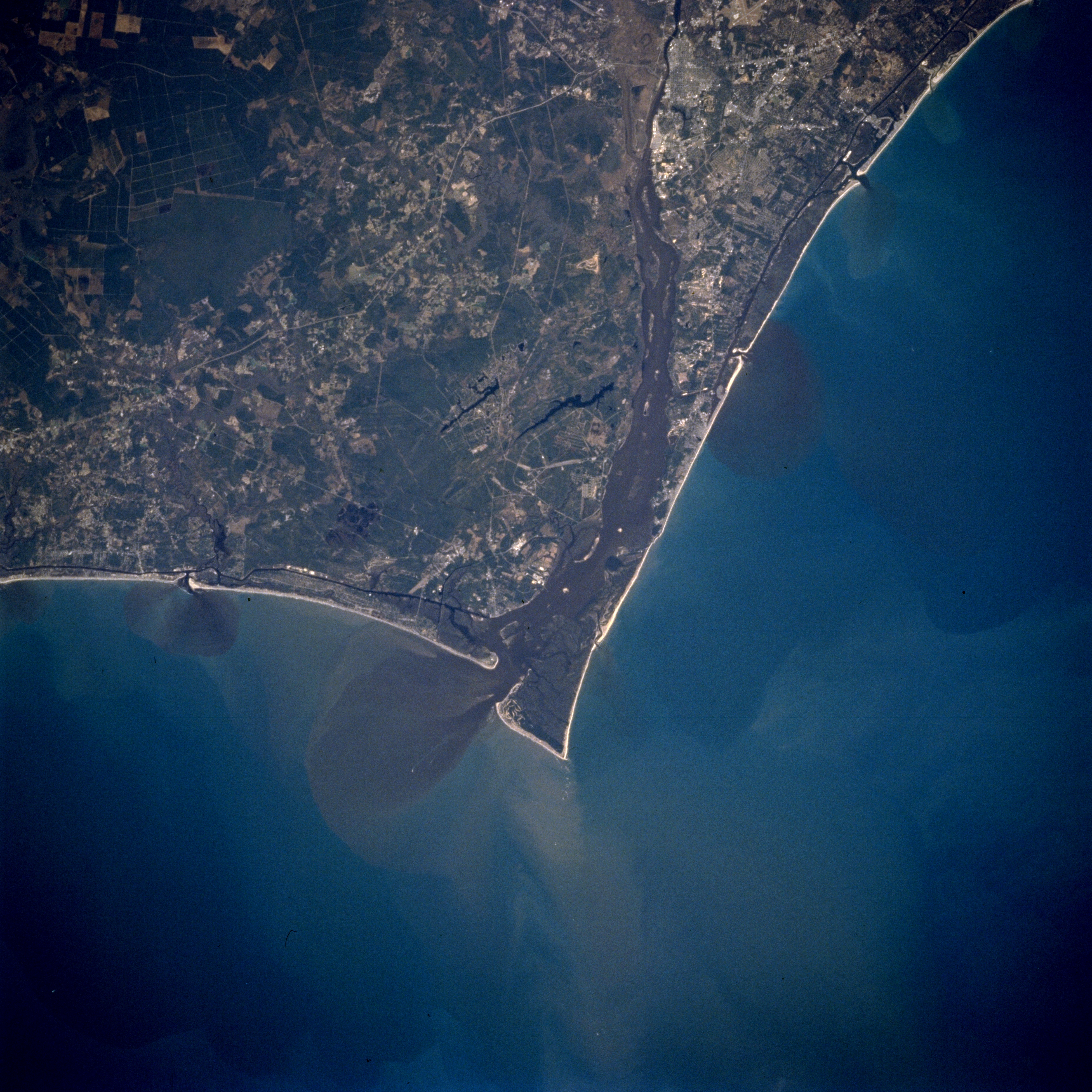
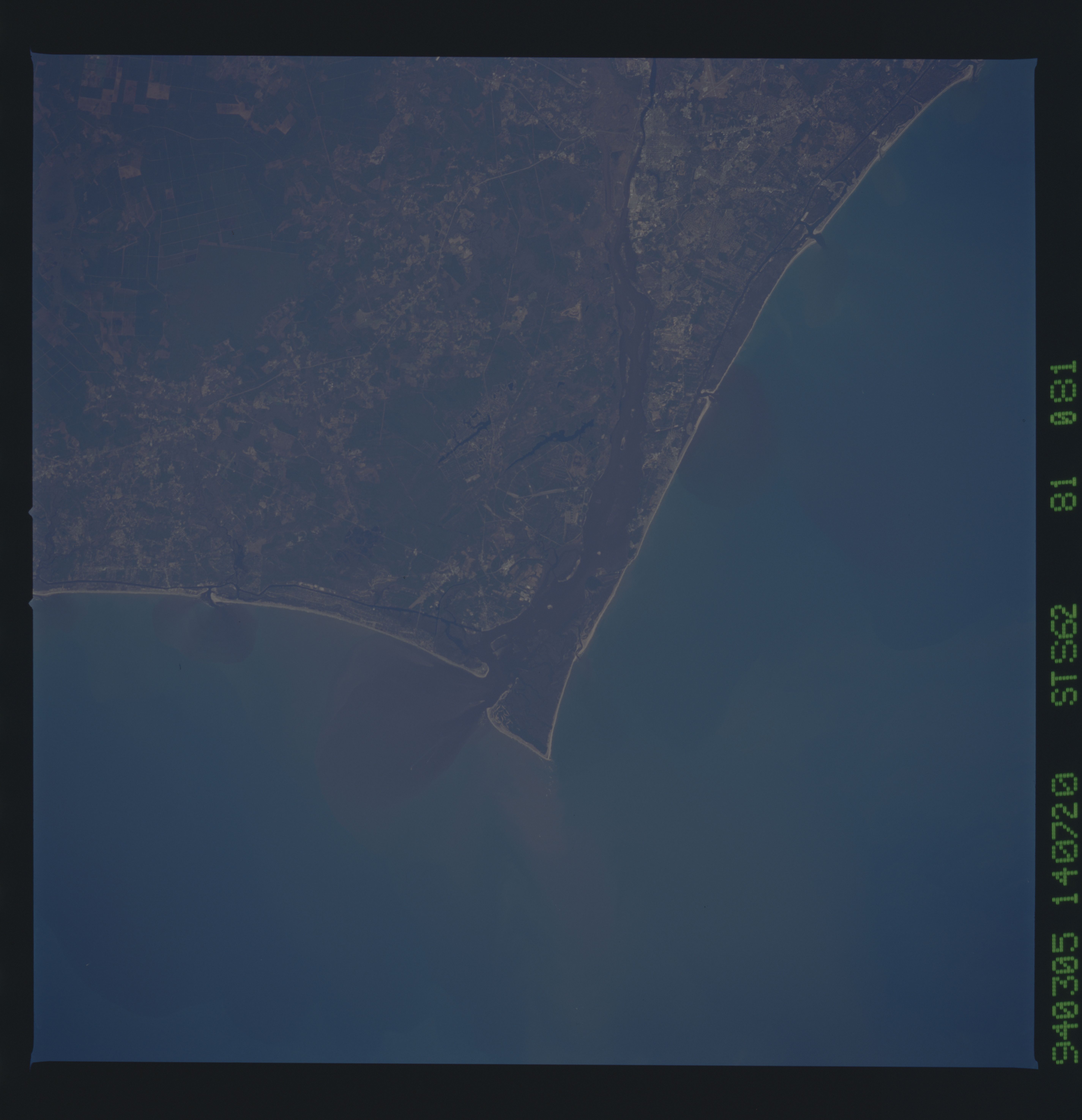
No GeoTIFF is available for this photo.Image Caption: STS062-081-081 Cape Fear, North Carolina, U.S.A. March 1994
The Cape Fear River exhibits a broad floodplain (dark, north-south swath in center of image) as the river drains south along the southeast coast of North Carolina. The mouth of the Cape Fear River can be identified by the fan-shaped sediment plume (dark in color) that extends into the Atlantic Ocean (slightly below the center of the image). Cape Fear is located on the point of land southeast of the mouth of the river. U. S. Highway 17 is the thin, light-colored line that extends across the picture from northeast to southwest. The dark looking landscape (upper left) is an uninhabited marshland known as the Green Swamp. The elongated, dark features near the center of the image and west of the Cape Fear River are part of another swampy area called Boiling Spring Lakes.
The Cape Fear River exhibits a broad floodplain (dark, north-south swath in center of image) as the river drains south along the southeast coast of North Carolina. The mouth of the Cape Fear River can be identified by the fan-shaped sediment plume (dark in color) that extends into the Atlantic Ocean (slightly below the center of the image). Cape Fear is located on the point of land southeast of the mouth of the river. U. S. Highway 17 is the thin, light-colored line that extends across the picture from northeast to southwest. The dark looking landscape (upper left) is an uninhabited marshland known as the Green Swamp. The elongated, dark features near the center of the image and west of the Cape Fear River are part of another swampy area called Boiling Spring Lakes.
