< STS059-209-81 >
| NASA Photo ID | STS059-209-81 |
| Focal Length | 40mm |
| Date taken | 1994.04.11 |
| Time taken | 07:56:47 GMT |
Cloud masks available for this image:
Spacecraft nadir point: 46.7° N, 73.2° E
Photo center point: 47.0° N, 75.0° E
Photo center point by machine learning:
Photo center point: 47.0° N, 75.0° E
Photo center point by machine learning:
Nadir to Photo Center: East
Spacecraft Altitude: 119 nautical miles (220km)
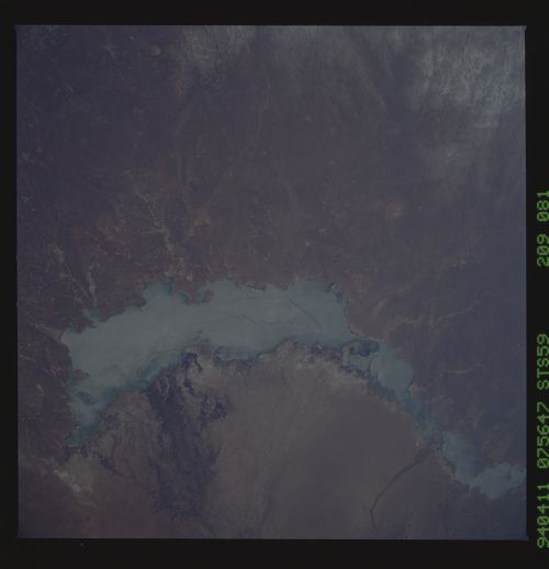
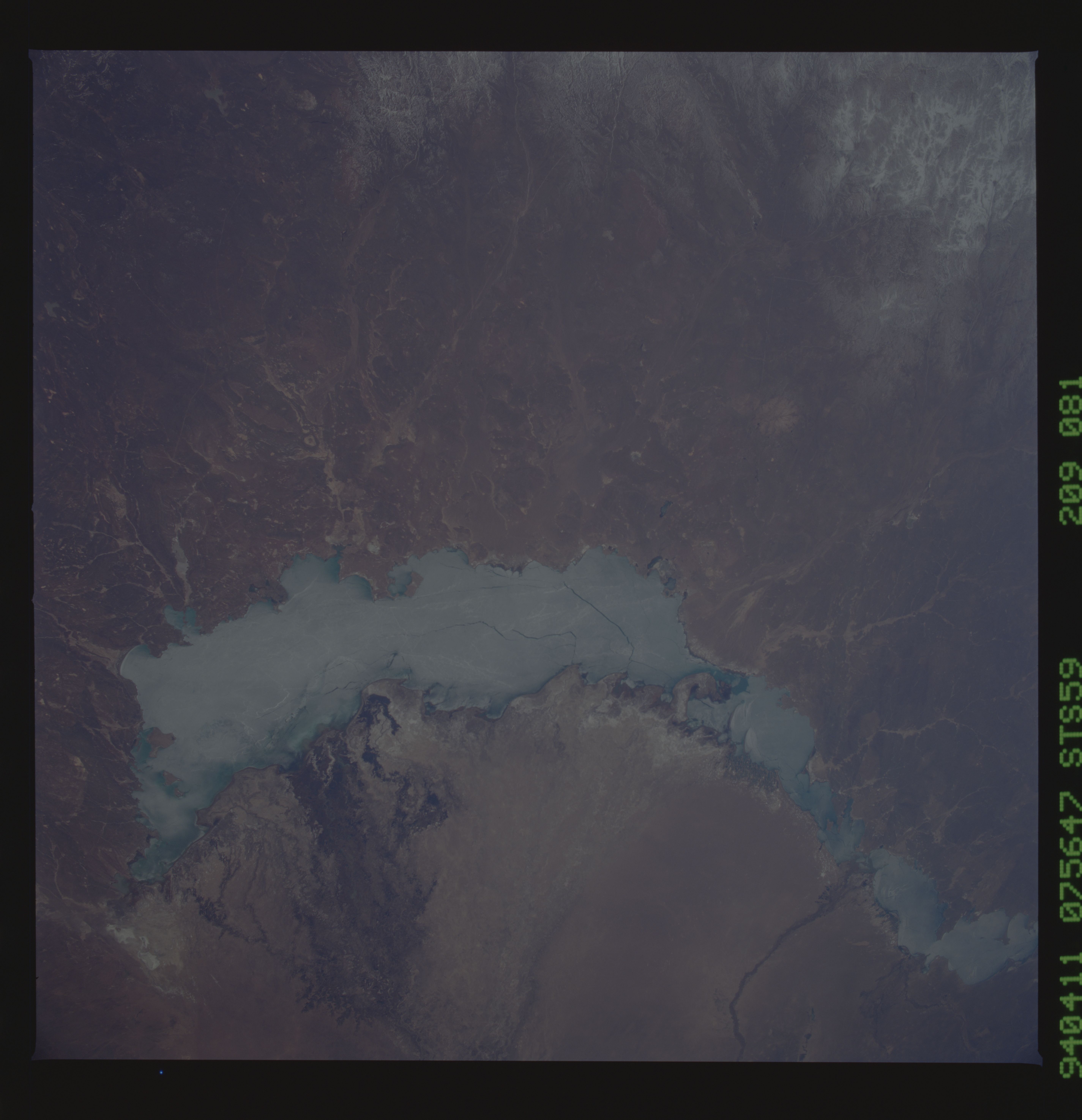
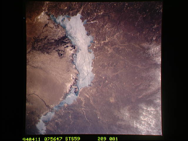
Country or Geographic Name: | KAZAKHSTAN |
Features: | LAKE BALKHASH |
| Features Found Using Machine Learning: | |
Cloud Cover Percentage: | 0 (no clouds present) |
Sun Elevation Angle: | 50° |
Sun Azimuth: | 199° |
Camera: | Hasselblad |
Focal Length: | 40mm |
Camera Tilt: | 43 degrees |
Format: | 5048: Kodak, natural color positive, Lumiere 100x/5048, ASA 100x, standard base |
Film Exposure: | Under Exposed |
| Additional Information | |
| Width | Height | Annotated | Cropped | Purpose | Links |
|---|---|---|---|---|---|
| 5700 pixels | 5900 pixels | No | No | Download Image Download Color Calibration Image for this Image |
|
| 500 pixels | 518 pixels | No | No | Download Image Download Color Calibration Image for this Image |
|
| 640 pixels | 480 pixels | No | No | Download Image |
Download Packaged File
Download a Google Earth KML for this Image
View photo footprint information
No GeoTIFF is available for this photo.Image Caption: Lake Balkhash, in eastern Kazakhstan, is some 300 miles long. The lake is seen frozen in this scene. The shape of the lake is controlled by the delta of the Ili River, which flows from the Tien Shan Mountains in western China across this arid steppe. Space Radar Laboratory (SRL) scientists will use radar data to study the microwave effects of differences in soil moisture, and in freezing or thawing, on the deltaic sediments.
