< SL4-52-8 >
| NASA Photo ID | SL4-52-8 |
| Focal Length | 152mm |
| Date taken | 1973.11.29 |
| Time taken | 18:55:21 GMT |
Cloud masks available for this image:
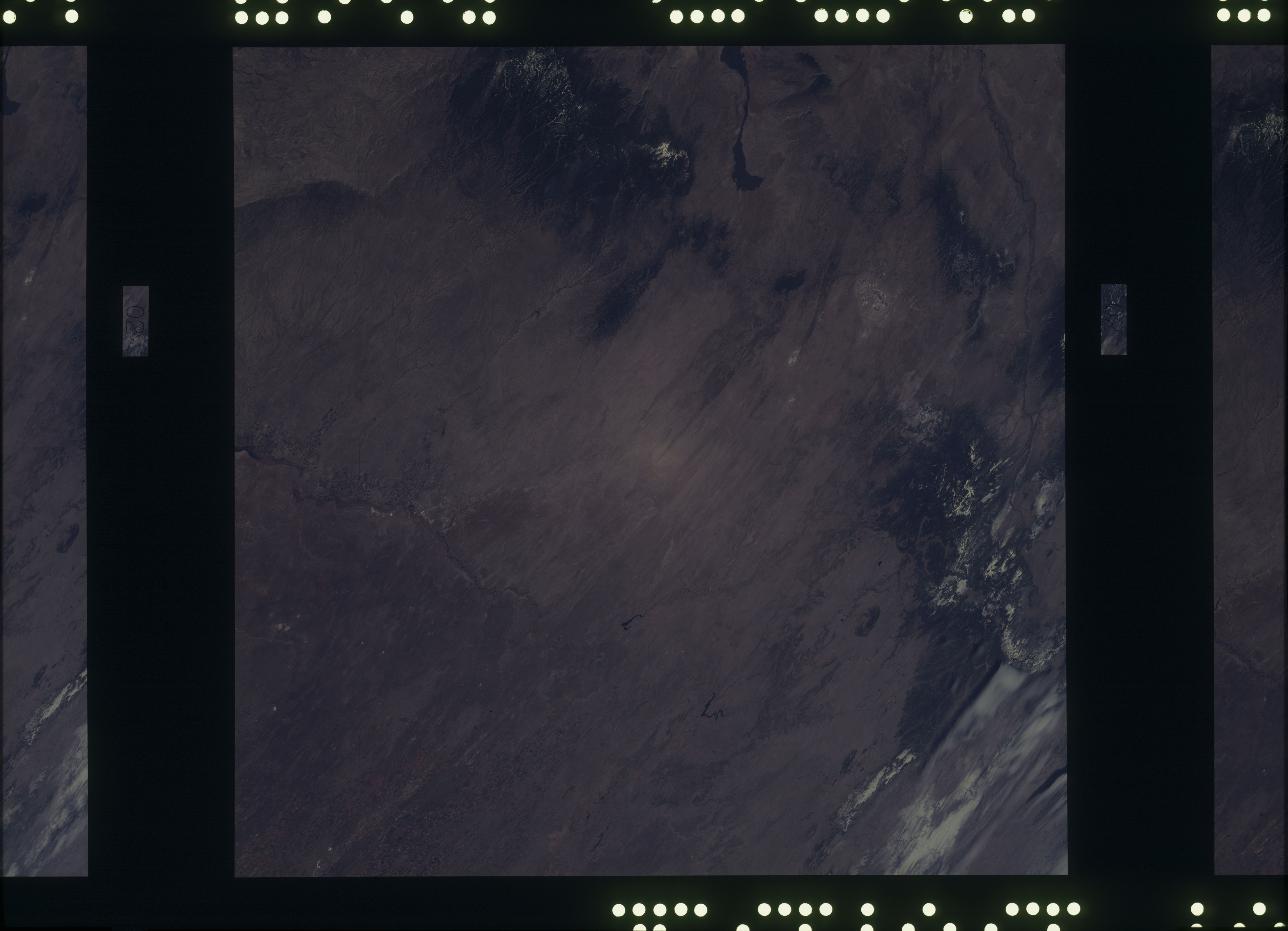
Spacecraft nadir point: 34.3° N, 105.0° W
Photo center point: 34.3° N, 105.0° W
Photo center point by machine learning:
Photo center point: 34.3° N, 105.0° W
Photo center point by machine learning:
Nadir to Photo Center:
Spacecraft Altitude: 239 nautical miles (443km)
Country or Geographic Name: | |
Features: | N. M., COLO., ALBUQUERQUE, SANGREE DE CRISTO MTS., SACRAMENTO MTS. |
| Features Found Using Machine Learning: | |
Cloud Cover Percentage: | 20 (11-25)% |
Sun Elevation Angle: | ° |
Sun Azimuth: | ° |
Camera: | Skylab Multispectral (S190A) |
Focal Length: | 152mm |
Camera Tilt: | 0 degrees |
Format: | SO356: Unknown SkyLab |
Film Exposure: | |
| Additional Information | |
| Width | Height | Annotated | Cropped | Purpose | Links |
|---|---|---|---|---|---|
| 6830 pixels | 4937 pixels | No | No | Download Image | |
| 500 pixels | 361 pixels | No | No | Download Image |
Download Packaged File
Download a Google Earth KML for this Image
View photo footprint information
No GeoTIFF is available for this photo.Image Caption: Mostly in New Mexico. Pecos River Valley past Fort Sumner and Las Vegas, New Mexico Rockies from the Guadalupe Mtns. to about Cimmaron, headwaters of the Canadian River including Wagon Mound, and western edge of the southern High Plains including Portales Valley.
