< STS082-731-79 >

| NASA Photo ID | STS082-731-79 |
| Focal Length | 250mm |
| Date taken | 1997.02.13 |
| Time taken | 13:49:47 GMT |
Resolutions offered for this image:
5700 x 5900 pixels 5591 x 5722 pixels 483 x 500 pixels 640 x 622 pixels
5700 x 5900 pixels 5591 x 5722 pixels 483 x 500 pixels 640 x 622 pixels

Cloud masks available for this image:
Spacecraft nadir point: 13.6° N, 90.6° W
Photo center point: 15.0° N, 91.0° W
Photo center point by machine learning:
Photo center point: 15.0° N, 91.0° W
Photo center point by machine learning:
Nadir to Photo Center: North
Spacecraft Altitude: 317 nautical miles (587km)
Country or Geographic Name: | GUATEMALA |
Features: | LAKE |
| Features Found Using Machine Learning: | |
Cloud Cover Percentage: | 10 (1-10)% |
Sun Elevation Angle: | 19° |
Sun Azimuth: | 109° |
Camera: | Hasselblad |
Focal Length: | 250mm |
Camera Tilt: | 15 degrees |
Format: | 5069: Kodak Elite 100S, E6 Reversal, Replaces Lumiere, Warmer in tone vs. Lumiere |
Film Exposure: | Normal |
| Additional Information | |
| Width | Height | Annotated | Cropped | Purpose | Links |
|---|---|---|---|---|---|
| 5700 pixels | 5900 pixels | No | No | Download Image Download Color Calibration Image for this Image |
|
| 5591 pixels | 5722 pixels | No | No | Scientist Request | Download Image |
| 483 pixels | 500 pixels | No | No | Download Image Download Color Calibration Image for this Image |
|
| 640 pixels | 622 pixels | No | No | Photographic Highlights | Download Image |
Download Packaged File
Download a Google Earth KML for this Image
View photo footprint information
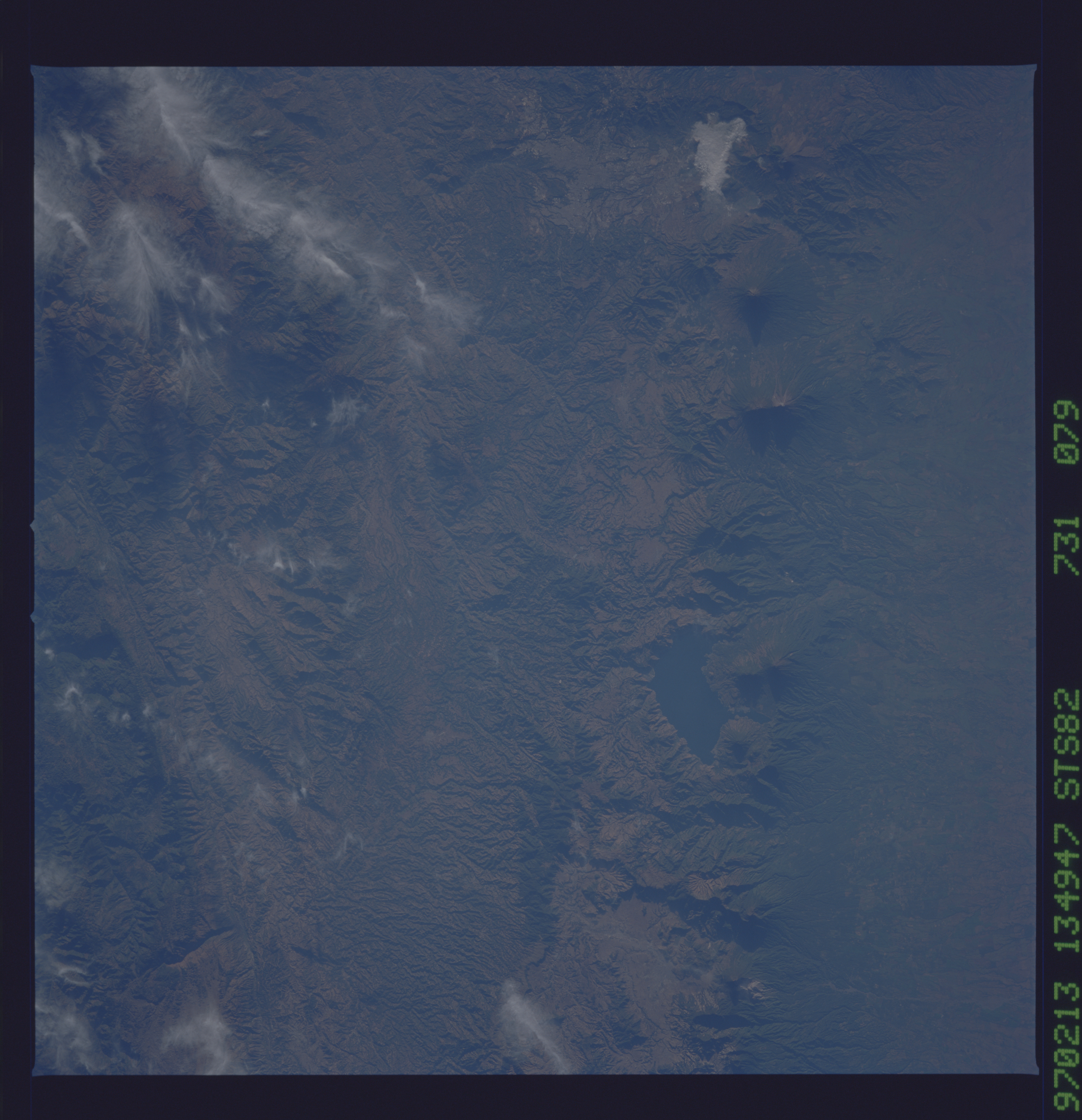
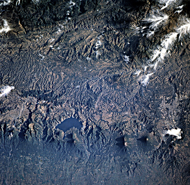
No GeoTIFF is available for this photo.Image Caption: Guatemala. Eastward continuations of the Motogua and Polochic faults
in the transform plate boundary, as well as the volcanoes of the
convergent boundary are well displayed here. Lake Atitlan in mid-frame
occupies the center of a caldera complex; Santiago Atitlan (11,804 ft)
is the larger and more easterly of the two volcanoes forming the
southern shore of the lake. Guatemala City is within a north-trending
graben -- one of several formed by stretching of the crust of the
Caribbean plate as it is pulled away to the east.
