< STS029-85-79 >
| NASA Photo ID | STS029-85-79 |
| Focal Length | 250mm |
| Date taken | 1989.03.17 |
| Time taken | 17:45:09 GMT |

Cloud masks available for this image:
Spacecraft nadir point: 13.6° S, 38.4° W
Photo center point: 10.0° S, 36.0° W
Photo center point by machine learning:
Photo center point: 10.0° S, 36.0° W
Photo center point by machine learning:
Nadir to Photo Center: Northeast
Spacecraft Altitude: 164 nautical miles (304km)
Country or Geographic Name: | BRAZIL |
Features: | RIO SAO FRANCISCO MOUTH |
| Features Found Using Machine Learning: | |
Cloud Cover Percentage: | 40 (26-50)% |
Sun Elevation Angle: | 43° |
Sun Azimuth: | 281° |
Camera: | Hasselblad |
Focal Length: | 250mm |
Camera Tilt: | Low Oblique |
Format: | 5017: Kodak, natural color positive, Ektachrome, X Professional, ASA 64, standard base |
Film Exposure: | Normal |
| Additional Information | |
| Width | Height | Annotated | Cropped | Purpose | Links |
|---|---|---|---|---|---|
| 5700 pixels | 5900 pixels | No | No | Download Image | |
| 500 pixels | 518 pixels | No | No | Download Image | |
| 640 pixels | 480 pixels | No | No | Download Image |
Download Packaged File
Download a Google Earth KML for this Image
View photo footprint information
No GeoTIFF is available for this photo.Image Caption:
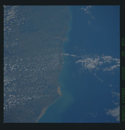
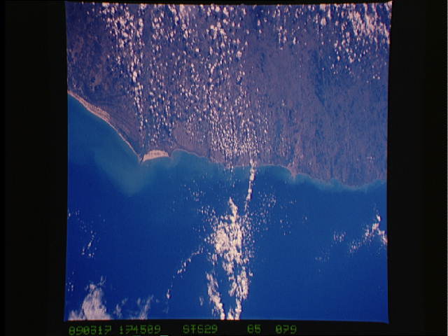
Eastern Brazil Coast; Mouth of the Rio Sao Francisco
The Eastern Brazil Coast, with the mouth of the Rio Sao Francisco
(1) is visible in this spectacular low oblique north-looking
panoramic view. The major coastal cities of Aracaju (2) and Ma-
ceio (3) can also be seen. Closer inspection shows that much of
the area has been deforested from the upland areas situated in-
land from the coast. (S29-85-076, 077, 078, 079)
