ISS033-E-7873
| NASA Photo ID | ISS033-E-7873 |
| Focal Length | 400mm |
| Date taken | 2012.09.27 |
| Time taken | 21:19:04 GMT |
Resolutions offered for this image:
1000 x 606 pixels 540 x 327 pixels 1440 x 960 pixels 720 x 480 pixels 4256 x 2832 pixels 640 x 426 pixels
1000 x 606 pixels 540 x 327 pixels 1440 x 960 pixels 720 x 480 pixels 4256 x 2832 pixels 640 x 426 pixels


Spacecraft nadir point: 19.9° N, 167.6° E
Photo center point: 19.3° N, 166.6° E
Photo center point by machine learning:
Photo center point: 19.3° N, 166.6° E
Photo center point by machine learning:
Nadir to Photo Center: Southwest
Spacecraft Altitude: 219 nautical miles (406km)
Country or Geographic Name: | WAKE ISLAND |
Features: | WAKE I., REEFS, AIRPORT, PACIFIC O. |
| Features Found Using Machine Learning: | |
Cloud Cover Percentage: | 10 (1-10)% |
Sun Elevation Angle: | 36° |
Sun Azimuth: | 108° |
Camera: | Nikon D3S Electronic Still Camera |
Focal Length: | 400mm |
Camera Tilt: | 18 degrees |
Format: | 4256E: 4256 x 2832 pixel CMOS sensor, 36.0mm x 23.9mm, total pixels: 12.87 million, Nikon FX format |
Film Exposure: | |
| Additional Information | |
| Width | Height | Annotated | Cropped | Purpose | Links |
|---|---|---|---|---|---|
| 1000 pixels | 606 pixels | No | Yes | Earth From Space collection | Download Image |
| 540 pixels | 327 pixels | Yes | Yes | Earth From Space collection | Download Image |
| 1440 pixels | 960 pixels | No | Yes | NASA's Earth Observatory web site | Download Image |
| 720 pixels | 480 pixels | Yes | Yes | NASA's Earth Observatory web site | Download Image |
| 4256 pixels | 2832 pixels | No | No | Download Image | |
| 640 pixels | 426 pixels | No | No | Download Image |
Download Packaged File
Download a Google Earth KML for this Image
View photo footprint information
Download a GeoTIFF for this photo
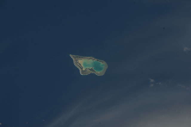
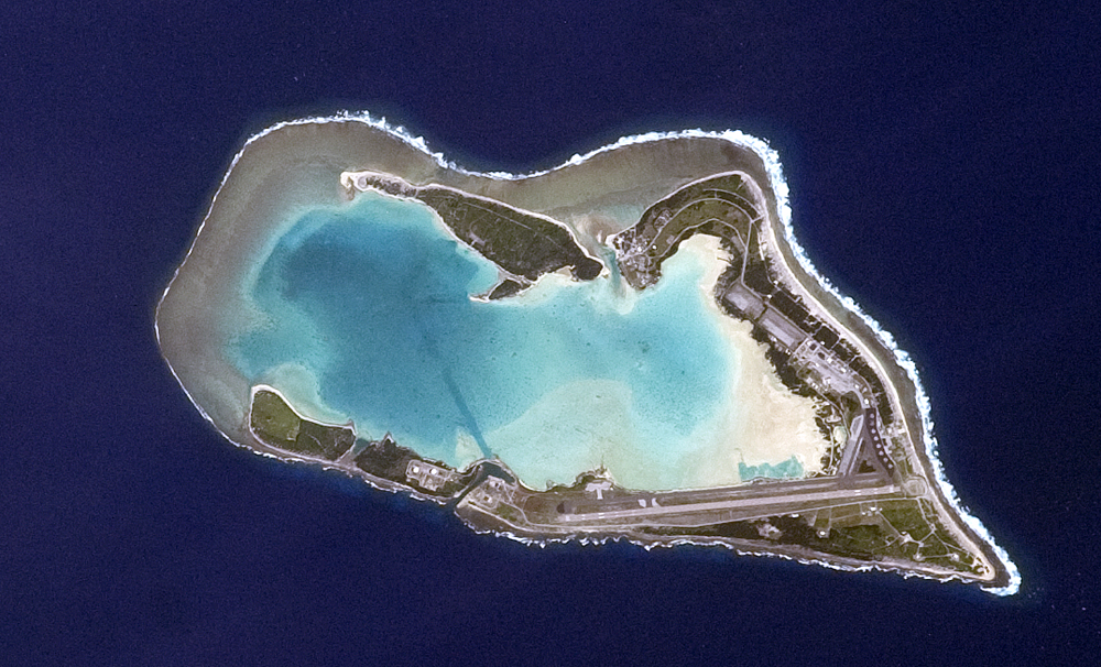
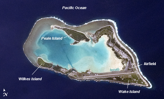
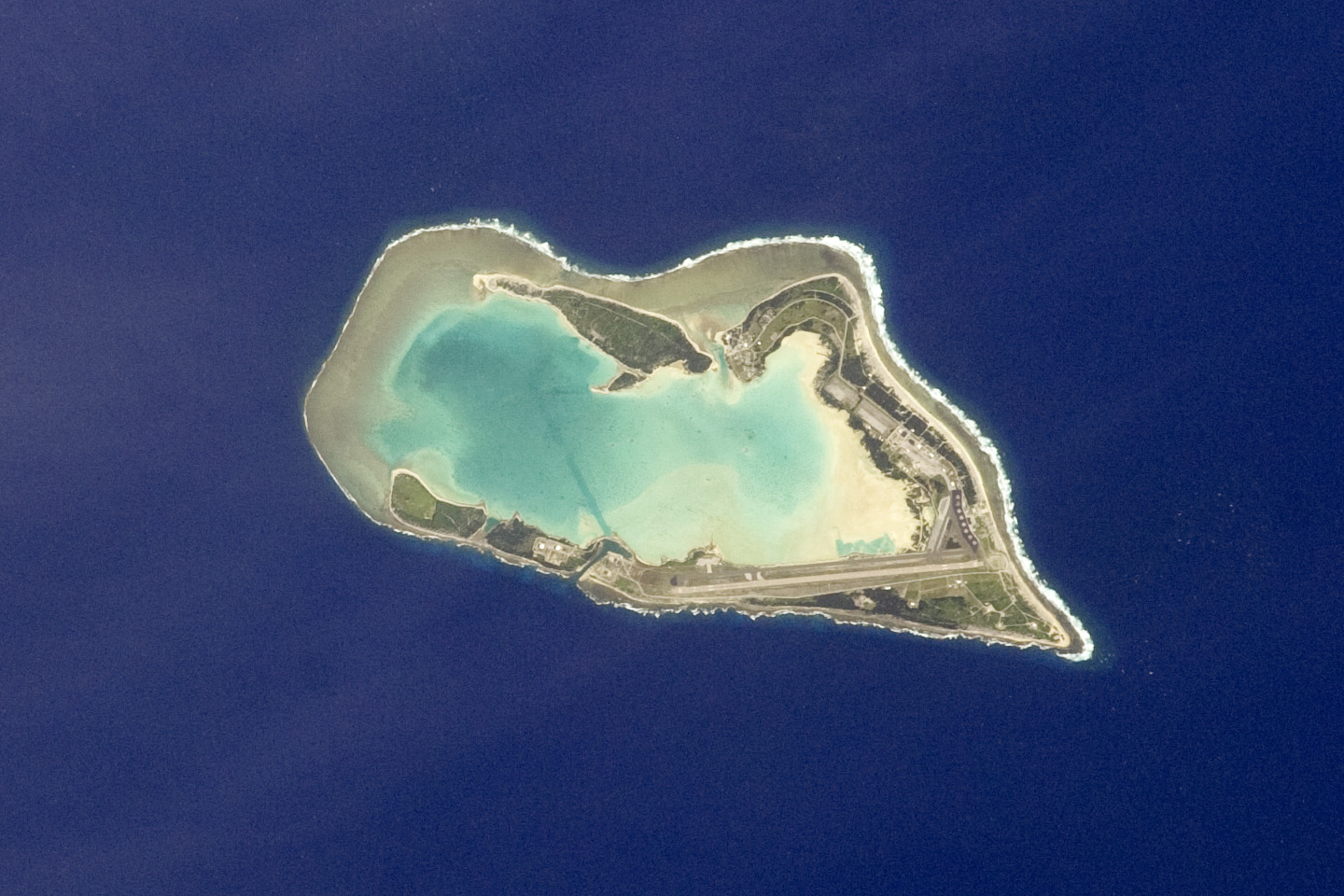
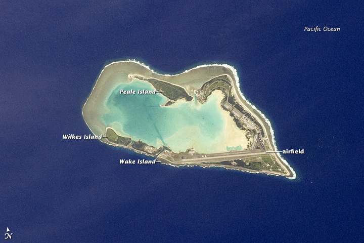
Image Caption: Wake Island, Pacific Ocean
Note: This caption refers to the image versions labeled "NASA's Earth Observatory web site".
The atoll of Wake Island is located in the central Pacific Ocean approximately 4000 kilometers to the west-southwest of Hawaii and 2400 kilometers to the northwest of Guam. In addition to Wake Island, the atoll includes the smaller Peale and Wilkes Island for a total land surface area of 6.5 square kilometers. Like many atolls in the Pacific, the islands and associated reefs formed around a submerged volcano. The lagoon (image center) in the center of the islands--characterized by shallow, light blue water in contrast to the surrounding darker, deeper Pacific Ocean waters--marks the approximate location of the summit crater of the volcano.
Wake Island was annexed by the United States of America (USA) in 1899, and it became an important military and commercial airfield by 1935. Following the bombing of Pearl Harbor and the mutual declaration of war between the USA and the Empire of Japan in 1941, the atoll was occupied by Japanese forces until the end of the war in the Pacific (1945). Today, the civil administration of the atoll is the responsibility of the US Department of the Interior, while the US Air Force and US Army maintain military facilities and operations (including an airfield and large ship anchorages). With the exception of direct support to missions--and potentially, emergency airplane landings--there are no commercial or civilian flights to Wake Island.
During 2006, Wake Island was in the path of Super Typhoon Ioke. Given the danger, the entire civilian and military population of the atoll was evacuated. While some damage to buildings and facilities occurred as a result of the storm, a US Air Force repair team subsequently restored full capabilities for strategic use of the atoll.
