< ISS017-E-7870 >
| NASA Photo ID | ISS017-E-7870 |
| Focal Length | 180mm |
| Date taken | 2008.05.27 |
| Time taken | 13:14:22 GMT |


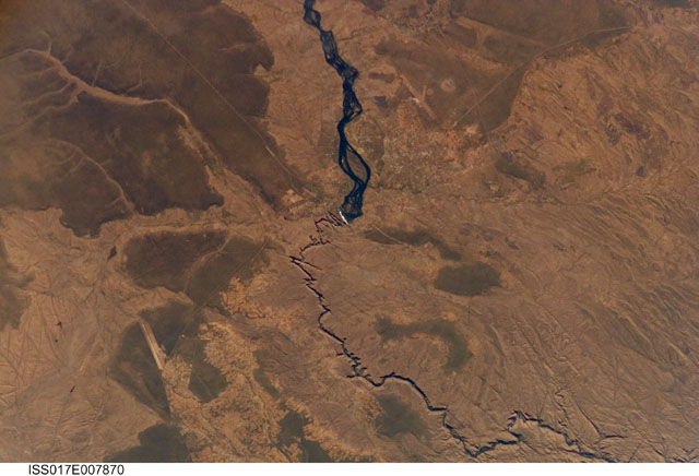
Spacecraft nadir point: 17.6° S, 24.3° E
Photo center point: 17.9° S, 25.9° E
Photo center point by machine learning:
Photo center point: 17.9° S, 25.9° E
Photo center point by machine learning:
Nadir to Photo Center: East
Spacecraft Altitude: 184 nautical miles (341km)
Country or Geographic Name: | ZAMBIA |
Features: | VICTORIA FALLS, ZAMBEZI R., AIRPORTS |
| Features Found Using Machine Learning: | |
Cloud Cover Percentage: | 0 (no clouds present) |
Sun Elevation Angle: | 32° |
Sun Azimuth: | 311° |
Camera: | Kodak DCS760c Electronic Still Camera |
Focal Length: | 180mm |
Camera Tilt: | 28 degrees |
Format: | 3060E: 3060 x 2036 pixel CCD, RGBG array |
Film Exposure: | |
| Additional Information | |
| Width | Height | Annotated | Cropped | Purpose | Links |
|---|---|---|---|---|---|
| 3032 pixels | 2065 pixels | No | No | Download Image | |
| 640 pixels | 436 pixels | No | No | Download Image |
Download Packaged File
Download a Google Earth KML for this Image
View photo footprint information
No GeoTIFF is available for this photo.Image Caption: none
