< STS047-90-78 >
| NASA Photo ID | STS047-90-78 |
| Focal Length | 250mm |
| Date taken | 1992.09.14 |
| Time taken | 23:55:21 GMT |
Resolutions offered for this image:
791 x 798 pixels 5700 x 6000 pixels 500 x 526 pixels 640 x 480 pixels
791 x 798 pixels 5700 x 6000 pixels 500 x 526 pixels 640 x 480 pixels


Cloud masks available for this image:
Spacecraft nadir point: 44.8° N, 143.5° E
Photo center point: 43.5° N, 141.5° E
Photo center point by machine learning:
Photo center point: 43.5° N, 141.5° E
Photo center point by machine learning:
Nadir to Photo Center: Southwest
Spacecraft Altitude: 169 nautical miles (313km)
Country or Geographic Name: | JAPAN |
Features: | HOKKAIDO, SAPPORO AREA |
| Features Found Using Machine Learning: | |
Cloud Cover Percentage: | 20 (11-25)% |
Sun Elevation Angle: | 37° |
Sun Azimuth: | 132° |
Camera: | Hasselblad |
Focal Length: | 250mm |
Camera Tilt: | 40 degrees |
Format: | VELVI: Fuji, natural color positive, Velvia 50, CS 135-36, ASA 32, standard base |
Film Exposure: | Normal |
| Additional Information | |
| Width | Height | Annotated | Cropped | Purpose | Links |
|---|---|---|---|---|---|
| 791 pixels | 798 pixels | No | No | Cities collection | Download Image |
| 5700 pixels | 6000 pixels | No | No | Download Image Download Color Calibration Image for this Image |
|
| 500 pixels | 526 pixels | No | No | Download Image Download Color Calibration Image for this Image |
|
| 640 pixels | 480 pixels | No | No | Download Image |
Download Packaged File
Download a Google Earth KML for this Image
View photo footprint information
No GeoTIFF is available for this photo.Image Caption:
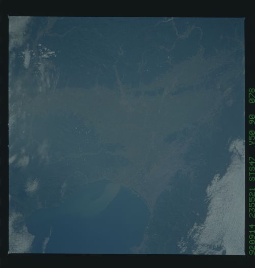
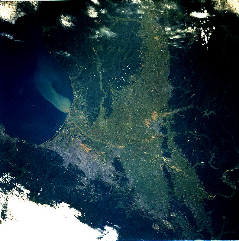
STS047-90-077, 078 SAPPORO, Hokkaido, Japan. The city of Sapporo
is visible in some detail as the gray area against the mountains.
Surrounding low country is intensively exploited for agriculture.
The agriculture is located mainly in the large valley of the
Ishikari River which can be seen winding through the fields. The
river injects a prominent sediment plume into the Ishikari-wan
Bay.
The city of Sapporo on the northernmost of the Japanese Home Island of Hokkaido (43.5N, 141.5E), host to the 1986 Winter Olympic Games is situated along the margin of a large valley which extends across the island from the Sea of Japan to the Pacific Ocean. The Valley is largely cultivated (the lighter green of the cultivated land distinguishes it from the gray urban development of Sapporo), but much of the island remains heavily forested.
