< STS030-151-78 >
| NASA Photo ID | STS030-151-78 |
| Focal Length | 90mm |
| Date taken | 1989.05.06 |
| Time taken | 05:23:32 GMT |
Resolutions offered for this image:
640 x 480 pixels
640 x 480 pixels
Cloud masks available for this image:
Spacecraft nadir point: 18.5° N, 62.5° E
Photo center point: 18.5° N, 62.5° E
Photo center point by machine learning:
Photo center point: 18.5° N, 62.5° E
Photo center point by machine learning:
Nadir to Photo Center:
Spacecraft Altitude: 177 nautical miles (328km)Body: Earth
Country or Geographic Name: | ARABIAN SEA |
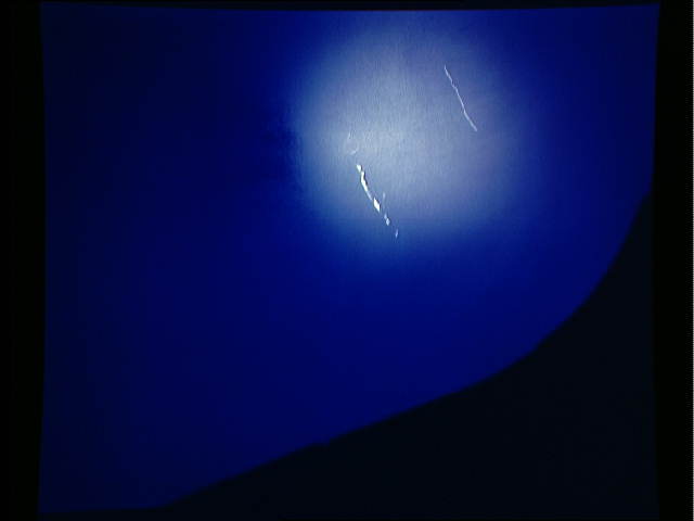
Features: | SUNGLINT |
| Features Found Using Machine Learning: | |
Cloud Cover Percentage: | 0 (no clouds present) |
Sun Elevation Angle: | 55° |
Sun Azimuth: | 87° |
Camera: | Linhof |
Focal Length: | 90mm |
Camera Tilt: | 0 degrees |
Format: | 5017: Kodak, natural color positive, Ektachrome, X Professional, ASA 64, standard base |
Film Exposure: | Normal |
| Additional Information | |
| Width | Height | Annotated | Cropped | Purpose | Links |
|---|---|---|---|---|---|
| 640 pixels | 480 pixels | No | No | ISD 1 | Download Image |
Download Packaged File
Download a Google Earth KML for this Image
View photo footprint information
No GeoTIFF is available for this photo.Image Caption: These dual oil slicks on the ocean surface are the result of tanker ships flushing their tanks (bilging) in the Arabian Sea (18.5N, 62.5E). These two ships flushed out their bilges, apparently contaminated with bunker oil, leaving oily residues on the ocean's surface. One wake, believed to have been done earlier than the other, has been broadened by the effects of surface winds and current.

