< STS094-732-77 >
| NASA Photo ID | STS094-732-77 |
| Focal Length | 100mm |
| Date taken | 1997.07.06 |
| Time taken | 15:29:51 GMT |
Cloud masks available for this image:
Spacecraft nadir point: 26.9° N, 104.2° W
Photo center point: 31.5° N, 106.5° W
Photo center point by machine learning:
Photo center point: 31.5° N, 106.5° W
Photo center point by machine learning:
Nadir to Photo Center: North
Spacecraft Altitude: 159 nautical miles (294km)
Country or Geographic Name: | USA-TEXAS |
Features: | RIO GRANDE |
| Features Found Using Machine Learning: | |
Cloud Cover Percentage: | 0 (no clouds present) |
Sun Elevation Angle: | 42° |
Sun Azimuth: | 83° |
Camera: | Hasselblad |
Focal Length: | 100mm |
Camera Tilt: | Low Oblique |
Format: | 5069: Kodak Elite 100S, E6 Reversal, Replaces Lumiere, Warmer in tone vs. Lumiere |
Film Exposure: | Normal |
| Additional Information | |
| Width | Height | Annotated | Cropped | Purpose | Links |
|---|---|---|---|---|---|
| 5700 pixels | 5900 pixels | No | No | Download Image Download Color Calibration Image for this Image |
|
| 483 pixels | 500 pixels | No | No | Download Image Download Color Calibration Image for this Image |
|
| 621 pixels | 640 pixels | No | No | Photographic Highlights | Download Image |
Download Packaged File
Download a Google Earth KML for this Image
View photo footprint information
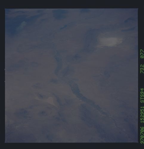
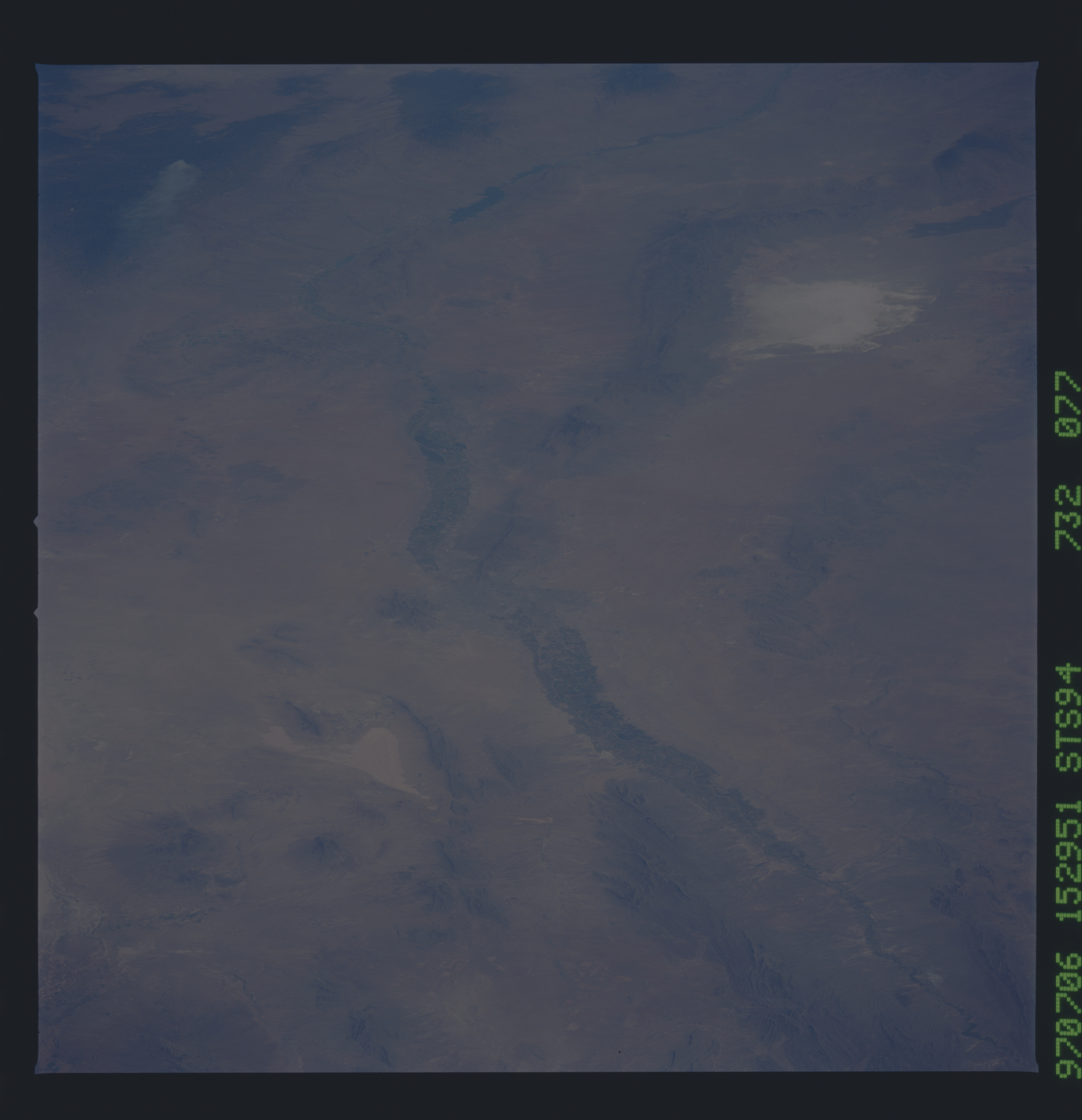
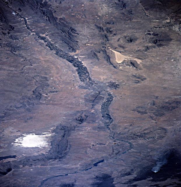
No GeoTIFF is available for this photo.Image Caption: STS094-732-77 Rio Grande Rift
One of a very few photos of the Rio Grande rift showing the interaction between faults of the rift valley, which head northward from El Paso, and faults of the Border Corridor transform zone, which head southeastward to Big Bend National Park. The Franklin Mountains, within El Paso, trend north and are typical of the rift ranges throughout New Mexico and into Colorado. Sierra Samalayuca (SE of Sierra Juarez near El Paso) trends southeast, as do most ranges within the transform zone. Volcanoes commonly mark such corners where major rift structures change trend; the Potrillo Mountains (dark area west of El Paso) are volcanic peaks in that setting. The Carrizozo lava flow (dark black) and White Sands (southern New Mexico) are visible in the upper right; the northern Quitman Mountains and Sierra Blanca (far west Texas) are near the bottom of the photo.
One of a very few photos of the Rio Grande rift showing the interaction between faults of the rift valley, which head northward from El Paso, and faults of the Border Corridor transform zone, which head southeastward to Big Bend National Park. The Franklin Mountains, within El Paso, trend north and are typical of the rift ranges throughout New Mexico and into Colorado. Sierra Samalayuca (SE of Sierra Juarez near El Paso) trends southeast, as do most ranges within the transform zone. Volcanoes commonly mark such corners where major rift structures change trend; the Potrillo Mountains (dark area west of El Paso) are volcanic peaks in that setting. The Carrizozo lava flow (dark black) and White Sands (southern New Mexico) are visible in the upper right; the northern Quitman Mountains and Sierra Blanca (far west Texas) are near the bottom of the photo.
