< STS042-96-77 >
| NASA Photo ID | STS042-96-77 |
| Focal Length | 100mm |
| Date taken | 1992.01.26 |
| Time taken | 21:40:25 GMT |
Cloud masks available for this image:
Spacecraft nadir point: 56.3° N, 150.1° W
Photo center point: 59.5° N, 153.5° W
Photo center point by machine learning:
Photo center point: 59.5° N, 153.5° W
Photo center point by machine learning:
Nadir to Photo Center: Northwest
Spacecraft Altitude: 167 nautical miles (309km)
Country or Geographic Name: | USA-ALASKA |
Features: | ALEUTIAN RAN., KAMISHAK B |
| Features Found Using Machine Learning: | |
Cloud Cover Percentage: | 5 (1-10)% |
Sun Elevation Angle: | 15° |
Sun Azimuth: | 172° |
Camera: | Hasselblad |
Focal Length: | 100mm |
Camera Tilt: | Low Oblique |
Format: | VELVI: Fuji, natural color positive, Velvia 50, CS 135-36, ASA 32, standard base |
Film Exposure: | Normal |
| Additional Information | |
| Width | Height | Annotated | Cropped | Purpose | Links |
|---|---|---|---|---|---|
| 5700 pixels | 6000 pixels | No | No | Download Image Download Color Calibration Image for this Image |
|
| 500 pixels | 526 pixels | No | No | Download Image Download Color Calibration Image for this Image |
|
| 640 pixels | 480 pixels | No | No | Download Image |
Download Packaged File
Download a Google Earth KML for this Image
View photo footprint information
No GeoTIFF is available for this photo.Image Caption:
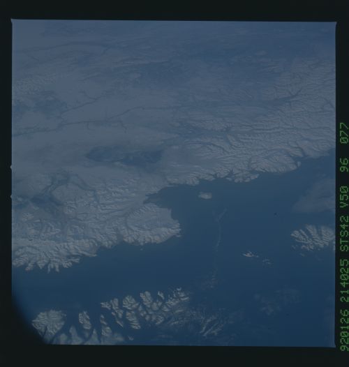
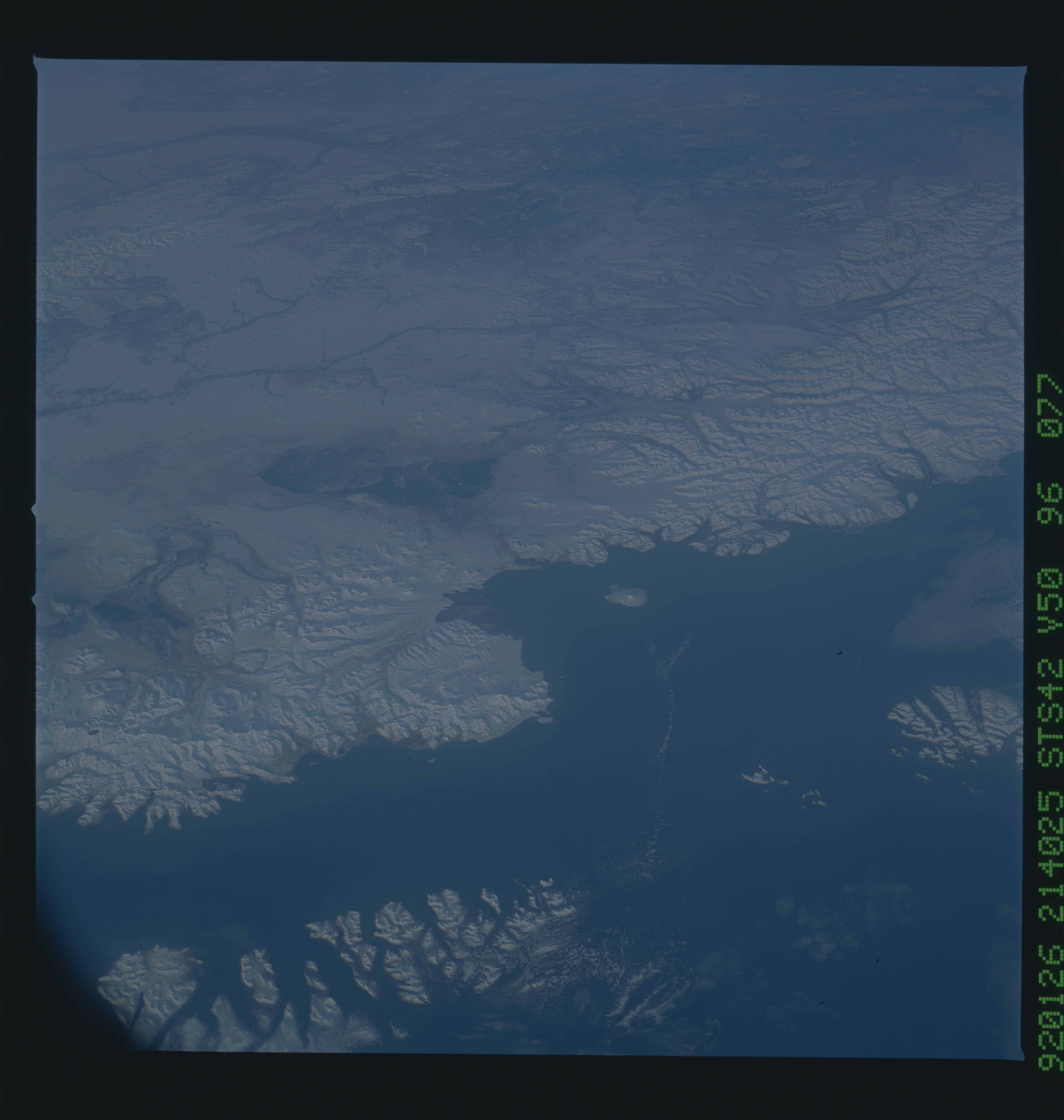
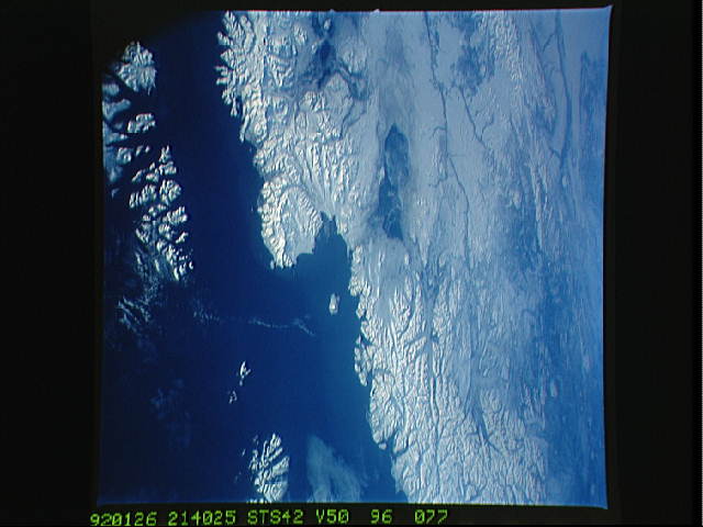
STS042-96-077 Cook Inlet, Alaska (59.0! N, 153.0! W) This
oblique view of the Alaskan coastline shows Kodiak Island in the
foreground, separated from the Aleutian Peninsula by Selikof
Strait. In the center of the photo is seen the southern extent
of Cook Inlet. A narrow band of turbid water is evident adjacent
to the Aleutian Peninsula and extending along the northern shore
of Cook Inlet. The suspended sediment is likely the result of
fresh-water runoff, laden with glacial silt, flowing into the
ocean water from the many rivers and streams draining the Aleu-
tian and Chigmit Mountain Ranges. A small amount of sea ice can
be seen in Kamishak Bay, to the west of Augustine Island in Cook
Inlet. The photograph was taken on 26 January at 21:40 GMT using
a Hasselblad camera equipped with natural color transparency film
and a 100 mm lens.
