< STS036-76-75 >
| NASA Photo ID | STS036-76-75 |
| Focal Length | 100mm |
| Date taken | 1990.03.03 |
| Time taken | 06:19:34 GMT |
Resolutions offered for this image:
5265 x 5265 pixels 639 x 639 pixels 5700 x 5900 pixels 500 x 518 pixels 640 x 480 pixels
5265 x 5265 pixels 639 x 639 pixels 5700 x 5900 pixels 500 x 518 pixels 640 x 480 pixels


Cloud masks available for this image:
Spacecraft nadir point: 33.4° N, 71.4° E
Photo center point: 28.5° N, 67.5° E
Photo center point by machine learning:
Photo center point: 28.5° N, 67.5° E
Photo center point by machine learning:
Nadir to Photo Center: Southwest
Spacecraft Altitude: 126 nautical miles (233km)
Country or Geographic Name: | PAKISTAN |
Features: | MOUNTAINS, INDUS RIVER |
| Features Found Using Machine Learning: | |
Cloud Cover Percentage: | 5 (1-10)% |
Sun Elevation Angle: | 47° |
Sun Azimuth: | 155° |
Camera: | Hasselblad |
Focal Length: | 100mm |
Camera Tilt: | High Oblique |
Format: | 5017: Kodak, natural color positive, Ektachrome, X Professional, ASA 64, standard base |
Film Exposure: | Normal |
| Additional Information | |
| Width | Height | Annotated | Cropped | Purpose | Links |
|---|---|---|---|---|---|
| 5265 pixels | 5265 pixels | No | No | Earth From Space collection | Download Image |
| 639 pixels | 639 pixels | No | No | Earth From Space collection | Download Image |
| 5700 pixels | 5900 pixels | No | No | Download Image Download Color Calibration Image for this Image |
|
| 500 pixels | 518 pixels | No | No | Download Image Download Color Calibration Image for this Image |
|
| 640 pixels | 480 pixels | No | No | Download Image |
Download Packaged File
Download a Google Earth KML for this Image
View photo footprint information
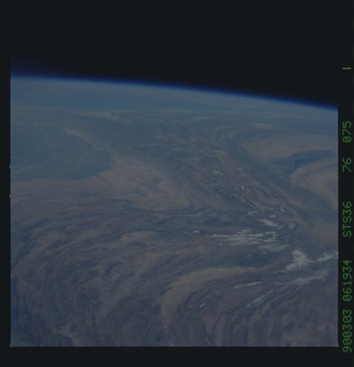
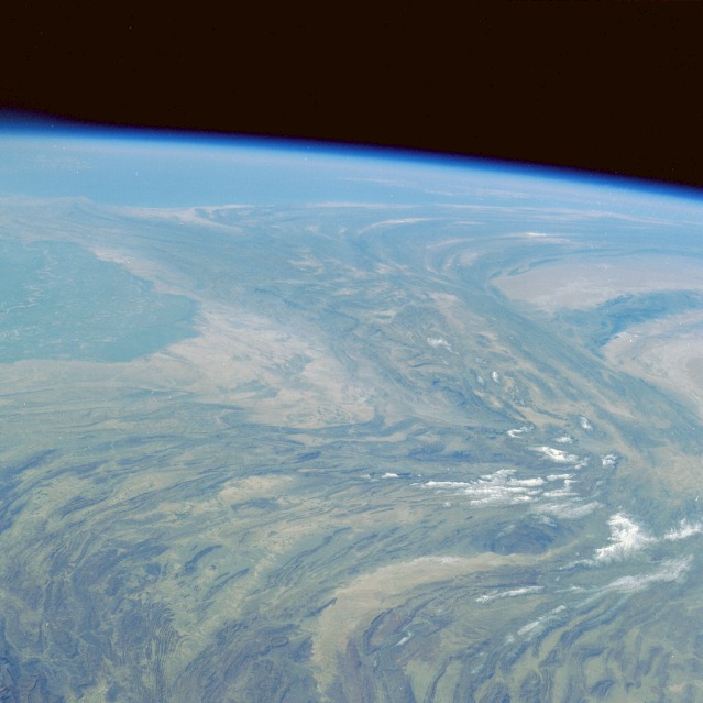
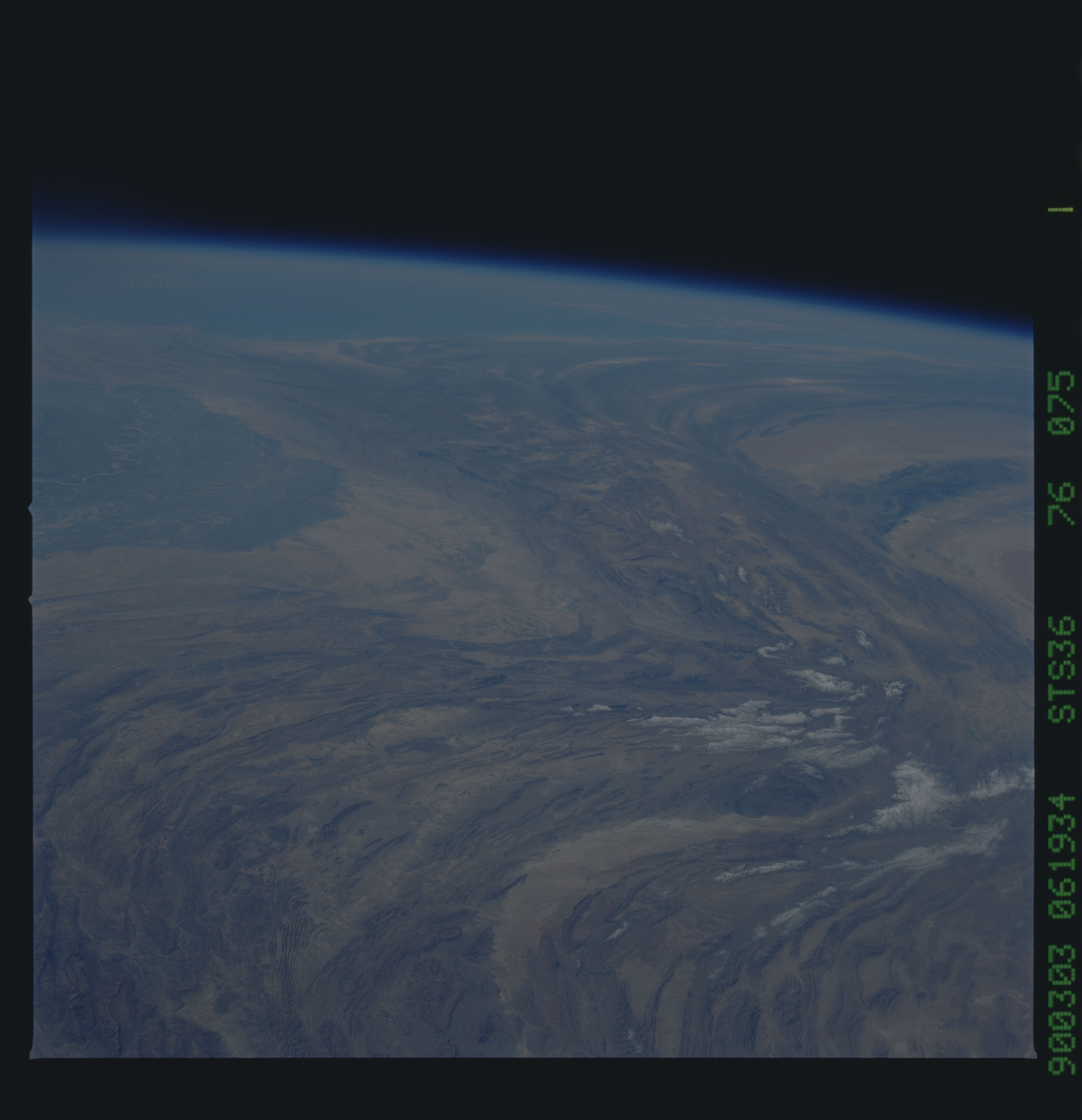
No GeoTIFF is available for this photo.Image Caption: STS036-076-075 Makran Mountains, Pakistan March 1990
While the collision of the Australian-Indian Tectonic Plate and the Eurasian Plate created the Himalayan Mountains millions of years ago, the land masses on either side of this northward force formed the folded, generally north-south trending Makran, Kirthar, and Sulaiman Ranges along the western border of Pakistan shown in this high-oblique, southwest-viewing photograph. The gently arcing northern Sulaiman Range splits into two separate ranges--the north-south trending Kirthar Range immediately west of the Indus River floodplain and the Makran Range that arcs westward near the coast and extends into southeastern Iran. The Chagai Hills, a smaller east-west trending range separates two sandy western deserts and form the boundary between southern Afghanistan and southwestern Pakistan. A small segment of the Indus River and its broad floodplain are visible along the eastern edge of the photograph.
While the collision of the Australian-Indian Tectonic Plate and the Eurasian Plate created the Himalayan Mountains millions of years ago, the land masses on either side of this northward force formed the folded, generally north-south trending Makran, Kirthar, and Sulaiman Ranges along the western border of Pakistan shown in this high-oblique, southwest-viewing photograph. The gently arcing northern Sulaiman Range splits into two separate ranges--the north-south trending Kirthar Range immediately west of the Indus River floodplain and the Makran Range that arcs westward near the coast and extends into southeastern Iran. The Chagai Hills, a smaller east-west trending range separates two sandy western deserts and form the boundary between southern Afghanistan and southwestern Pakistan. A small segment of the Indus River and its broad floodplain are visible along the eastern edge of the photograph.
