< ISS040-E-74047 >
| NASA Photo ID | ISS040-E-74047 |
| Focal Length | 85mm |
| Date taken | 2014.07.22 |
| Time taken | 22:25:54 GMT |

Cloud masks available for this image:
Spacecraft nadir point: 31.7° N, 34.4° E
Photo center point:
Photo center point by machine learning: 31.35° N, 34.76° E
Photo center point:
Photo center point by machine learning: 31.35° N, 34.76° E
Nadir to Photo Center:
Spacecraft Altitude: 223 nautical miles (413km)

Country or Geographic Name: | |
Features: | |
| Features Found Using Machine Learning: | |
Cloud Cover Percentage: | 0 (no clouds present) |
Sun Elevation Angle: | -38° |
Sun Azimuth: | 11° |
Camera: | NIKON D3S S/N: 2007931 |
Focal Length: | 85mm |
Camera Tilt: | |
Format: | |
Film Exposure: | |
| Additional Information | |
| Width | Height | Annotated | Cropped | Purpose | Links |
|---|---|---|---|---|---|
| 4256 pixels | 2832 pixels | No | No | Download Image | |
| 640 pixels | 426 pixels | No | No | Download Image |
Download Packaged File
Download a Google Earth KML for this Image
View photo footprint information
Download a GeoTIFF for this photo
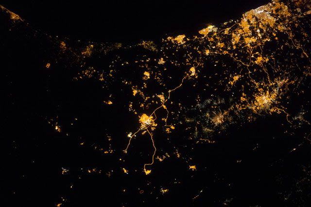
Image Caption: ISS040-E-074047 (22 July 2014) --- Because of city lights, several points in the mid-east along the Eastern Mediterranean Sea coast and a bit inland can be delineated in this early morning view photographed by one of the Expedition 40 crew members aboard the Earth-orbiting International Space Station on July 22, 2014. A portion of the Mediterranean Sea is at the top (northwest) of this image. The orbital outpost was flying at an altitude of approximately 223 nautical miles above a point the coordinates of which are 31.7 degrees north latitude and 34.4 degrees east longitude when the image was exposed, using an 85mm lens.
