< STS090-707-74 >
| NASA Photo ID | STS090-707-74 |
| Focal Length | 100mm |
| Date taken | 1998.04.25 |
| Time taken | 03:02:03 GMT |
Resolutions offered for this image:
4031 x 4096 pixels 629 x 640 pixels 5700 x 5900 pixels 483 x 500 pixels 522 x 481 pixels
4031 x 4096 pixels 629 x 640 pixels 5700 x 5900 pixels 483 x 500 pixels 522 x 481 pixels


Cloud masks available for this image:
Spacecraft nadir point: 37.5° N, 122.0° E
Photo center point: 39.0° N, 121.5° E
Photo center point by machine learning:
Photo center point: 39.0° N, 121.5° E
Photo center point by machine learning:
Nadir to Photo Center: North
Spacecraft Altitude: 133 nautical miles (246km)
Country or Geographic Name: | CHINA |
Features: | DALIAN, LUSHUN, JINZHOU B. |
| Features Found Using Machine Learning: | |
Cloud Cover Percentage: | 0 (no clouds present) |
Sun Elevation Angle: | 63° |
Sun Azimuth: | 153° |
Camera: | Hasselblad |
Focal Length: | 100mm |
Camera Tilt: | 35 degrees |
Format: | 5069: Kodak Elite 100S, E6 Reversal, Replaces Lumiere, Warmer in tone vs. Lumiere |
Film Exposure: | Normal |
| Additional Information | |
| Width | Height | Annotated | Cropped | Purpose | Links |
|---|---|---|---|---|---|
| 4031 pixels | 4096 pixels | No | No | Earth From Space collection | Download Image |
| 629 pixels | 640 pixels | No | No | Earth From Space collection | Download Image |
| 5700 pixels | 5900 pixels | No | No | Download Image Download Color Calibration Image for this Image |
|
| 483 pixels | 500 pixels | No | No | Download Image Download Color Calibration Image for this Image |
|
| 522 pixels | 481 pixels | No | No | Download Image |
Download Packaged File
Download a Google Earth KML for this Image
View photo footprint information
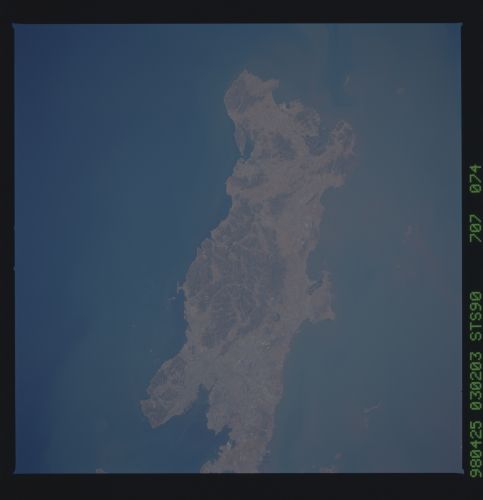
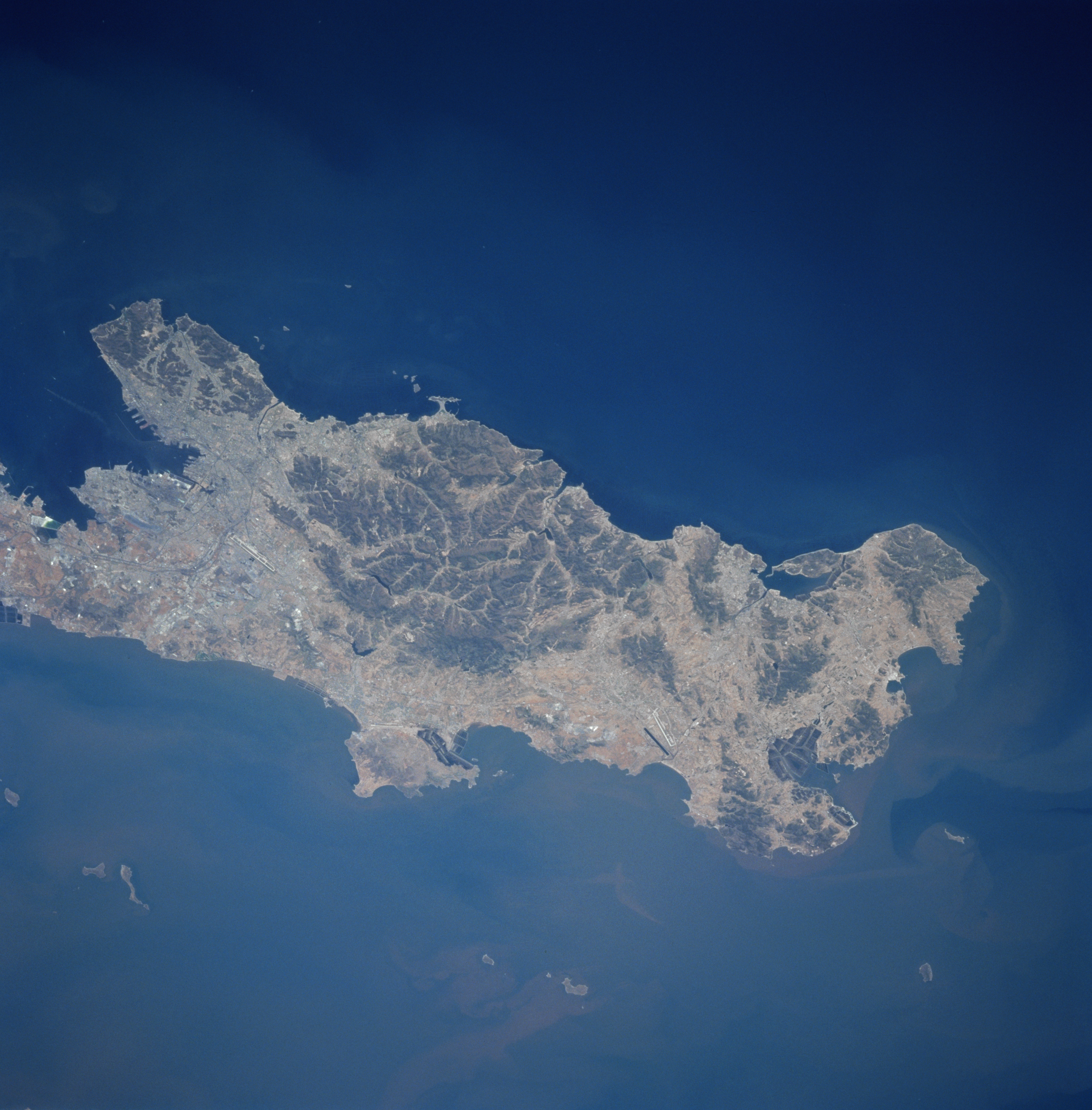
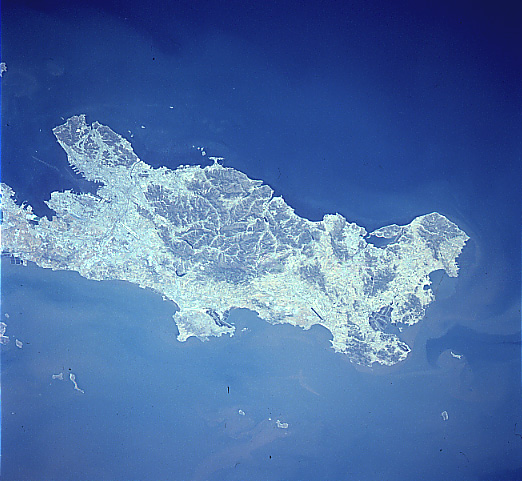
No GeoTIFF is available for this photo.Image Caption: STS090-707-074 Dalian (Dairen), China April 1998
The large city of Dalian (Dairen), visible at the left center of the image, is the leading port city of northeast China and China's second leading port behind Shanghai. Darian is located at the southern end of the Liaodong Peninsula. In this southeast-looking view, the many port facilities in Dalian Bay are discernible. With one of the finest harbors in East Asia, Dalian is a leading manufacturing, cultural, and financial center. The city is also a major tourist area with a mild climate and miles (km) of fine beaches. A major railroad transportation line connects with railroads in Manchuria to the north and eastern China to the west and south. Dalian has low mountains and hills on three sides of the city.
The large city of Dalian (Dairen), visible at the left center of the image, is the leading port city of northeast China and China's second leading port behind Shanghai. Darian is located at the southern end of the Liaodong Peninsula. In this southeast-looking view, the many port facilities in Dalian Bay are discernible. With one of the finest harbors in East Asia, Dalian is a leading manufacturing, cultural, and financial center. The city is also a major tourist area with a mild climate and miles (km) of fine beaches. A major railroad transportation line connects with railroads in Manchuria to the north and eastern China to the west and south. Dalian has low mountains and hills on three sides of the city.
