< STS042-96-74 >
| NASA Photo ID | STS042-96-74 |
| Focal Length | 100mm |
| Date taken | 1992.01.26 |
| Time taken | 21:40:08 GMT |
Cloud masks available for this image:
Spacecraft nadir point: 56.0° N, 151.9° W
Photo center point: 59.0° N, 154.0° W
Photo center point by machine learning:
Photo center point: 59.0° N, 154.0° W
Photo center point by machine learning:
Nadir to Photo Center: Northwest
Spacecraft Altitude: 167 nautical miles (309km)
Country or Geographic Name: | USA-ALASKA |
Features: | ALEUTIAN RAN., KAMISHAK B |
| Features Found Using Machine Learning: | |
Cloud Cover Percentage: | 0 (no clouds present) |
Sun Elevation Angle: | 15° |
Sun Azimuth: | 170° |
Camera: | Hasselblad |
Focal Length: | 100mm |
Camera Tilt: | 53 degrees |
Format: | VELVI: Fuji, natural color positive, Velvia 50, CS 135-36, ASA 32, standard base |
Film Exposure: | Normal |
| Additional Information | |
| Width | Height | Annotated | Cropped | Purpose | Links |
|---|---|---|---|---|---|
| 5700 pixels | 6000 pixels | No | No | Download Image Download Color Calibration Image for this Image |
|
| 500 pixels | 526 pixels | No | No | Download Image Download Color Calibration Image for this Image |
|
| 640 pixels | 480 pixels | No | No | Download Image |
Download Packaged File
Download a Google Earth KML for this Image
View photo footprint information
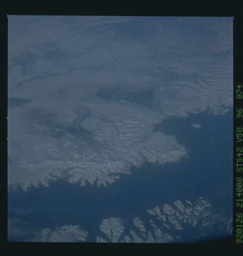
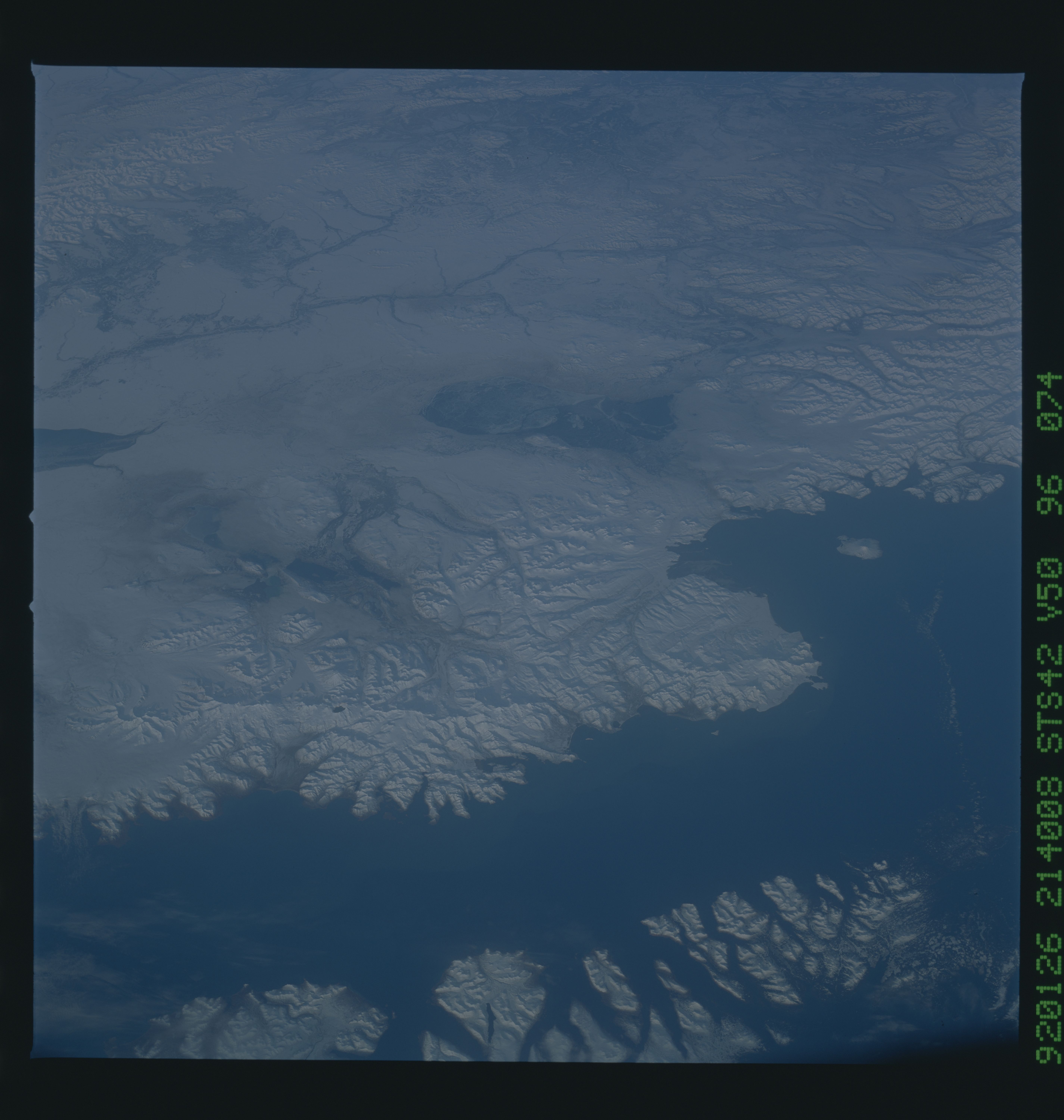
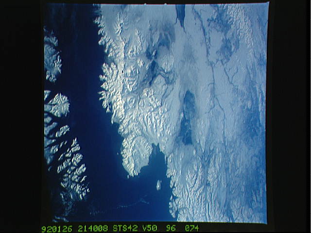
No GeoTIFF is available for this photo.Image Caption: STS042-96-074: Katmai National Park and Mt. Augustine, Alaska
TodayUs Katmai National Park was the site of the centur-
yUs largestJvolcanic eruption (Novarupta, 1912) which formed the
Valley of 10J000JSmokes, so named because of its many fumaroles.
However, the Pinatubo eruption rivals the 1912 Novarupta eruption
in size. Nevertheless, large glacial valleys are still filled
with the pyroclastic material from that eruption 80 years ago.
This scene shows the large Novarupta crater, from which
the Valley of 10J000 Smokes descends into the background. The
snow hides most of the ash-covered area. Further to the north is
Augustine Island, a volcano which has been fairly active over the
past 5 years (its ash emissions have closed Anchorage airport
several times).
