< ISS072-E-73171 >
| NASA Photo ID | ISS072-E-73171 |
| Focal Length | 400mm |
| Date taken | 2024.10.20 |
| Time taken | 18:55:00 GMT |
Resolutions offered for this image:
2752 x 4128 pixels 720 x 600 pixels 8256 x 5504 pixels 640 x 427 pixels
2752 x 4128 pixels 720 x 600 pixels 8256 x 5504 pixels 640 x 427 pixels
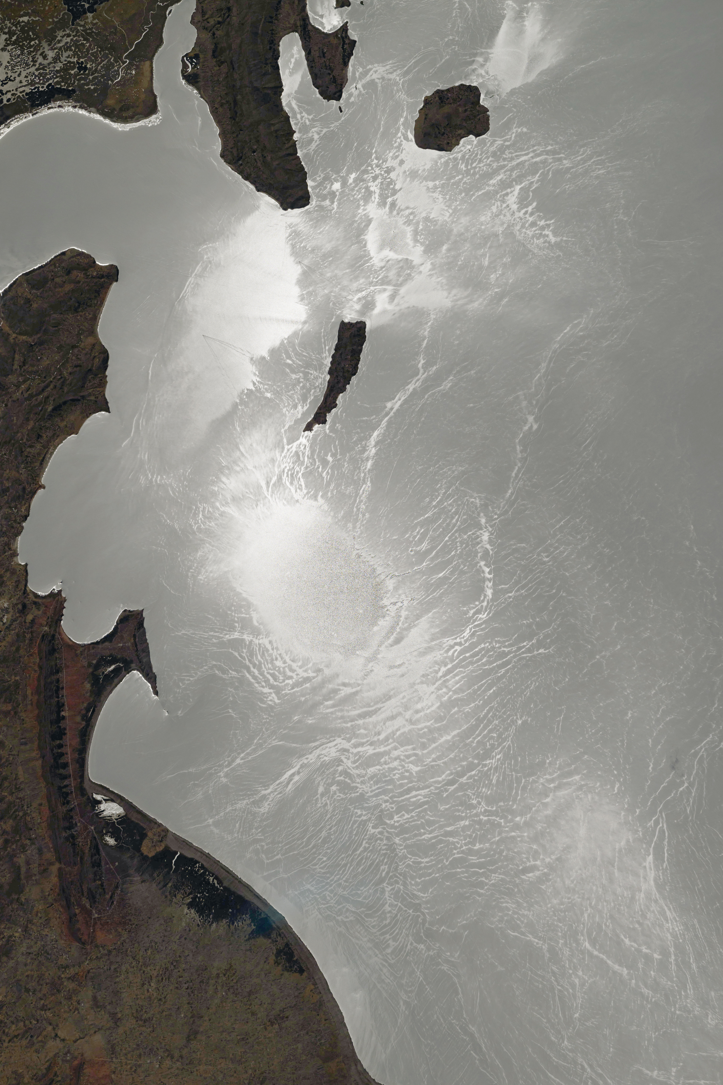
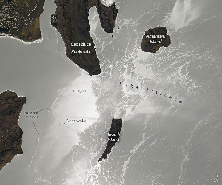


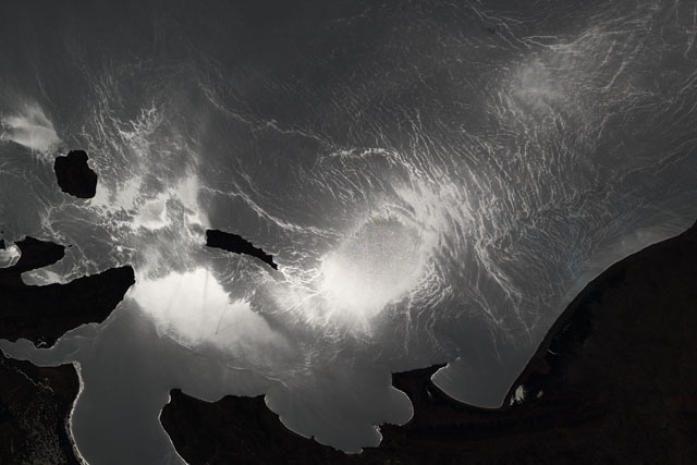
Spacecraft nadir point: 15.9° S, 67.2° W
Photo center point: 15.8° S, 69.6° W
Photo center point by machine learning:
Photo center point: 15.8° S, 69.6° W
Photo center point by machine learning:
Nadir to Photo Center: West
Spacecraft Altitude: 227 nautical miles (420km)
Country or Geographic Name: | PERU |
Features: | SUN GLINT, WATER, TILILACA, AMANTANI, HUILLANOPAMPA, COASTAL WETLANDS, TACASAYONIPAMPA, OYUYO |
| Features Found Using Machine Learning: | |
Cloud Cover Percentage: | 10 (1-10)% |
Sun Elevation Angle: | 50° |
Sun Azimuth: | 272° |
Camera: | Nikon Z9 Electronic Still Camera |
Focal Length: | 400mm |
Camera Tilt: | 32 degrees |
Format: | 8256E2: 8256 x 5504 pixel Stacked CMOS sensor, 35.9mm x 23.9mm, total pixels: 52.37 million, Nikon FX format |
Film Exposure: | |
| Additional Information | |
| Width | Height | Annotated | Cropped | Purpose | Links |
|---|---|---|---|---|---|
| 2752 pixels | 4128 pixels | No | Yes | NASA's Earth Observatory web site | Download Image |
| 720 pixels | 600 pixels | Yes | Yes | NASA's Earth Observatory web site | Download Image |
| 8256 pixels | 5504 pixels | Download Image | |||
| 640 pixels | 427 pixels | Download Image |
Download Packaged File
Download a Google Earth KML for this Image
View photo footprint information
No GeoTIFF is available for this photo.Image Caption: none
