< ISS042-E-7131 >

| NASA Photo ID | ISS042-E-7131 |
| Focal Length | 200mm |
| Date taken | 2014.11.22 |
| Time taken | 09:47:38 GMT |


Spacecraft nadir point: 22.5° N, 12.1° W
Photo center point:
Photo center point by machine learning: 21.12° N, 11.35° W
Photo center point:
Photo center point by machine learning: 21.12° N, 11.35° W
Nadir to Photo Center:
Spacecraft Altitude: 222 nautical miles (411km)

Country or Geographic Name: | |
Features: | |
| Features Found Using Machine Learning: | |
Cloud Cover Percentage: | 0 (no clouds present) |
Sun Elevation Angle: | 31° |
Sun Azimuth: | 133° |
Camera: | NIKON D4 S/N: 2071131 |
Focal Length: | 200mm |
Camera Tilt: | |
Format: | |
Film Exposure: | |
| Additional Information | |
| Width | Height | Annotated | Cropped | Purpose | Links |
|---|---|---|---|---|---|
| 4928 pixels | 3280 pixels | No | No | Download Image | |
| 640 pixels | 426 pixels | No | No | Download Image |
Download Packaged File
Download a Google Earth KML for this Image
View photo footprint information
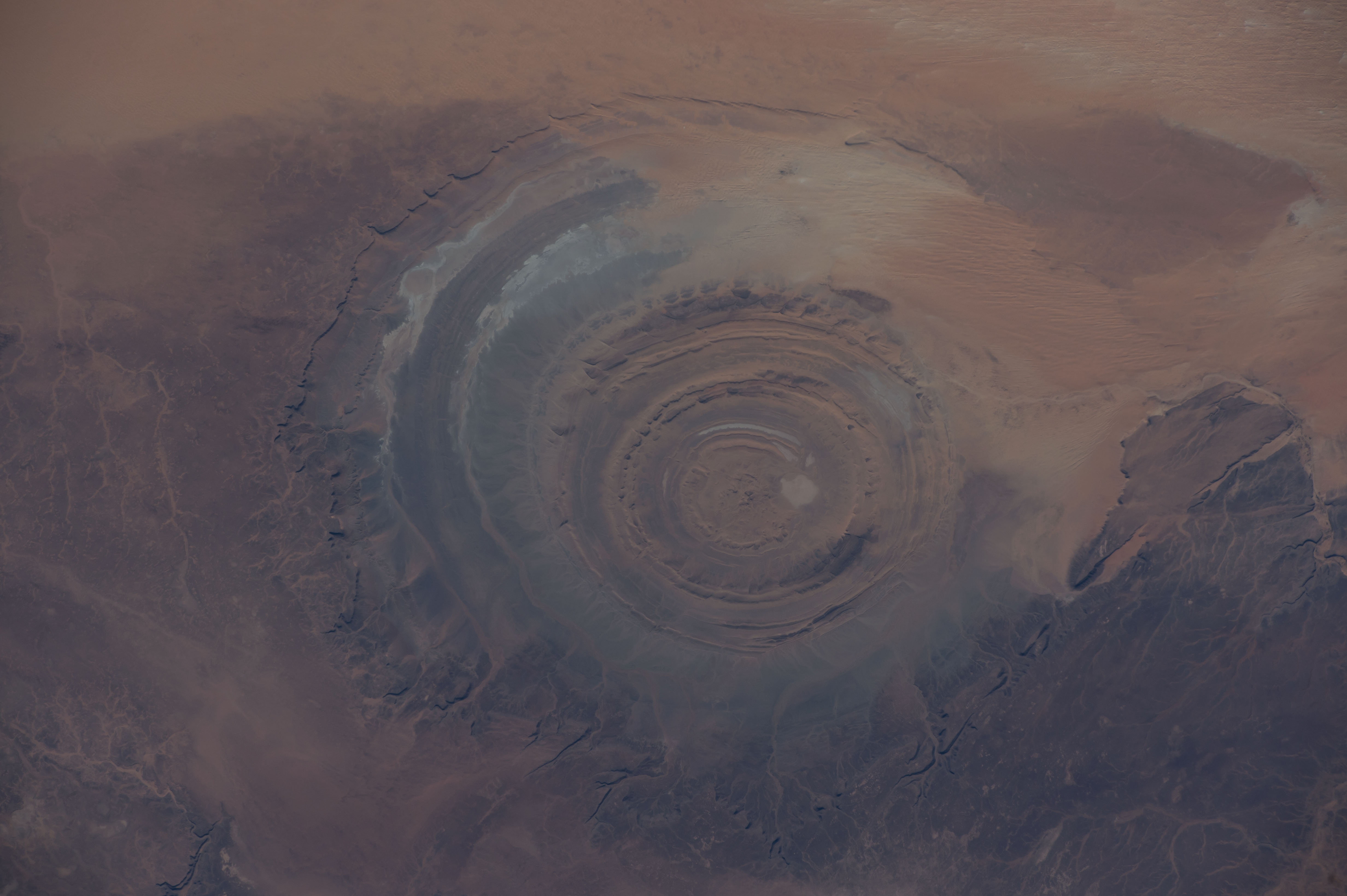
No GeoTIFF is available for this photo.Image Caption: ISS042E007131 (11/22/2014) -- Astronauts aboard the International Space Station captured this image of a huge crater in Africa on Nov. 22, 2014. This is the Richat Structure in northwestern Mauritania, otherwise known as the "Eye of the Sahara." Scientists are still deciding whether this was formed by a subterranean volcano or impact from a large meteor. Deep in the Sahara Desert it is nearly a perfect circle, it is 1.2 miles (1.9 kilometers) wide, and sports a rim 330 feet (100 meters) tall. The crater sits in a vast plain of rocks so ancient they were deposited hundreds of millions of years before the first dinosaurs walked the Earth.
