< STS033-72-71 >
| NASA Photo ID | STS033-72-71 |
| Focal Length | 250mm |
| Date taken | 1989.11.26 |
| Time taken | 09:42:12 GMT |

Cloud masks available for this image:
Spacecraft nadir point: 24.2° N, 80.2° E
Photo center point: 33.0° N, 78.0° E
Photo center point by machine learning:
Photo center point: 33.0° N, 78.0° E
Photo center point by machine learning:
Nadir to Photo Center: North
Spacecraft Altitude: 134 nautical miles (248km)Body: Earth
Country or Geographic Name: | INDIA |
Features: | HIMALAYAS |
| Features Found Using Machine Learning: | |
Cloud Cover Percentage: | 10 (1-10)% |
Sun Elevation Angle: | 24° |
Sun Azimuth: | 231° |
Camera: | Hasselblad |
Focal Length: | 250mm |
Camera Tilt: | High Oblique |
Format: | 5017: Kodak, natural color positive, Ektachrome, X Professional, ASA 64, standard base |
Film Exposure: | Normal |
| Additional Information | |
| Width | Height | Annotated | Cropped | Purpose | Links |
|---|---|---|---|---|---|
| 5700 pixels | 5900 pixels | No | No | Download Image | |
| 500 pixels | 518 pixels | No | No | Download Image | |
| 640 pixels | 480 pixels | No | No | Download Image |
Download Packaged File
Download a Google Earth KML for this Image
View photo footprint information
No GeoTIFF is available for this photo.Image Caption:
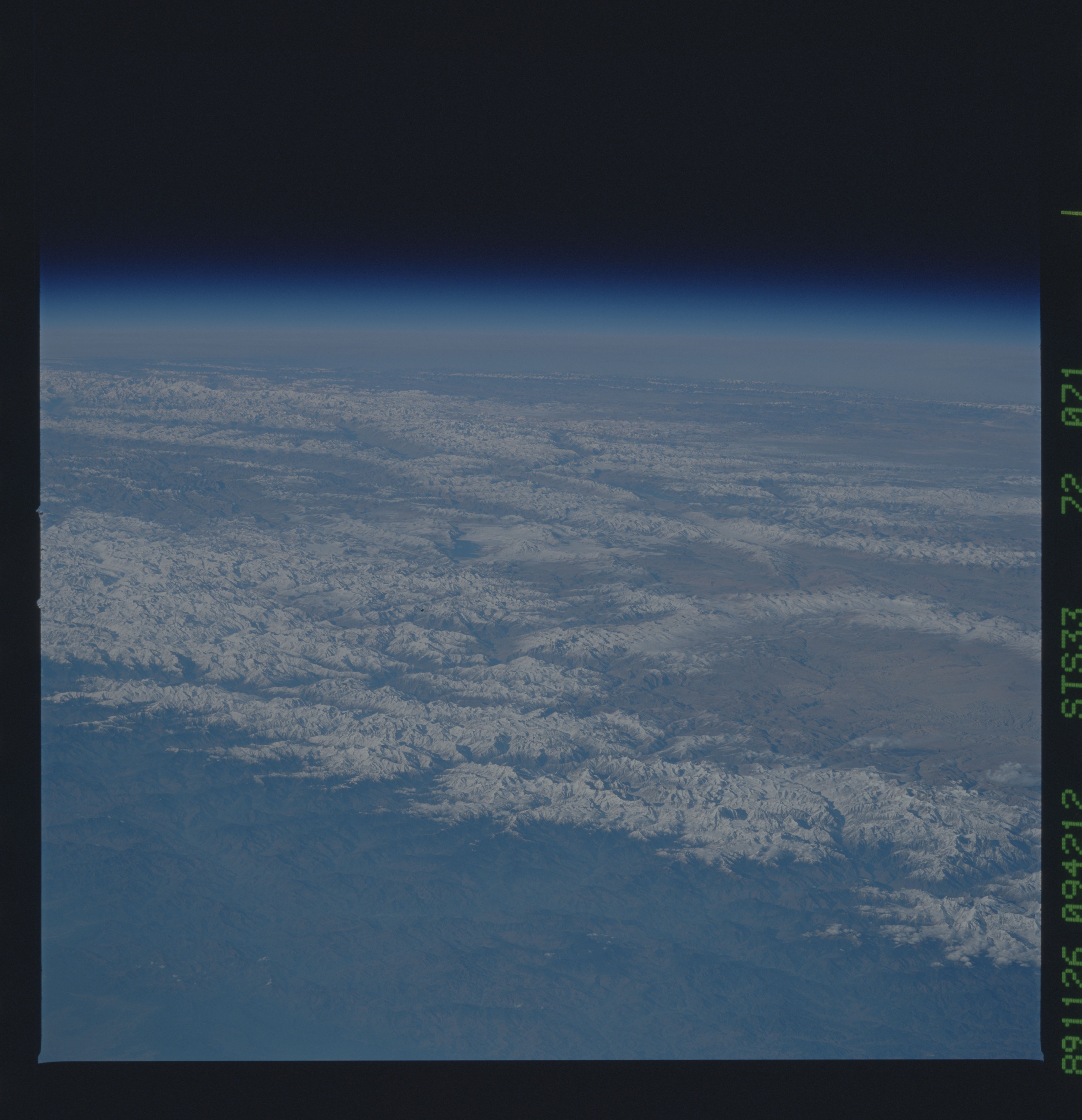
View northward across the Great Himalaya Range in northwest India
north of Chandigarh, Punjab State, taken during the STS-33 Space
Shuttle mission November 26, 1989. The Karakorum Fault Zone is
expressed as a straight valley extending northwestward from the
right center of the frame. The striking snow-covered massif above
the center of the frame has an elevation of 21,760 feet, accord-
ing to U. S. Operational Navigation Chart G-7. Strong shadows,
snow cover, and the relatively low spacecraft altitude (x KM, 134
NM) give the appearance of three dimensions within the mountain
chains. NASA photograph S33-72-071.
View northward across the Great Himalaya Range in northwest India
north of Chandigarh, Punjab State, taken during the STS-33 Space
Shuttle mission November 26, 1989. The Karakorum Fault Zone is
expressed as a straight valley extending northwestward from the
right center of the frame. The striking snow-covered massif above
the center of the frame has an elevation of 21,760 feet, accord-
ing to U. S. Operational Navigation Chart G-7. Strong shadows,
snow cover, and the relatively low spacecraft altitude (x KM, 134
NM) give the appearance of three dimensions within the mountain
chains. NASA photograph S33-72-071.

