< STS087-715-70 >
| NASA Photo ID | STS087-715-70 |
| Focal Length | 100mm |
| Date taken | 1997.11.30 |
| Time taken | 06:20:49 GMT |
Resolutions offered for this image:
832 x 830 pixels 4096 x 4060 pixels 640 x 634 pixels 5700 x 5900 pixels 483 x 500 pixels 633 x 639 pixels
832 x 830 pixels 4096 x 4060 pixels 640 x 634 pixels 5700 x 5900 pixels 483 x 500 pixels 633 x 639 pixels

Cloud masks available for this image:
Spacecraft nadir point: 24.3° N, 67.0° E
Photo center point: 25.0° N, 67.0° E
Photo center point by machine learning:
Photo center point: 25.0° N, 67.0° E
Photo center point by machine learning:
Nadir to Photo Center: North
Spacecraft Altitude: 150 nautical miles (278km)
Country or Geographic Name: | PAKISTAN |
Features: | KARACHI |
| Features Found Using Machine Learning: | |
Cloud Cover Percentage: | 10 (1-10)% |
Sun Elevation Angle: | 42° |
Sun Azimuth: | 161° |
Camera: | Hasselblad |
Focal Length: | 100mm |
Camera Tilt: | 16 degrees |
Format: | 5069: Kodak Elite 100S, E6 Reversal, Replaces Lumiere, Warmer in tone vs. Lumiere |
Film Exposure: | Normal |
| Additional Information | |
| Width | Height | Annotated | Cropped | Purpose | Links |
|---|---|---|---|---|---|
| 832 pixels | 830 pixels | No | No | Cities collection | Download Image |
| 4096 pixels | 4060 pixels | No | No | Earth From Space collection | Download Image |
| 640 pixels | 634 pixels | No | No | Earth From Space collection | Download Image |
| 5700 pixels | 5900 pixels | No | No | Download Image Download Color Calibration Image for this Image |
|
| 483 pixels | 500 pixels | No | No | Download Image Download Color Calibration Image for this Image |
|
| 633 pixels | 639 pixels | No | No | Download Image |
Download Packaged File
Download a Google Earth KML for this Image
View photo footprint information
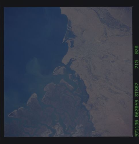
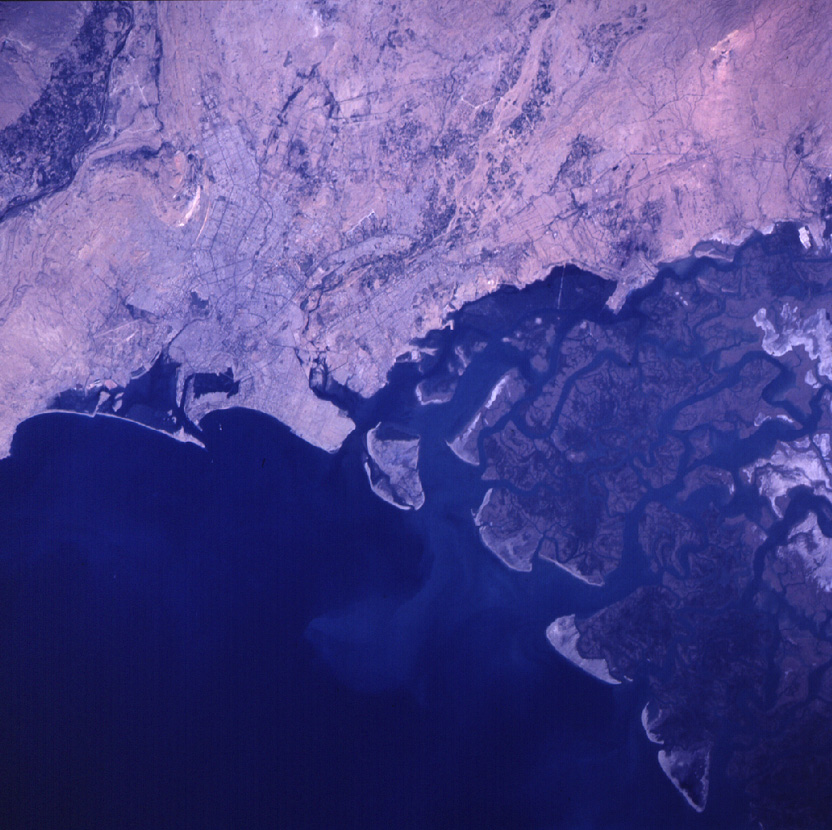
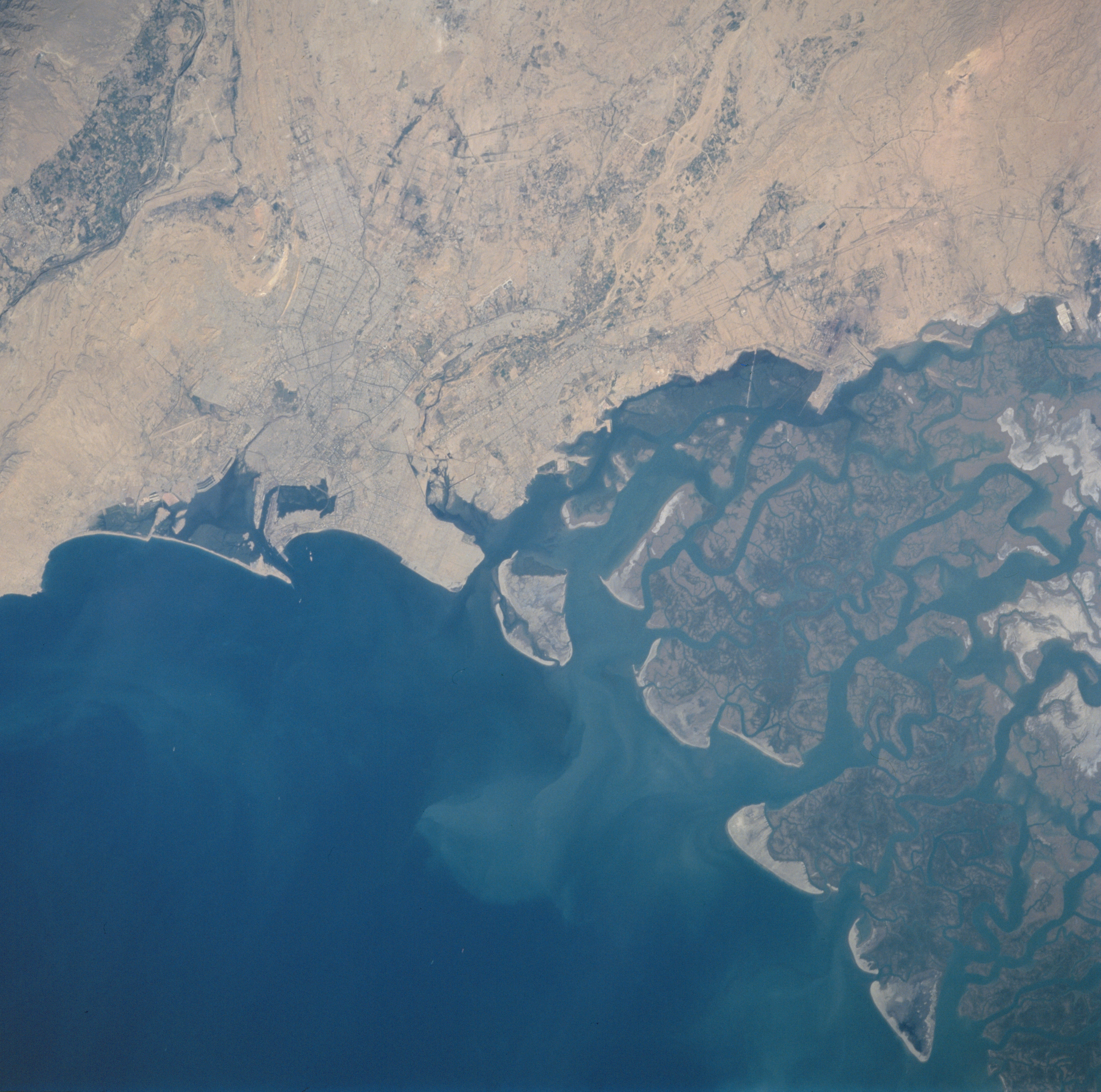
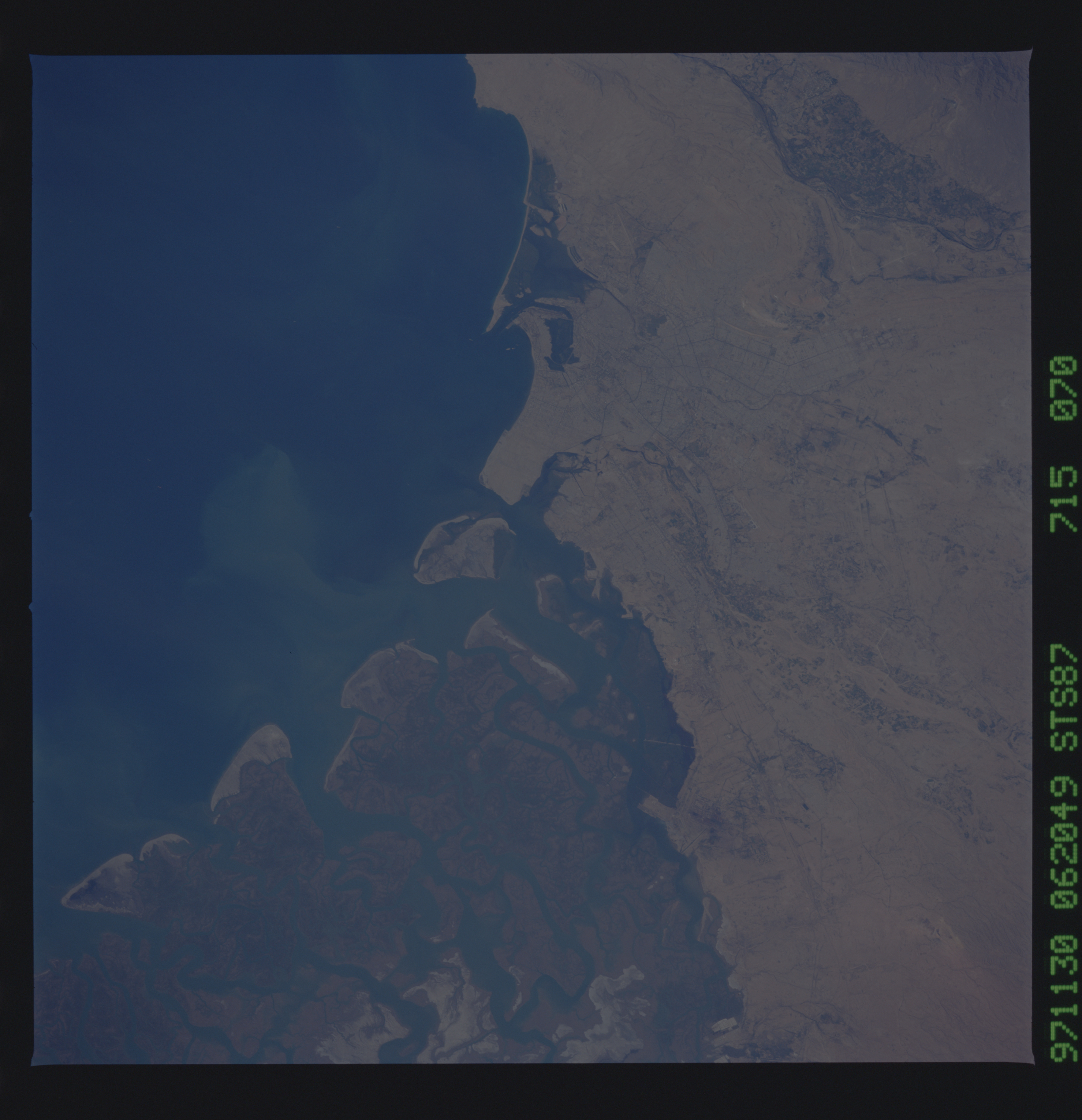
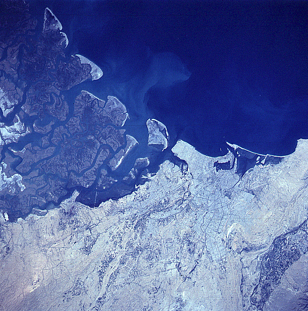
No GeoTIFF is available for this photo.Image Caption: STS087-715-70 Karachi, Pakistan November 1997
Karachi, the largest city and former capital (nearly 10 million people) of Pakistan, is located along the arid southern coast on the Arabian Sea. The central business district of Karachi is located close to the harbor (dark area enclosed by elongated island) where several roads converge (slightly right of center). Some of the road network (thin, dark lines) is discernible throughout different parts of the large metropolitan area. As seen on this image, Karachi is also situated northwest of the Indus River delta (darker land area upper left). The northwest end of the broad deltaic plain consists of a complicated network of meandering tidal channels. This section of the delta is inundated with salt water and sediment (a light colored sediment plume is visible immediately offshore). The small lighter colored tips of land along the shoreline shows the development of sandy beaches and sand dunes.
Karachi, the largest city and former capital (nearly 10 million people) of Pakistan, is located along the arid southern coast on the Arabian Sea. The central business district of Karachi is located close to the harbor (dark area enclosed by elongated island) where several roads converge (slightly right of center). Some of the road network (thin, dark lines) is discernible throughout different parts of the large metropolitan area. As seen on this image, Karachi is also situated northwest of the Indus River delta (darker land area upper left). The northwest end of the broad deltaic plain consists of a complicated network of meandering tidal channels. This section of the delta is inundated with salt water and sediment (a light colored sediment plume is visible immediately offshore). The small lighter colored tips of land along the shoreline shows the development of sandy beaches and sand dunes.
