< STS51B-39-69 >
| NASA Photo ID | STS51B-39-69 |
| Focal Length | 100mm |
| Date taken | 1985.05.03 |
| Time taken | 23:43:28 GMT |
Cloud masks available for this image:
Spacecraft nadir point: 0.0° N, 121.1° E
Photo center point: 1.5° S, 120.5° E
Photo center point by machine learning:
Photo center point: 1.5° S, 120.5° E
Photo center point by machine learning:
Nadir to Photo Center: South
Spacecraft Altitude: 189 nautical miles (350km)
Country or Geographic Name: | INDONESIA |
Features: | CELEBES |
| Features Found Using Machine Learning: | |
Cloud Cover Percentage: | 60 (51-75)% |
Sun Elevation Angle: | 26° |
Sun Azimuth: | 72° |
Camera: | Hasselblad |
Focal Length: | 100mm |
Camera Tilt: | 27 degrees |
Format: | 5017: Kodak, natural color positive, Ektachrome, X Professional, ASA 64, standard base |
Film Exposure: | Normal |
| Additional Information | |
| Width | Height | Annotated | Cropped | Purpose | Links |
|---|---|---|---|---|---|
| 5700 pixels | 5900 pixels | No | No | Download Image | |
| 500 pixels | 518 pixels | No | No | Download Image |
Download Packaged File
Download a Google Earth KML for this Image
View photo footprint information
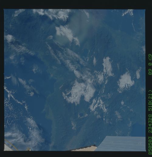
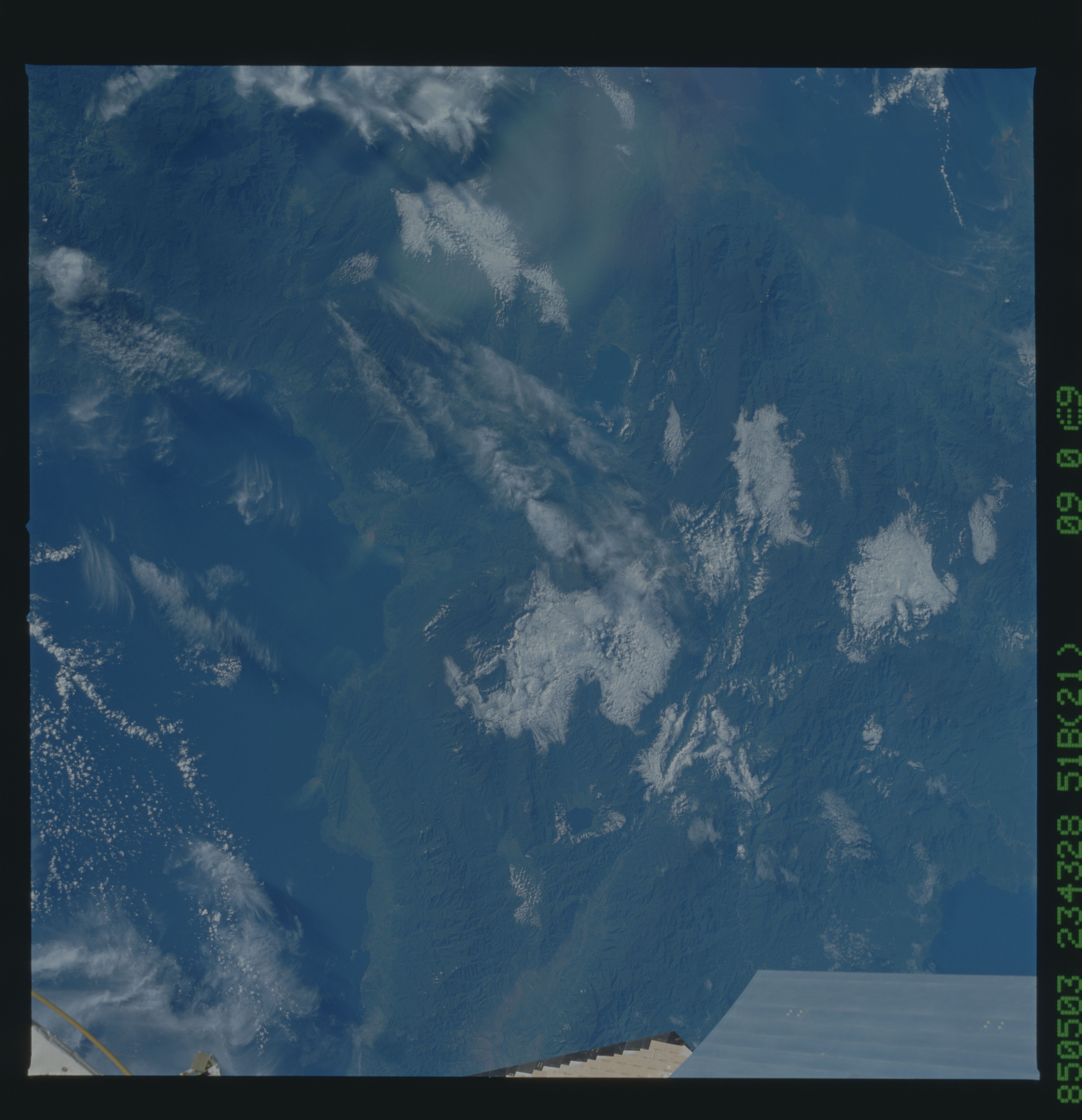
No GeoTIFF is available for this photo.Image Caption: This photograph includes the central part of Sulawesi at the
junction between the western part of the island (north and south
arms) and the east (east and southeast arms). The north and south
arms extend directly off this photograph at (1) and (2). The
junction is approximately outlined at (3) and (4). The eastern
mountains comprise deformed rocks (5) and ophiolites. The western
mountains (6) are volcanic rocks. The Palu fault, a large tran-
scurrent fault much like the San Andreas fault in California can
be seen at (7). (51B- 39-69)
