< STS091-718-69 >
| NASA Photo ID | STS091-718-69 |
| Focal Length | 100mm |
| Date taken | 1998.06.11 |
| Time taken | 09:30:03 GMT |
Cloud masks available for this image:
Spacecraft nadir point: 9.3° S, 26.6° E
Photo center point: 7.5° S, 32.0° E
Photo center point by machine learning:
Photo center point: 7.5° S, 32.0° E
Photo center point by machine learning:
Nadir to Photo Center: East
Spacecraft Altitude: 203 nautical miles (376km)
Country or Geographic Name: | DEM. REP. OF CONGO |
Features: | PAN-L. RUKWA, L. TANGANYIKA |
| Features Found Using Machine Learning: | |
Cloud Cover Percentage: | 20 (11-25)% |
Sun Elevation Angle: | 56° |
Sun Azimuth: | 18° |
Camera: | Hasselblad |
Focal Length: | 100mm |
Camera Tilt: | High Oblique |
Format: | 5069: Kodak Elite 100S, E6 Reversal, Replaces Lumiere, Warmer in tone vs. Lumiere |
Film Exposure: | Normal |
| Additional Information | |
| Width | Height | Annotated | Cropped | Purpose | Links |
|---|---|---|---|---|---|
| 5700 pixels | 5900 pixels | No | No | Download Image Download Color Calibration Image for this Image |
|
| 483 pixels | 500 pixels | No | No | Download Image Download Color Calibration Image for this Image |
Download Packaged File
Download a Google Earth KML for this Image
View photo footprint information
No GeoTIFF is available for this photo.Image Caption:
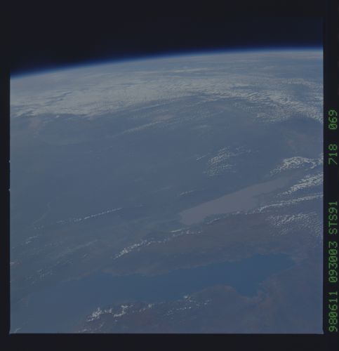
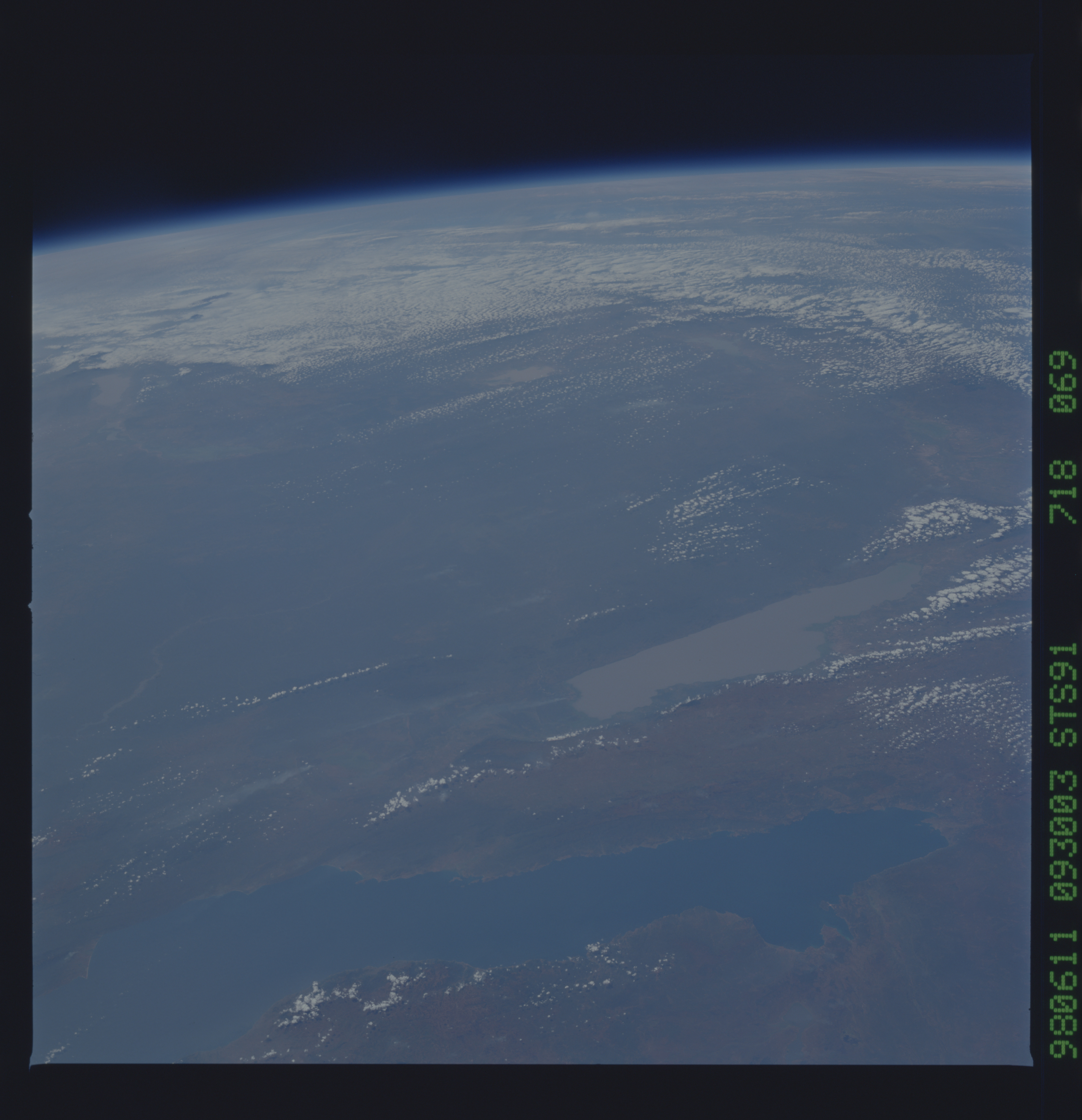
STS 91-718-069
These eastward views are the clearest ever of the transform fault zone that links the Lake Tanganyka and Lake Malawi rift valleys in the western branch of the East African rift. Fault-bounded Lake Rukwa occupies much of the transform zone. For the first time, details of the Rungwe volcanic field at the southeastern rift/transform intersection can be seen. In addition, the structures that define Lakes Mweru and Mweru Waptipa (SW of Lake Tanganyika) have been captured. These fine photos permit visual comparison of these East African rift/transform structures with those of the Border Corridor transform in the Rio Grande rift of West Texas and adjacent Mexico (from El Paso to Big Bend National Park).
